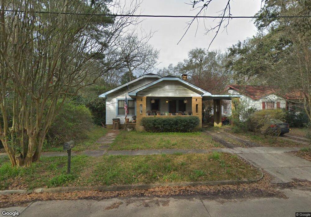
264 Crenshaw St Mobile, AL 36606
Midtown Mobile NeighborhoodEstimated Value: $191,533 - $214,000
Studio
1
Bath
1,200
Sq Ft
$167/Sq Ft
Est. Value
About This Home
This home is located at 264 Crenshaw St, Mobile, AL 36606 and is currently estimated at $200,633, approximately $167 per square foot. 264 Crenshaw St is a home located in Mobile County with nearby schools including Leinkauf Elementary School, Booker T. Washington Middle School, and Murphy High School.
Ownership History
Date
Name
Owned For
Owner Type
Purchase Details
Closed on
Oct 24, 2001
Sold by
Amsouth Bank
Bought by
Betts Karl W and Betts Leah F
Current Estimated Value
Purchase Details
Closed on
Jun 29, 2001
Sold by
Davis William Andrew and Davis Dawn Marie
Bought by
Betts Karl W and Betts Leah F
Home Financials for this Owner
Home Financials are based on the most recent Mortgage that was taken out on this home.
Original Mortgage
$69,600
Interest Rate
7.17%
Purchase Details
Closed on
Mar 3, 2000
Sold by
Tmt Inc
Bought by
Davis William Andrew and Davis Dawn Marie
Home Financials for this Owner
Home Financials are based on the most recent Mortgage that was taken out on this home.
Original Mortgage
$74,000
Interest Rate
8.3%
Create a Home Valuation Report for This Property
The Home Valuation Report is an in-depth analysis detailing your home's value as well as a comparison with similar homes in the area
Home Values in the Area
Average Home Value in this Area
Purchase History
We collect this data history from publicly available records. To have your information removed, we recommend requesting removal directly through your county’s website.
| Date | Buyer | Sale Price | Title Company |
|---|---|---|---|
| Betts Karl W | -- | -- | |
| Betts Karl W | $87,000 | Surety Land Title Inc | |
| Davis William Andrew | -- | -- |
Source: Public Records
Mortgage History
We collect this data history from publicly available records. To have your information removed, we recommend requesting removal directly through your county’s website.
| Date | Status | Borrower | Loan Amount |
|---|---|---|---|
| Previous Owner | Betts Karl W | $69,600 | |
| Previous Owner | Davis William Andrew | $74,000 |
Source: Public Records
Tax History
| Year | Tax Paid | Tax Assessment Tax Assessment Total Assessment is a certain percentage of the fair market value that is determined by local assessors to be the total taxable value of land and additions on the property. | Land | Improvement |
|---|---|---|---|---|
| 2025 | $1,049 | $32,720 | $16,560 | $16,160 |
| 2024 | $1,049 | $31,820 | $16,560 | $15,260 |
| 2023 | $1,882 | $29,640 | $13,800 | $15,840 |
| 2022 | $1,900 | $14,960 | $7,360 | $7,600 |
| 2021 | $1,900 | $14,960 | $7,360 | $7,600 |
| 2020 | $1,969 | $15,500 | $7,360 | $8,140 |
| 2019 | $1,863 | $29,340 | $0 | $0 |
| 2018 | $1,863 | $29,340 | $0 | $0 |
| 2017 | $1,863 | $29,340 | $0 | $0 |
| 2016 | $1,864 | $29,360 | $0 | $0 |
| 2013 | -- | $15,340 | $0 | $0 |
Source: Public Records
Map
Nearby Homes
- 266 Mohawk St
- 260 Westwood St
- 2155 Old Government St
- 255 Seminole St
- 262 Seminole St
- 263 Morgan Ave
- 312 Glenwood St
- 309 Morgan Ave
- 203 Mohawk St
- 2054 Old Government St
- 317 Morgan Ave
- 255 Pinehill Dr
- 168 Mohawk St
- 318 Morgan Ave
- 202 Morgan Ave
- 160 Westwood St
- 208 Pinehill Dr
- 407 Seminole St
- 157 Westwood St
- 1958 Myrtle Ave
- 262 Crenshaw St
- 267 Westwood St
- 269 Westwood St
- 260 Crenshaw St
- 265 Westwood St
- 263 Westwood St
- 267 Crenshaw St
- 265 Crenshaw St
- 269 Crenshaw St
- 258 Crenshaw St
- 263 Crenshaw St
- 261 Westwood St
- 261 Crenshaw St
- 2158 Airport Blvd
- 2158 Airport Blvd
- 259 Westwood St
- 256 Crenshaw St
- 259 Crenshaw St
- 2156 Airport Blvd
- 257 Westwood St
Your Personal Tour Guide
Ask me questions while you tour the home.