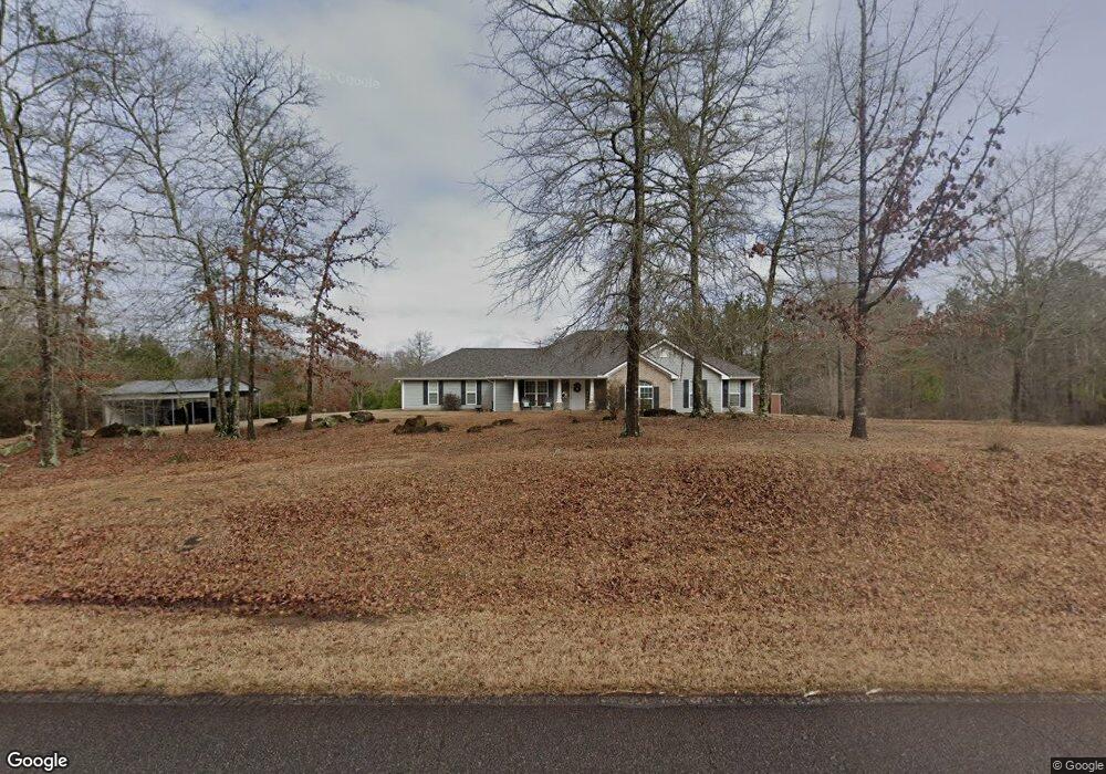
265 Brooks Rd Jackson, GA 30233
Southwest Butts NeighborhoodEstimated Value: $447,000 - $624,000
4
Beds
2
Baths
2,192
Sq Ft
$246/Sq Ft
Est. Value
About This Home
This home is located at 265 Brooks Rd, Jackson, GA 30233 and is currently estimated at $538,318, approximately $245 per square foot. 265 Brooks Rd is a home located in Butts County with nearby schools including Jackson High School.
Ownership History
Date
Name
Owned For
Owner Type
Purchase Details
Closed on
Oct 20, 2016
Bought by
Proctor Richard Lynn and Proctor Barbara Louise
Current Estimated Value
Home Financials for this Owner
Home Financials are based on the most recent Mortgage that was taken out on this home.
Original Mortgage
$205,026
Outstanding Balance
$162,555
Interest Rate
3.37%
Mortgage Type
FHA
Estimated Equity
$375,763
Purchase Details
Closed on
Oct 6, 2015
Sold by
Lawson Perry Chris
Bought by
Wells Fargo Bank
Create a Home Valuation Report for This Property
The Home Valuation Report is an in-depth analysis detailing your home's value as well as a comparison with similar homes in the area
Home Values in the Area
Average Home Value in this Area
Purchase History
| Date | Buyer | Sale Price | Title Company |
|---|---|---|---|
| Proctor Richard Lynn | $212,000 | -- | |
| Wells Fargo Bank | $218,500 | -- |
Source: Public Records
Mortgage History
| Date | Status | Borrower | Loan Amount |
|---|---|---|---|
| Open | Proctor Richard Lynn | $205,026 |
Source: Public Records
Tax History
| Year | Tax Paid | Tax Assessment Tax Assessment Total Assessment is a certain percentage of the fair market value that is determined by local assessors to be the total taxable value of land and additions on the property. | Land | Improvement |
|---|---|---|---|---|
| 2025 | $4,005 | $221,508 | $46,719 | $174,789 |
| 2024 | $4,005 | $221,508 | $46,719 | $174,789 |
| 2023 | $4,391 | $205,402 | $46,719 | $158,683 |
| 2022 | $3,036 | $141,772 | $35,442 | $106,330 |
| 2021 | $3,188 | $139,723 | $35,442 | $104,281 |
| 2020 | $2,687 | $119,124 | $35,442 | $83,682 |
| 2019 | $2,107 | $102,369 | $35,442 | $66,927 |
| 2018 | $1,895 | $92,495 | $35,442 | $57,053 |
| 2017 | $1,793 | $88,182 | $35,442 | $52,740 |
| 2016 | $2,822 | $86,153 | $35,442 | $50,711 |
| 2015 | $1,668 | $88,822 | $35,442 | $53,380 |
| 2014 | $1,673 | $85,305 | $35,442 | $49,863 |
Source: Public Records
Map
Nearby Homes
- 245 Brooks Rd
- 214 Woodlands Dr
- 3070 High Falls Rd
- 131 Post Oak Dr Unit 209
- 131 Post Oak Dr
- 169 Ridgeway Rd
- 130 Oak Cir
- 138 Post Oak Dr
- 140 Post Oak Dr
- 521 Levi Barnes Rd
- 142 Post Oak Dr Unit 136
- 144 Post Oak Dr
- 144 Post Oak Dr Unit 137
- 146 Post Oak Dr Unit 138
- 146 Post Oak Dr
- 148 Post Oak Dr Unit 139
- 148 Post Oak Dr
- 162 Feather Ln
- 128 Feather Ln
- 276 Harbour Shores Dr
- 274 Brooks Rd
- 291 Brooks Rd
- 234 Brooks Rd
- 298 Brooks Rd
- 231 Brooks Rd
- 316 Brooks Rd Unit A
- 316B Brooks Rd
- 316 Brooks Rd
- 316 Brooks Rd Unit A
- 310 Brooks Rd
- 225 Brooks Rd
- 321 Brooks Rd Unit P
- 336 Brooks Rd
- 211 Brooks Rd
- 215 Brooks Rd Unit TANE
- 215 Brooks Rd Unit 6
- 207 Brooks Rd
- 342 Brooks Rd
- 199 Brooks Rd
- 300 Nathan Thaxton Rd
Your Personal Tour Guide
Ask me questions while you tour the home.