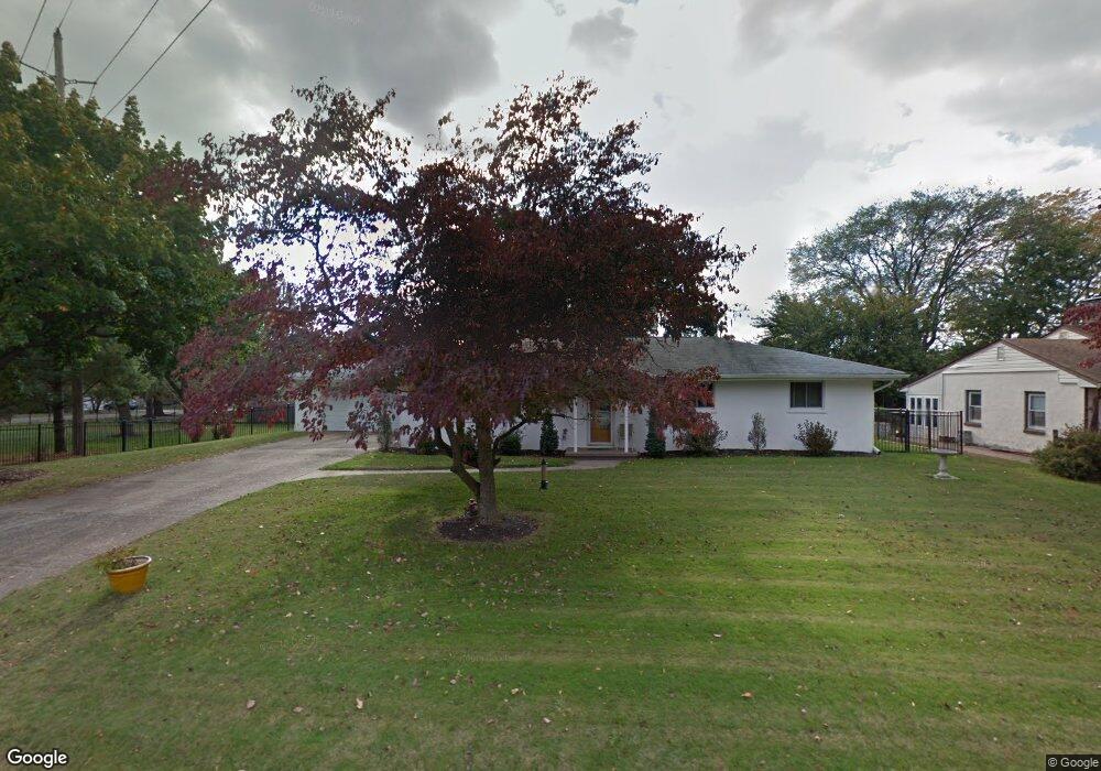
265 Harmony Rd Gibbstown, NJ 08027
Estimated Value: $328,649 - $406,000
3
Beds
3
Baths
1,512
Sq Ft
$243/Sq Ft
Est. Value
About This Home
This home is located at 265 Harmony Rd, Gibbstown, NJ 08027 and is currently estimated at $367,662, approximately $243 per square foot. 265 Harmony Rd is a home located in Gloucester County with nearby schools including Nehaunsey Middle School and Guardian Angels Regional School.
Ownership History
Date
Name
Owned For
Owner Type
Purchase Details
Closed on
Nov 25, 2009
Sold by
Ognibene Jennifer and The Estate Of Anthony J Catand
Bought by
Fanders Herbert K and Fanders Karen M
Current Estimated Value
Home Financials for this Owner
Home Financials are based on the most recent Mortgage that was taken out on this home.
Original Mortgage
$193,500
Outstanding Balance
$126,341
Interest Rate
4.92%
Mortgage Type
New Conventional
Estimated Equity
$241,321
Purchase Details
Closed on
Nov 19, 1997
Sold by
Cahill Madeline A and Cahill James T
Bought by
Catando Anthony J
Home Financials for this Owner
Home Financials are based on the most recent Mortgage that was taken out on this home.
Original Mortgage
$94,200
Interest Rate
7.28%
Mortgage Type
VA
Create a Home Valuation Report for This Property
The Home Valuation Report is an in-depth analysis detailing your home's value as well as a comparison with similar homes in the area
Home Values in the Area
Average Home Value in this Area
Purchase History
| Date | Buyer | Sale Price | Title Company |
|---|---|---|---|
| Fanders Herbert K | $215,000 | Infinity Title Agency Inc | |
| Catando Anthony J | $111,500 | -- |
Source: Public Records
Mortgage History
| Date | Status | Borrower | Loan Amount |
|---|---|---|---|
| Open | Fanders Herbert K | $193,500 | |
| Previous Owner | Catando Anthony J | $94,200 |
Source: Public Records
Tax History
| Year | Tax Paid | Tax Assessment Tax Assessment Total Assessment is a certain percentage of the fair market value that is determined by local assessors to be the total taxable value of land and additions on the property. | Land | Improvement |
|---|---|---|---|---|
| 2025 | $6,015 | $174,700 | $42,500 | $132,200 |
| 2024 | $5,699 | $174,700 | $42,500 | $132,200 |
| 2023 | $5,699 | $174,700 | $42,500 | $132,200 |
| 2022 | $5,643 | $174,700 | $42,500 | $132,200 |
| 2021 | $5,643 | $174,700 | $42,500 | $132,200 |
| 2020 | $5,721 | $174,700 | $42,500 | $132,200 |
| 2019 | $5,725 | $174,700 | $42,500 | $132,200 |
| 2018 | $5,562 | $174,700 | $42,500 | $132,200 |
| 2017 | $5,428 | $174,700 | $42,500 | $132,200 |
| 2016 | $5,369 | $174,700 | $42,500 | $132,200 |
| 2015 | $5,196 | $174,700 | $42,500 | $132,200 |
| 2014 | $4,972 | $174,700 | $42,500 | $132,200 |
Source: Public Records
Map
Nearby Homes
- 312 Croce Ave
- 50 E Vine St
- 400 Thomson Ave
- 255 Elizabeth Ave
- 403 W Broad St
- 459 W Broad St
- L18 20 W Broad St
- 1224 Heddon Ave
- 318 W Buck St
- 1221 Walter Ave
- 1265 Walter Ave
- 1534 Pine St
- 227 W Buck St
- 227 W Washington St
- 1519 Pine St
- 1003 Hoffman Ave
- 122 W Washington St
- 205 W Adams St
- 423 Country Way
- 415 Country Way
- 257 Harmony Rd
- 315 Swedesboro Rd
- 104 Carson Ave
- 268 Harmony Rd
- 40 Swedesboro Rd
- 251 Harmony Rd
- 112 Carson Ave
- 269 Swedesboro Rd
- 310 Swedesboro Rd
- 243 Harmony Rd
- 331 Swedesboro Rd
- 338 Swedesboro Rd
- 246 Harmony Rd
- 109 Carson Ave
- 272 Swedesboro Rd
- 263 Swedesboro Rd
- 262 Swedesboro Rd
- 262 Swedesboro Rd Unit C
- 235 Harmony Rd
- 346 Swedesboro Rd
Your Personal Tour Guide
Ask me questions while you tour the home.