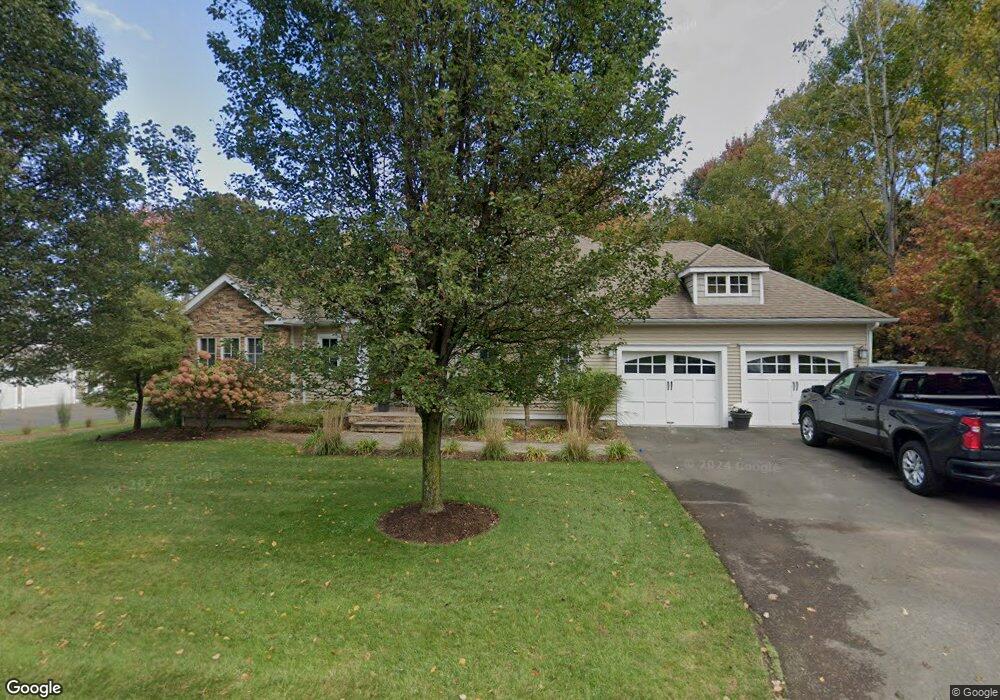
265 Silo Rd Bristol, CT 06010
Forestville NeighborhoodEstimated Value: $648,000 - $793,000
About This Home
This home is located at 265 Silo Rd, Bristol, CT 06010 and is currently estimated at $698,174, approximately $295 per square foot. 265 Silo Rd is a home located in Hartford County with nearby schools including Bristol Central High School, Great Beginnings, and St Matthew School.
Ownership History
We collect this data history from publicly available records. To have your information removed, we recommend requesting removal directly through your county’s website.
Purchase Details
Purchase Details
Home Financials for this Owner
Home Financials are based on the most recent Mortgage that was taken out on this home.Home Values in the Area
Average Home Value in this Area
Purchase History
We collect this data history from publicly available records. To have your information removed, we recommend requesting removal directly through your county’s website.
| Date | Buyer | Sale Price | Title Company |
|---|---|---|---|
| -- | None Available | ||
| -- | None Available | ||
| $165,000 | -- | ||
| $165,000 | -- |
Mortgage History
We collect this data history from publicly available records. To have your information removed, we recommend requesting removal directly through your county’s website.
| Date | Status | Borrower | Loan Amount |
|---|---|---|---|
| Previous Owner | $400,000 | ||
| Previous Owner | $132,000 |
Tax History
We collect this data history from publicly available records. To have your information removed, we recommend requesting removal directly through your county’s website.
| Year | Tax Paid | Tax Assessment Tax Assessment Total Assessment is a certain percentage of the fair market value that is determined by local assessors to be the total taxable value of land and additions on the property. | Land | Improvement |
|---|---|---|---|---|
| 2025 | $11,189 | $331,520 | $81,480 | $250,040 |
| 2024 | $10,559 | $331,520 | $81,480 | $250,040 |
| 2023 | $10,062 | $331,520 | $81,480 | $250,040 |
| 2022 | $9,482 | $247,240 | $61,740 | $185,500 |
| 2021 | $9,482 | $247,240 | $61,740 | $185,500 |
| 2020 | $9,482 | $247,240 | $61,740 | $185,500 |
| 2019 | $9,407 | $247,240 | $61,740 | $185,500 |
| 2018 | $9,118 | $247,240 | $61,740 | $185,500 |
| 2017 | $9,019 | $250,320 | $88,200 | $162,120 |
| 2016 | $8,923 | $247,660 | $88,200 | $159,460 |
| 2015 | $8,572 | $247,660 | $88,200 | $159,460 |
| 2014 | $8,572 | $247,660 | $88,200 | $159,460 |
Map
- 542 Village St
- 575 Village St
- 554 Village St
- 592 Village St
- 519 Village St
- 581 Village St
- 530 Village St
- 595 Village St
- 69 Elizabeth Dr
- 357 Village St
- 75 Village St
- 11 Eastview Rd
- 138 Butternut Ln Unit A
- 5 Cedar Grove Rd
- 7 Cedar Grove Rd
- 161 Red Stone Hill
- 156 Red Stone Hill
- 14 Redstone St
- 111 Daisy Cir
- 258 Candlewood Dr
- 251 Silo Rd
- 264 Silo Rd
- 239 Silo Rd
- 40 Mill Pond Dr
- 229 Silo Rd
- 252 Silo Rd
- 274 Silo Rd
- 15 Mill Pond Dr
- 5 Mill Pond Dr
- 285 Silo Rd
- 210 Silo Rd
- 286 Silo Rd
- 230 Silo Rd
- 450 Village St
- 16 Mill Pond Dr
- 654 Village St
- 674 Village St
- 622 Village St
- 0 Mill Pond Dr Dr Unit 170041140
- 0 Mill Pond Dr Unit 170027259
Ask me questions while you tour the home.