2667 Corn Pile Rd Myrtle Beach, SC 29588
Forestbrook AreaEstimated Value: $318,000 - $375,000
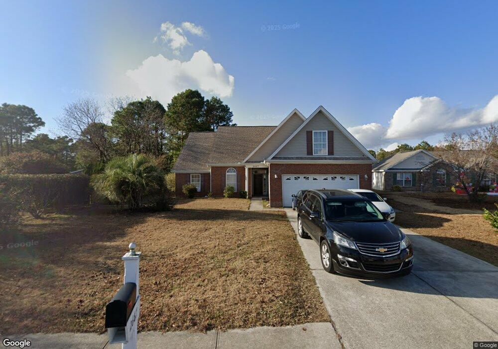
About This Home
This home is located at 2667 Corn Pile Rd, Myrtle Beach, SC 29588 and is currently estimated at $340,667, approximately $162 per square foot. 2667 Corn Pile Rd is a home located in Horry County with nearby schools including Forestbrook Elementary School, Forestbrook Middle School, and Socastee High School.
Ownership History
We collect this data history from publicly available records. To have your information removed, we recommend requesting removal directly through your county’s website.
Purchase Details
Home Financials for this Owner
Home Financials are based on the most recent Mortgage that was taken out on this home.Home Values in the Area
Average Home Value in this Area
Purchase History
We collect this data history from publicly available records. To have your information removed, we recommend requesting removal directly through your county’s website.
| Date | Buyer | Sale Price | Title Company |
|---|---|---|---|
| $28,900 | -- |
Mortgage History
We collect this data history from publicly available records. To have your information removed, we recommend requesting removal directly through your county’s website.
| Date | Status | Borrower | Loan Amount |
|---|---|---|---|
| Open | $56,000 | ||
| Open | $120,000 | ||
| Closed | $116,000 |
Tax History
We collect this data history from publicly available records. To have your information removed, we recommend requesting removal directly through your county’s website.
| Year | Tax Paid | Tax Assessment Tax Assessment Total Assessment is a certain percentage of the fair market value that is determined by local assessors to be the total taxable value of land and additions on the property. | Land | Improvement |
|---|---|---|---|---|
| 2025 | $2,980 | $0 | $0 | $0 |
| 2024 | $2,980 | $19,795 | $6,008 | $13,787 |
| 2023 | $2,980 | $12,504 | $1,692 | $10,812 |
| 2021 | $2,748 | $12,764 | $1,916 | $10,848 |
| 2020 | $2,608 | $12,764 | $1,916 | $10,848 |
| 2019 | $2,608 | $12,764 | $1,916 | $10,848 |
| 2018 | $694 | $10,873 | $1,447 | $9,426 |
| 2017 | $679 | $10,873 | $1,447 | $9,426 |
| 2016 | -- | $10,873 | $1,447 | $9,426 |
| 2015 | $679 | $10,874 | $1,448 | $9,426 |
| 2014 | $627 | $10,874 | $1,448 | $9,426 |
Map
- Lot 133 Squealer Lake Covey
- 2645 Corn Pile Rd
- 2601 Corn Pile Rd
- 2423 Hunters Trail
- 3955 Camden Dr
- 776 Harrison Mill St
- 780 Harrison Mill St
- 4154 Steeple Chase Dr
- 820 Harrison Mill St
- 2611 Ringneck Trail
- 281 La Patos Dr
- 264 La Patos Dr
- 425 Dog Pen Ct
- 2618 Ringneck Trail
- 1108 Harbison Cir
- 1091 Harbison Cir
- 1080 Harbison Cir
- 117 Black Bear Rd
- 479 Harbison Cir
- 117 Maddux Ln Unit D
- 3663 Corn Pile Rd
- 2669 Corn Pile Rd
- 2670 Corn Pile Rd
- 2666 Corn Pile Rd
- 2666 Corn Pile Rd Unit Hunters Ridge Landin
- 2666 Corn Pile Rd Unit Hunters Ridge
- 2664 Corn Pile Rd
- 2663 Corn Pile Rd
- 2769 Squealer Lake Trail Unit Hunters Ridge Legacy
- 2768 Squealer Lake Trail
- 2662 Corn Pile Rd
- 2659 Corn Pile Rd
- 2660 Corn Pile Rd
- 2631 Corn Pile Rd
- 1902 Squealer Lake Covey
- 2652 Corn Pile Rd
- 2536 Bear Stand Trail
- 2657 Corn Pile Rd
- 2540 Bearstand Trail
- 2538 Bear Stand Trail
Ask me questions while you tour the home.