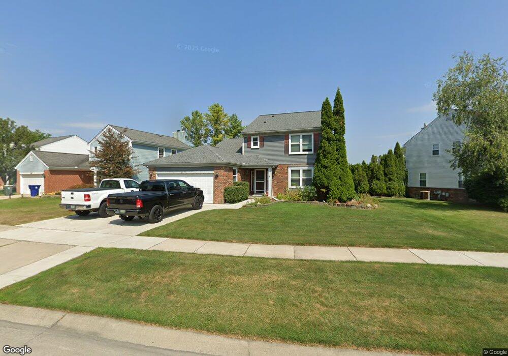
2677 Brookhaven Rd Canton, MI 48188
Estimated Value: $345,994 - $385,000
Studio
3
Baths
1,680
Sq Ft
$221/Sq Ft
Est. Value
About This Home
This home is located at 2677 Brookhaven Rd, Canton, MI 48188 and is currently estimated at $370,749, approximately $220 per square foot. 2677 Brookhaven Rd is a home located in Wayne County with nearby schools including Benjamin Franklin Middle School, John Glenn High School, and Schoolhouse Montessori Academy -Canton.
Ownership History
Date
Name
Owned For
Owner Type
Purchase Details
Closed on
Aug 19, 2021
Sold by
Anderson Daeena H
Bought by
Anderson Shane
Current Estimated Value
Home Financials for this Owner
Home Financials are based on the most recent Mortgage that was taken out on this home.
Original Mortgage
$186,000
Interest Rate
3.09%
Mortgage Type
Purchase Money Mortgage
Purchase Details
Closed on
Oct 26, 2006
Sold by
Anderson Christopher C
Bought by
Anderson Daena H
Create a Home Valuation Report for This Property
The Home Valuation Report is an in-depth analysis detailing your home's value as well as a comparison with similar homes in the area
Home Values in the Area
Average Home Value in this Area
Purchase History
We collect this data history from publicly available records. To have your information removed, we recommend requesting removal directly through your county’s website.
| Date | Buyer | Sale Price | Title Company |
|---|---|---|---|
| Anderson Shane | $260,000 | Amrock Llc | |
| Anderson Daena H | -- | None Available |
Source: Public Records
Mortgage History
We collect this data history from publicly available records. To have your information removed, we recommend requesting removal directly through your county’s website.
| Date | Status | Borrower | Loan Amount |
|---|---|---|---|
| Previous Owner | Anderson Shane | $186,000 |
Source: Public Records
Tax History
| Year | Tax Paid | Tax Assessment Tax Assessment Total Assessment is a certain percentage of the fair market value that is determined by local assessors to be the total taxable value of land and additions on the property. | Land | Improvement |
|---|---|---|---|---|
| 2025 | $1,839 | $179,100 | $0 | $0 |
| 2024 | $1,789 | $165,900 | $0 | $0 |
| 2023 | $1,706 | $141,200 | $0 | $0 |
| 2022 | $4,165 | $132,500 | $0 | $0 |
| 2021 | $4,041 | $125,100 | $0 | $0 |
| 2020 | $3,987 | $118,400 | $0 | $0 |
| 2019 | $3,917 | $113,750 | $0 | $0 |
| 2018 | $1,336 | $111,540 | $0 | $0 |
| 2017 | $4,347 | $101,800 | $0 | $0 |
| 2016 | $3,698 | $101,100 | $0 | $0 |
| 2015 | $8,335 | $95,470 | $0 | $0 |
| 2013 | $8,074 | $88,700 | $0 | $0 |
| 2010 | -- | $87,340 | $38,716 | $48,624 |
Source: Public Records
Map
Nearby Homes
- 2481 Woodmont Dr E
- 2210 Woodmont Dr W
- 2053 Brookfield St
- 345 Canton Center Rd
- 44125 Michigan Ave
- 0000 Inkster Rd
- 0 Barr Rd Unit 20261015295
- 0 Haggerty Unit 23129906
- 1675 S Sheldon Rd
- 1891 Vine Way Dr Unit 33
- 2131 Vine Way Dr Unit 97
- 1921 Vine Way Dr Unit 36
- 1921 Vine Way Dr Unit 41
- 1951 N Arbor
- 1849 Wentworth Ct
- 1774 Thistle Dr
- 1752 Thistle Dr
- 43419 Arbor Way W Unit 189
- 1632 Bennington Ct Unit 1632
- 2577 Cleveland Way
- 2482 Cranbrook Rd
- 2504 Cranbrook Rd
- 2456 Cranbrook Rd
- 2599 Brookhaven Rd
- 2537 Brookhaven Rd
- 2438 Cranbrook Rd
- 2530 Cranbrook Rd
- 2651 Brookhaven Rd
- 2483 Cranbrook Rd
- 2738 Woodmont Dr E
- 2422 Cranbrook Rd
- 2415 Brookhaven Rd
- 2457 Cranbrook Rd
- 2783 Brookhaven Rd
- 2431 Cranbrook Rd
- 2404 Cranbrook Rd
- 2722 Woodmont Dr E
- 2769 Woodmont Dr E
- 2405 Cranbrook Rd
- 2753 Woodmont Dr E
Your Personal Tour Guide
Ask me questions while you tour the home.