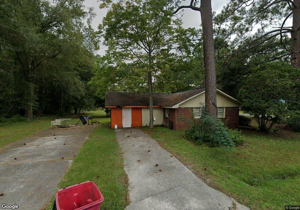
268 N McCrorie St Baxley, GA 31513
Estimated Value: $63,000 - $135,000
3
Beds
2
Baths
920
Sq Ft
$100/Sq Ft
Est. Value
About This Home
This home is located at 268 N McCrorie St, Baxley, GA 31513 and is currently estimated at $91,963, approximately $99 per square foot. 268 N McCrorie St is a home located in Appling County with nearby schools including Appling Christian Academy.
Ownership History
Date
Name
Owned For
Owner Type
Purchase Details
Closed on
Jul 28, 2010
Sold by
Belote Michael D
Bought by
K A K Holdings Llc
Current Estimated Value
Home Financials for this Owner
Home Financials are based on the most recent Mortgage that was taken out on this home.
Original Mortgage
$133,000
Interest Rate
4.61%
Mortgage Type
Unknown
Purchase Details
Closed on
Apr 2, 2010
Sold by
Spearmon Billy E
Bought by
Belote Michael D
Purchase Details
Closed on
Mar 2, 1998
Bought by
Spearmon Billy G and Spearmon Mary
Purchase Details
Closed on
Jun 23, 1992
Bought by
Paulk Shirley and Paulk Rozell
Create a Home Valuation Report for This Property
The Home Valuation Report is an in-depth analysis detailing your home's value as well as a comparison with similar homes in the area
Home Values in the Area
Average Home Value in this Area
Purchase History
| Date | Buyer | Sale Price | Title Company |
|---|---|---|---|
| K A K Holdings Llc | -- | -- | |
| Belote Michael D | -- | -- | |
| Spearmon Billy G | $40,000 | -- | |
| Paulk Shirley | $33,500 | -- |
Source: Public Records
Mortgage History
| Date | Status | Borrower | Loan Amount |
|---|---|---|---|
| Closed | K A K Holdings Llc | $133,000 |
Source: Public Records
Tax History
| Year | Tax Paid | Tax Assessment Tax Assessment Total Assessment is a certain percentage of the fair market value that is determined by local assessors to be the total taxable value of land and additions on the property. | Land | Improvement |
|---|---|---|---|---|
| 2025 | $569 | $21,360 | $880 | $20,480 |
| 2024 | $569 | $19,060 | $1,130 | $17,930 |
| 2023 | $560 | $19,060 | $1,130 | $17,930 |
| 2022 | $491 | $15,526 | $1,130 | $14,396 |
| 2021 | $491 | $15,526 | $1,130 | $14,396 |
| 2020 | $506 | $15,526 | $1,130 | $14,396 |
| 2019 | $515 | $15,526 | $1,130 | $14,396 |
| 2018 | $522 | $15,526 | $1,130 | $14,396 |
| 2017 | $522 | $15,526 | $1,130 | $14,396 |
| 2016 | $522 | $15,526 | $1,130 | $14,396 |
| 2015 | $433 | $15,526 | $1,130 | $14,396 |
| 2014 | $434 | $15,526 | $1,130 | $14,396 |
| 2013 | -- | $15,526 | $1,130 | $14,396 |
Source: Public Records
Map
Nearby Homes
- 336 Brobston St
- 374 Patterson St
- 0 Parker and Tippins Unit 27062
- 0 Parker and Tippins Unit 10712105
- 464 W Parker St
- 207 Thomas St
- 303 W Parker St
- 181 N Main St
- 18 S Thomas St
- 390 Bay St
- 0 W Parker St Unit 10547390
- 0 Hwy 341 Unit 23738
- 0 Hwy 341 Unit 10628717
- 001 Piney Grove Church Rd
- 342 E Allen St
- 7 Burke St
- 65 Fleming Dr
- 298 S Main St
- 88 Oak St
- 102 Crosby St
- 256 N McCrorie St
- 265 Brobston St
- 301 Brobston St
- 261 N McCrorie St
- 249 Brobston St
- 304 N McCrorie St
- 241 N McCrorie St
- 233 Brobston St
- 359 Brobston St
- 204 N McCrorie St
- 188 Penniman St
- 199 Brobston St
- 337 Brobston St
- 349 Patterson St
- 196 Brobston St
- 348 Patterson St
- 174 N McCrorie St
- 158 Penniman St
- 286 Harvey St
Your Personal Tour Guide
Ask me questions while you tour the home.