Estimated Value: $1,047,158 - $1,208,000
5
Beds
3
Baths
2,538
Sq Ft
$456/Sq Ft
Est. Value
About This Home
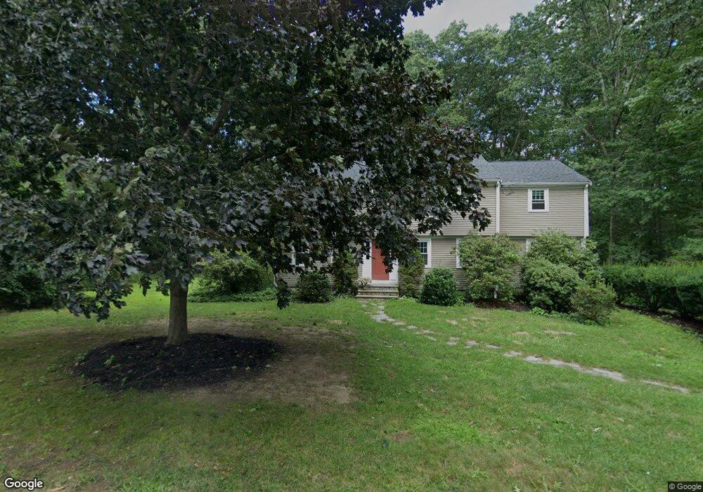
This home is located at 27 Captain Browns Ln, Acton, MA 01720 and is currently estimated at $1,157,540, approximately $456 per square foot. 27 Captain Browns Ln is a home located in Middlesex County with nearby schools including Acton-Boxborough Regional High School.
Ownership History
Date
Name
Owned For
Owner Type
Purchase Details
Closed on
Aug 5, 2013
Sold by
Bischoff Darren R
Bought by
Marcinkiewicz Paul and Bischoff Shannon I
Current Estimated Value
Home Financials for this Owner
Home Financials are based on the most recent Mortgage that was taken out on this home.
Original Mortgage
$417,000
Outstanding Balance
$300,657
Interest Rate
3.95%
Mortgage Type
New Conventional
Estimated Equity
$856,883
Purchase Details
Closed on
Aug 15, 2007
Sold by
Welna Robert J and Welna Susan R
Bought by
Bischoff Darren R and Bischoff Shannon I
Home Financials for this Owner
Home Financials are based on the most recent Mortgage that was taken out on this home.
Original Mortgage
$417,000
Interest Rate
6.67%
Mortgage Type
Purchase Money Mortgage
Purchase Details
Closed on
Aug 1, 1996
Sold by
Melia Kevin and Melia Ann
Bought by
Welna Robert and Welna Susan
Create a Home Valuation Report for This Property
The Home Valuation Report is an in-depth analysis detailing your home's value as well as a comparison with similar homes in the area
Home Values in the Area
Average Home Value in this Area
Purchase History
| Date | Buyer | Sale Price | Title Company |
|---|---|---|---|
| Marcinkiewicz Paul | -- | -- | |
| Bischoff Darren R | $615,000 | -- | |
| Welna Robert | $318,000 | -- |
Source: Public Records
Mortgage History
| Date | Status | Borrower | Loan Amount |
|---|---|---|---|
| Open | Marcinkiewicz Paul | $417,000 | |
| Closed | Marcinkiewicz Paul | $58,000 | |
| Previous Owner | Bischoff Darren R | $417,000 | |
| Previous Owner | Welna Robert | $188,000 |
Source: Public Records
Tax History
| Year | Tax Paid | Tax Assessment Tax Assessment Total Assessment is a certain percentage of the fair market value that is determined by local assessors to be the total taxable value of land and additions on the property. | Land | Improvement |
|---|---|---|---|---|
| 2025 | $15,222 | $887,600 | $377,600 | $510,000 |
| 2024 | $14,290 | $857,200 | $377,600 | $479,600 |
| 2023 | $13,923 | $792,900 | $343,500 | $449,400 |
| 2022 | $13,177 | $677,500 | $298,500 | $379,000 |
| 2021 | $12,848 | $635,100 | $276,200 | $358,900 |
| 2020 | $12,321 | $640,400 | $276,200 | $364,200 |
| 2019 | $11,820 | $610,200 | $276,200 | $334,000 |
| 2018 | $11,622 | $599,700 | $276,200 | $323,500 |
| 2017 | $10,900 | $571,900 | $276,200 | $295,700 |
| 2016 | $10,715 | $557,200 | $276,200 | $281,000 |
| 2015 | $10,681 | $560,700 | $276,200 | $284,500 |
| 2014 | $10,365 | $532,900 | $276,200 | $256,700 |
Source: Public Records
Map
Nearby Homes
- 20 Joseph Reed Ln
- 79 Charter Rd
- 5 Perkins Ln
- 235 Arlington St
- 18 Hayward Rd
- 7 Kelley Rd
- 631 Massachusetts Ave Unit 631
- 11 Braebrook
- 96 Newtown Rd
- 4 Littlefield Rd
- 184 Main St Unit 3
- 46 Taylor Rd
- 92 Willow St Unit 3
- 92 Willow St Unit 2
- 90 Willow St Unit 1
- 33 Meadowbrook Rd
- 129 Main St Unit 129
- 131 Main St
- 134 Russet Ln Unit 134
- 491 Main St
- 27 Captain Brown's Ln
- 25 Captain Browns Ln
- 29 Captain Browns Ln
- 110 Hayward Rd
- 29 Capt Brown's Ln
- 106 Hayward Rd
- 24 Captain Browns Ln
- 26 Captain Browns Ln
- 23 Captain Browns Ln
- 31 Captain Browns Ln
- 114 Hayward Rd
- 102 Hayward Rd
- 28 Captain Browns Ln
- 109 Hayward Rd
- 107 Hayward Rd
- 20 Captain Browns Ln
- 105 Hayward Rd
- 13 Captain Forbush Ln
- 20 Captain Brown's Ln
- 21 Captain Browns Ln
Your Personal Tour Guide
Ask me questions while you tour the home.