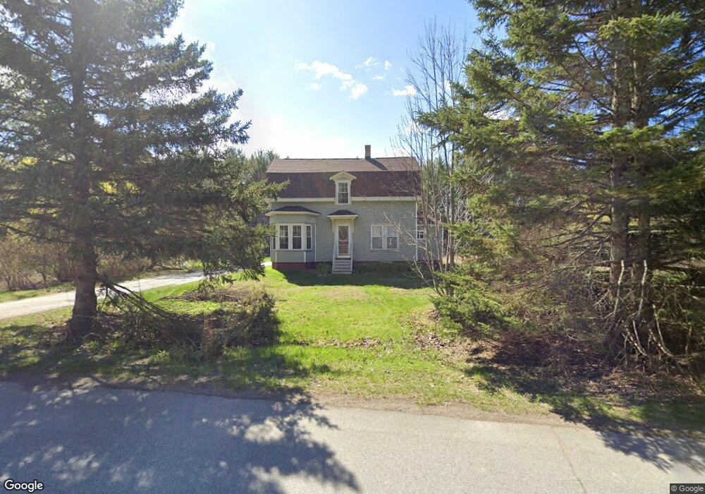
27 Papermill Rd Hampden, ME 04444
Estimated Value: $298,000 - $397,000
3
Beds
1
Bath
1,898
Sq Ft
$182/Sq Ft
Est. Value
About This Home
This home is located at 27 Papermill Rd, Hampden, ME 04444 and is currently estimated at $345,111, approximately $181 per square foot. 27 Papermill Rd is a home located in Penobscot County with nearby schools including North Star Christian School.
Ownership History
Date
Name
Owned For
Owner Type
Purchase Details
Closed on
Mar 19, 2018
Sold by
Vassiliev Properties Llc
Bought by
Vassiliev Victor
Current Estimated Value
Home Financials for this Owner
Home Financials are based on the most recent Mortgage that was taken out on this home.
Original Mortgage
$300,000
Outstanding Balance
$254,952
Interest Rate
4.22%
Mortgage Type
New Conventional
Estimated Equity
$90,159
Purchase Details
Closed on
May 17, 2006
Sold by
Gr Pa Grep 2004-2 Llc
Bought by
Vassiliev Victor
Create a Home Valuation Report for This Property
The Home Valuation Report is an in-depth analysis detailing your home's value as well as a comparison with similar homes in the area
Home Values in the Area
Average Home Value in this Area
Purchase History
We collect this data history from publicly available records. To have your information removed, we recommend requesting removal directly through your county’s website.
| Date | Buyer | Sale Price | Title Company |
|---|---|---|---|
| Vassiliev Victor | -- | -- | |
| Vassiliev Victor | -- | -- | |
| Vassiliev Victor | -- | -- |
Source: Public Records
Mortgage History
We collect this data history from publicly available records. To have your information removed, we recommend requesting removal directly through your county’s website.
| Date | Status | Borrower | Loan Amount |
|---|---|---|---|
| Open | Vassiliev Victor | $300,000 |
Source: Public Records
Tax History
| Year | Tax Paid | Tax Assessment Tax Assessment Total Assessment is a certain percentage of the fair market value that is determined by local assessors to be the total taxable value of land and additions on the property. | Land | Improvement |
|---|---|---|---|---|
| 2025 | $3,693 | $209,260 | $52,360 | $156,900 |
| 2024 | $2,984 | $190,700 | $48,100 | $142,600 |
| 2023 | $3,007 | $156,200 | $39,500 | $116,700 |
| 2022 | $2,884 | $139,300 | $35,600 | $103,700 |
| 2021 | $2,884 | $139,300 | $35,600 | $103,700 |
| 2020 | $9,343 | $139,300 | $35,600 | $103,700 |
| 2019 | $692 | $135,500 | $34,600 | $100,900 |
| 2018 | $2,656 | $135,500 | $34,600 | $100,900 |
| 2017 | $2,493 | $135,500 | $34,600 | $100,900 |
| 2016 | $2,475 | $136,000 | $35,000 | $101,000 |
| 2015 | $2,380 | $136,000 | $35,000 | $101,000 |
| 2014 | $2,371 | $135,500 | $34,600 | $100,900 |
| 2013 | $2,256 | $135,500 | $34,600 | $100,900 |
Source: Public Records
Map
Nearby Homes
- 223 Coldbrook Rd
- 73 Papermill Rd
- 20 Ruth Ave
- 55 Main Trail
- 12 Surrey Ln
- 42 Coldbrook Rd
- 7 Williams St
- 51 Stearns Farm Rd
- 180 Main Rd N
- 35 George St
- 188 Main Rd N
- 12 Western Ave
- 13 Westbrook Terrace
- 202 Main Rd N
- 47 Main Rd N
- 338 Western Ave
- 164 Mayo Rd
- 0 Western Ave Unit 21258039
- 23 Frances Dr
- 304 Main Rd N
- 31 Papermill Rd
- 24 Papermill Rd
- 16 Papermill Rd
- 42 Papermill Rd
- 46 Papermill Rd
- 41 Papermill Rd
- 6 Papermill Rd
- Lot 7 Papermill Rd
- 51 Papermill Rd
- 255 Coldbrook Rd
- 214 Coldbrook Rd
- 52 Papermill Rd
- 250 Coldbrook Rd
- 5 Lindsey Way
- 53 Papermill Rd
- 64 Papermill Rd
- 9 Lindsey Way
- 266 Coldbrook Rd
- 69 Papermill Rd
- 15 Lindsey Way
Your Personal Tour Guide
Ask me questions while you tour the home.