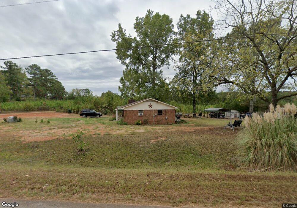
270 Mauldin Rd Thomaston, GA 30286
Estimated Value: $126,000 - $145,000
2
Beds
1
Bath
1,026
Sq Ft
$132/Sq Ft
Est. Value
About This Home
This home is located at 270 Mauldin Rd, Thomaston, GA 30286 and is currently estimated at $135,683, approximately $132 per square foot. 270 Mauldin Rd is a home located in Upson County with nearby schools including Upson-Lee South Elementary School, Upson-Lee North Elementary School, and Upson-Lee Middle School.
Ownership History
Date
Name
Owned For
Owner Type
Purchase Details
Closed on
Sep 16, 2025
Sold by
Barron Stacey Ann
Bought by
Sanders Makayla N
Current Estimated Value
Home Financials for this Owner
Home Financials are based on the most recent Mortgage that was taken out on this home.
Original Mortgage
$122,735
Outstanding Balance
$122,626
Interest Rate
6.58%
Mortgage Type
FHA
Estimated Equity
$13,057
Purchase Details
Closed on
Aug 7, 2025
Sold by
Williams Beulah June
Bought by
Barron Stacey Ann and Oneal Rickey Darrell
Home Financials for this Owner
Home Financials are based on the most recent Mortgage that was taken out on this home.
Original Mortgage
$122,735
Outstanding Balance
$122,626
Interest Rate
6.58%
Mortgage Type
FHA
Estimated Equity
$13,057
Purchase Details
Closed on
Jun 5, 2025
Sold by
Watkins Martha Jennifer
Bought by
Barron Stacey Ann
Purchase Details
Closed on
Apr 28, 2025
Sold by
Sanders Martha Jennifer
Bought by
Barron Stacey Ann and Oneal Rickey Darrell
Create a Home Valuation Report for This Property
The Home Valuation Report is an in-depth analysis detailing your home's value as well as a comparison with similar homes in the area
Purchase History
| Date | Buyer | Sale Price | Title Company |
|---|---|---|---|
| Sanders Makayla N | $125,000 | -- | |
| Barron Stacey Ann | -- | -- | |
| Barron Stacey Ann | -- | -- | |
| Barron Stacey Ann | -- | -- | |
| Sanders Martha Jennifer | -- | -- |
Source: Public Records
Mortgage History
| Date | Status | Borrower | Loan Amount |
|---|---|---|---|
| Open | Sanders Makayla N | $122,735 |
Source: Public Records
Tax History
| Year | Tax Paid | Tax Assessment Tax Assessment Total Assessment is a certain percentage of the fair market value that is determined by local assessors to be the total taxable value of land and additions on the property. | Land | Improvement |
|---|---|---|---|---|
| 2025 | $886 | $42,209 | $4,049 | $38,160 |
| 2024 | $886 | $34,414 | $3,374 | $31,040 |
| 2023 | $420 | $34,414 | $3,374 | $31,040 |
| 2022 | $577 | $22,811 | $1,527 | $21,284 |
| 2021 | $449 | $19,041 | $1,527 | $17,514 |
| 2020 | $461 | $18,359 | $1,787 | $16,572 |
| 2019 | $458 | $16,945 | $1,787 | $15,158 |
| 2018 | $458 | $16,945 | $1,787 | $15,158 |
| 2017 | $478 | $16,221 | $1,787 | $14,434 |
| 2016 | $423 | $14,374 | $1,489 | $12,885 |
| 2015 | $423 | $14,374 | $1,489 | $12,885 |
| 2014 | $424 | $14,397 | $1,512 | $12,885 |
Source: Public Records
Map
Nearby Homes
- 291 Mauldin Rd
- 0 Stone Ln Unit 7573332
- 0 Stone Ln Unit 10514742
- 47 Childrees Rd
- 47 Mathis Lake Rd
- 164 New Harmony Church Rd
- 5911 Indian Trail
- 1210 Waymanville Rd
- 1242 Waymanville Rd
- 1224 Waymanville Rd
- 374 Gordon School Rd
- 112 Pasley St
- 0 Highway 19 S Unit 24061935
- 2088 Wiley St
- 0 Davis Lake Rd Unit 10511531
- 107 Hammerhead Ln Unit LOT 32
- 615 Peachtree Dr
- 315 Dallas Dr
- 0 Goshen Rd Unit 10695051
- 0 Goshen Rd Unit 26382561
Your Personal Tour Guide
Ask me questions while you tour the home.