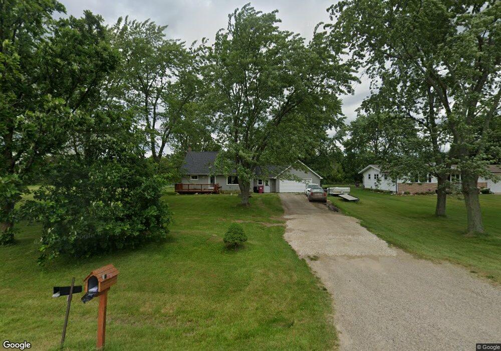
270 W Wilkinson Rd Owosso, MI 48867
Estimated Value: $177,633 - $326,000
Studio
--
Bath
--
Sq Ft
2
Acres Lot
About This Home
This home is located at 270 W Wilkinson Rd, Owosso, MI 48867 and is currently estimated at $233,658. 270 W Wilkinson Rd is a home located in Shiawassee County with nearby schools including Owosso High School, Owosso Sda School, and St. Paul School.
Ownership History
Date
Name
Owned For
Owner Type
Purchase Details
Closed on
Aug 13, 2014
Sold by
Kidwell Michele L and Kidwell Michele L
Bought by
Cole Tony A
Current Estimated Value
Home Financials for this Owner
Home Financials are based on the most recent Mortgage that was taken out on this home.
Original Mortgage
$100,152
Outstanding Balance
$77,463
Interest Rate
4.5%
Mortgage Type
FHA
Estimated Equity
$156,195
Purchase Details
Closed on
Sep 28, 2002
Sold by
Lovell Kim
Bought by
Lovell Ted
Create a Home Valuation Report for This Property
The Home Valuation Report is an in-depth analysis detailing your home's value as well as a comparison with similar homes in the area
Home Values in the Area
Average Home Value in this Area
Purchase History
| Date | Buyer | Sale Price | Title Company |
|---|---|---|---|
| Cole Tony A | $102,000 | -- | |
| Lovell Ted | -- | -- |
Source: Public Records
Mortgage History
| Date | Status | Borrower | Loan Amount |
|---|---|---|---|
| Open | Cole Tony A | $100,152 |
Source: Public Records
Tax History
| Year | Tax Paid | Tax Assessment Tax Assessment Total Assessment is a certain percentage of the fair market value that is determined by local assessors to be the total taxable value of land and additions on the property. | Land | Improvement |
|---|---|---|---|---|
| 2025 | $2,551 | $77,400 | $0 | $0 |
| 2024 | $2,542 | $74,700 | $0 | $0 |
| 2023 | $577 | $70,200 | $0 | $0 |
| 2022 | $550 | $63,600 | $0 | $0 |
| 2021 | $2,357 | $53,700 | $0 | $0 |
| 2020 | $2,344 | $51,400 | $0 | $0 |
| 2019 | $2,144 | $47,600 | $0 | $0 |
| 2018 | $1,882 | $46,900 | $0 | $0 |
| 2017 | $1,127 | $44,900 | $0 | $0 |
| 2016 | -- | $44,900 | $0 | $0 |
| 2015 | -- | $42,200 | $0 | $0 |
| 2014 | $5 | $39,000 | $0 | $0 |
Source: Public Records
Map
Nearby Homes
- 2183 N Burning Tree Cir
- 2145 N M 52
- 2445 N Hickory Rd
- 553 W Wildwood Dr
- 570 W Wildwood Dr
- 770 Getman Rd
- 914 Chipman Ln
- 1131 Riverside Dr
- 1200 N Dewey St
- 1473 Mallard Cir
- 1430 Mallard Cir
- 1475 N Water St
- 1090 Jackson Dr
- 647 N Washington St
- 707 W King St
- 1339 Olmstead St
- 615 Clark Ave
- 1532 Alta Vista Dr
- 1590 Mason Rd
- 1568 Kenneth St
- 260 W Wilkinson Rd
- 360 W Wilkinson Rd
- 245 Clover Brook Dr
- 267 Clover Brook Dr
- 240 W Wilkinson Rd
- 289 Clover Brook Dr
- 390 W Wilkinson Rd
- 182 W Wilkinson Rd
- 311 Clover Brook Dr
- 2100 Evergreen Ct
- 2100 Evergreen Ct
- 2101 Evergreen Ct
- 173 Clover Brook Dr
- 160 W Wilkinson Rd
- 2106 Evergreen Ct
- 320 Clover Brook Dr
- 420 W Wilkinson Rd
- 331 Clover Brook Dr
- 2105 Evergreen Ct
- 2256 Burning Tree Cir
Your Personal Tour Guide
Ask me questions while you tour the home.