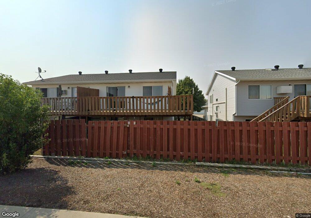
2703 33 1 2 Ave S Fargo, ND 58104
Stonebridge NeighborhoodEstimated Value: $243,000 - $269,000
3
Beds
2
Baths
1,672
Sq Ft
$153/Sq Ft
Est. Value
About This Home
This home is located at 2703 33 1 2 Ave S, Fargo, ND 58104 and is currently estimated at $255,853, approximately $153 per square foot. 2703 33 1 2 Ave S is a home located in Cass County with nearby schools including Ed Clapp Elementary School, Discovery Middle School, and Fargo Davies High School.
Ownership History
Date
Name
Owned For
Owner Type
Purchase Details
Closed on
May 11, 2022
Sold by
Markos Oil Lllp
Bought by
C & E Finance Inc
Current Estimated Value
Home Financials for this Owner
Home Financials are based on the most recent Mortgage that was taken out on this home.
Original Mortgage
$161,250
Outstanding Balance
$138,174
Interest Rate
3.89%
Mortgage Type
New Conventional
Estimated Equity
$117,679
Purchase Details
Closed on
Mar 31, 2022
Sold by
C & E Finance Inc
Bought by
Meester Properties Llc
Home Financials for this Owner
Home Financials are based on the most recent Mortgage that was taken out on this home.
Original Mortgage
$161,250
Outstanding Balance
$138,174
Interest Rate
3.89%
Mortgage Type
New Conventional
Estimated Equity
$117,679
Purchase Details
Closed on
Dec 26, 2018
Sold by
Lue Marlas
Bought by
Lee Ctc Finalce
Create a Home Valuation Report for This Property
The Home Valuation Report is an in-depth analysis detailing your home's value as well as a comparison with similar homes in the area
Home Values in the Area
Average Home Value in this Area
Purchase History
| Date | Buyer | Sale Price | Title Company |
|---|---|---|---|
| C & E Finance Inc | -- | None Listed On Document | |
| Meester Properties Llc | -- | Fm Title | |
| Meester Properties Llc | $215,000 | Fm Title | |
| Lee Ctc Finalce | -- | None Available |
Source: Public Records
Mortgage History
| Date | Status | Borrower | Loan Amount |
|---|---|---|---|
| Open | Meester Properties Llc | $161,250 | |
| Closed | Meester Properties Llc | $161,250 |
Source: Public Records
Tax History
| Year | Tax Paid | Tax Assessment Tax Assessment Total Assessment is a certain percentage of the fair market value that is determined by local assessors to be the total taxable value of land and additions on the property. | Land | Improvement |
|---|---|---|---|---|
| 2025 | $3,089 | $110,350 | $13,100 | $97,250 |
| 2024 | $3,087 | $110,350 | $13,100 | $97,250 |
| 2023 | $2,739 | $100,300 | $13,100 | $87,200 |
| 2022 | $2,616 | $94,300 | $10,700 | $83,600 |
| 2021 | $2,300 | $84,200 | $10,700 | $73,500 |
| 2020 | $2,089 | $79,450 | $10,700 | $68,750 |
| 2019 | $2,050 | $77,900 | $6,350 | $71,550 |
| 2018 | $2,050 | $77,900 | $6,350 | $71,550 |
| 2017 | $2,005 | $77,900 | $6,350 | $71,550 |
| 2016 | $1,555 | $66,000 | $6,200 | $59,800 |
| 2015 | $1,508 | $60,000 | $4,250 | $55,750 |
| 2014 | $1,547 | $60,000 | $4,250 | $55,750 |
| 2013 | $1,522 | $59,000 | $4,250 | $54,750 |
Source: Public Records
Map
Nearby Homes
- 2606 33rd Ave S
- 3401 28th St S Unit 102
- 2705 35th Ave S Unit 202
- 2629 35th Ave S Unit 306
- 3004 Dakota Park Cir S
- 2408 34th Ave S
- 3064 23rd St S
- 3111 22nd St S
- 2501 30th Ave S Unit 201
- 2332 30th Ave S
- 2330 30th Ave S
- 3240 35th Ave S
- 2338 30th Ave S
- 2336 30th Ave S
- 2111 32nd Ave S
- 3053 22nd St S
- 61 Fremont Dr S
- 3018 36th Ave S
- 3628 28th St S
- 46 Fremont Dr S
- 2703 33 1/2 Ave S
- 2701 33 1 2 Ave S
- 2709 33 1/2 Ave S
- 2701 33 1/2 Ave S
- 2709 33 1 2 Ave S
- 2711 33 1/2 Ave S
- 2711 33 1 2 Ave S
- 2717 33 1/2 Ave S
- 2717 33 1 2 Ave S Unit N
- 2717 33 1 2 Ave S
- 2719 33 1 2 Ave S
- 2719 33 1/2 Ave S
- 2725 33 1/2 Ave S
- 2725 33 1 2 Ave S
- 2710 33 1 2 Ave S
- 2702 33 1 2 Ave S
- 2704 33 1/2 Ave S
- 2710 33 1/2 Ave S
- 2727 33 1 2 Ave S
- 2702 33 1/2 Ave S
Your Personal Tour Guide
Ask me questions while you tour the home.