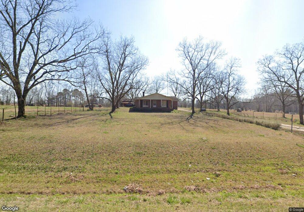
2708 Wire Rd Thomson, GA 30824
Estimated Value: $318,809
Studio
--
Bath
1,904
Sq Ft
$167/Sq Ft
Est. Value
About This Home
This home is located at 2708 Wire Rd, Thomson, GA 30824 and is currently estimated at $318,809, approximately $167 per square foot. 2708 Wire Rd is a home with nearby schools including Freeman Elementary School, Warren County Middle School, and Warren County High School.
Ownership History
Date
Name
Owned For
Owner Type
Purchase Details
Closed on
Mar 30, 2004
Sold by
Bridges James Malcol
Bought by
Bridges James Malcol
Current Estimated Value
Purchase Details
Closed on
May 9, 1994
Bought by
Bridges James Malcol
Purchase Details
Closed on
May 31, 1979
Sold by
Bridges Marie
Bought by
Bridges James M
Purchase Details
Closed on
Mar 27, 1964
Sold by
Bridges Ja
Bought by
Bridges
Create a Home Valuation Report for This Property
The Home Valuation Report is an in-depth analysis detailing your home's value as well as a comparison with similar homes in the area
Purchase History
| Date | Buyer | Sale Price | Title Company |
|---|---|---|---|
| Bridges James Malcol | -- | -- | |
| Bridges James Malcol | -- | -- | |
| Bridges James M | -- | -- | |
| Bridges | -- | -- |
Source: Public Records
Tax History
| Year | Tax Paid | Tax Assessment Tax Assessment Total Assessment is a certain percentage of the fair market value that is determined by local assessors to be the total taxable value of land and additions on the property. | Land | Improvement |
|---|---|---|---|---|
| 2025 | $2,007 | $128,388 | $89,286 | $39,102 |
| 2024 | $2,044 | $89,150 | $50,048 | $39,102 |
| 2023 | $1,941 | $86,485 | $50,048 | $36,437 |
| 2022 | $1,918 | $86,485 | $50,048 | $36,437 |
| 2021 | $1,895 | $86,485 | $50,048 | $36,437 |
| 2020 | $1,885 | $86,485 | $50,048 | $36,437 |
| 2019 | $1,867 | $86,485 | $50,048 | $36,437 |
| 2018 | $2,626 | $86,485 | $50,048 | $36,437 |
| 2017 | $1,779 | $86,885 | $50,048 | $36,837 |
| 2016 | $2,811 | $86,885 | $50,048 | $36,837 |
| 2015 | -- | $86,885 | $50,048 | $36,837 |
| 2014 | -- | $86,885 | $50,048 | $36,837 |
| 2013 | -- | $86,884 | $50,048 | $36,836 |
Source: Public Records
Map
Nearby Homes
- 151 Gin Branch Rd
- 141 Gin Branch Rd
- 110 Gin Branch Rd
- 125 Gin Branch Rd
- 150 Gin Branch Rd
- 140 Gin Branch Rd
- 124 Gin Branch Rd
- 125 Big Rock Rd
- 126 Big Rock Rd
- 110 Big Rock Rd
- 141 Big Rock Rd
- 140 Big Rock Rd
- 150 Big Rock Rd
- 111 Alcovy Rd
- 156 Alcovy Rd
- 167 Alcovy Rd
- 125 Alcovy Rd
- 126 Alcovy Rd
- 141 Alcovy Rd
- 155 Alcovy Rd
- 3095 Wire Rd
- 147 Wire Extension
- 638 Old Wire Rd
- 622 Old Wire Rd
- 621 Old Wire Rd
- 2499 Wire Rd
- 586 Old Wire Rd
- 566 Old Wire Rd
- 2944 Mesena Rd
- 2966 Old Mesena Rd NW
- 2956 Old Mesena Rd NW
- 2916 Old Mesena Rd NW
- 2932 Old Mesena Rd NW
- 230 E Reese Rd Unit 276
- 276 E Reese Rd
- 188 E Reese Rd
- 3155 Mesena Rd
- 3017 Mesena Rd
- 3171 Mesena Rd
- 3063 Mesena Rd
Your Personal Tour Guide
Ask me questions while you tour the home.