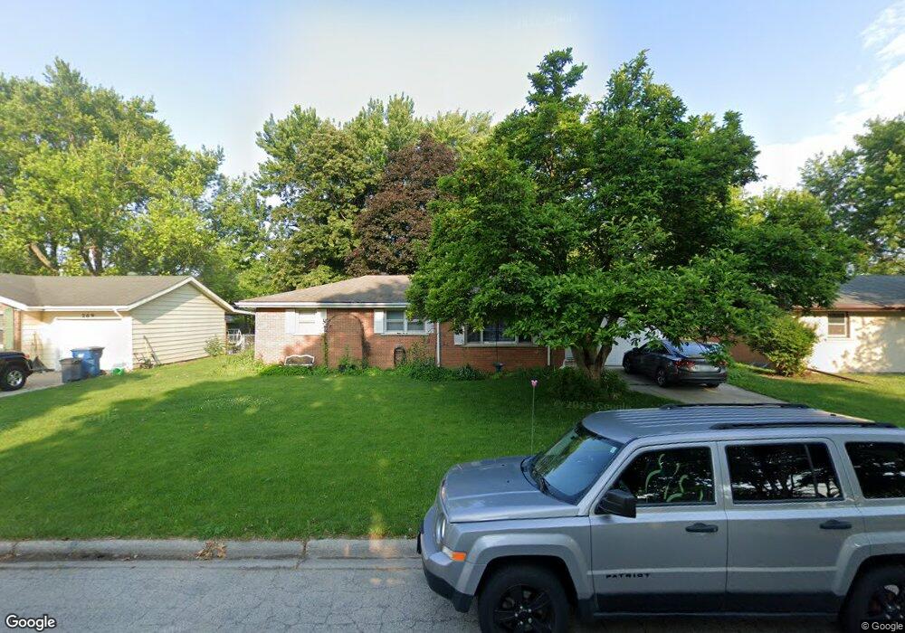
271 Ashley Ave Bourbonnais, IL 60914
Estimated Value: $186,000 - $223,506
4
Beds
3
Baths
1,300
Sq Ft
$160/Sq Ft
Est. Value
About This Home
This home is located at 271 Ashley Ave, Bourbonnais, IL 60914 and is currently estimated at $207,377, approximately $159 per square foot. 271 Ashley Ave is a home located in Kankakee County with nearby schools including Shabbona Elementary School, Liberty Intermediate School, and Bourbonnais Upper Grade Center.
Ownership History
Date
Name
Owned For
Owner Type
Purchase Details
Closed on
Aug 16, 2005
Sold by
Justin Brummond and Justin Jennifer
Bought by
Pfeiffer Joseph R and Pfeiffer Jaime L
Current Estimated Value
Home Financials for this Owner
Home Financials are based on the most recent Mortgage that was taken out on this home.
Original Mortgage
$112,000
Outstanding Balance
$62,076
Interest Rate
7.15%
Mortgage Type
New Conventional
Estimated Equity
$145,301
Create a Home Valuation Report for This Property
The Home Valuation Report is an in-depth analysis detailing your home's value as well as a comparison with similar homes in the area
Home Values in the Area
Average Home Value in this Area
Purchase History
| Date | Buyer | Sale Price | Title Company |
|---|---|---|---|
| Pfeiffer Joseph R | $140,000 | Ticor Title |
Source: Public Records
Mortgage History
| Date | Status | Borrower | Loan Amount |
|---|---|---|---|
| Open | Pfeiffer Joseph R | $112,000 |
Source: Public Records
Tax History
| Year | Tax Paid | Tax Assessment Tax Assessment Total Assessment is a certain percentage of the fair market value that is determined by local assessors to be the total taxable value of land and additions on the property. | Land | Improvement |
|---|---|---|---|---|
| 2025 | $4,054 | $61,136 | $6,956 | $54,180 |
| 2024 | $4,054 | $54,782 | $6,562 | $48,220 |
| 2023 | $3,693 | $50,724 | $6,076 | $44,648 |
| 2022 | $3,619 | $48,046 | $5,856 | $42,190 |
| 2021 | $3,550 | $46,989 | $5,727 | $41,262 |
| 2020 | $3,454 | $45,095 | $5,574 | $39,521 |
| 2019 | $3,242 | $42,306 | $5,412 | $36,894 |
| 2018 | $3,331 | $43,181 | $5,332 | $37,849 |
| 2017 | $3,259 | $42,128 | $5,202 | $36,926 |
| 2016 | $3,164 | $41,145 | $5,125 | $36,020 |
| 2015 | $3,233 | $41,465 | $5,074 | $36,391 |
| 2014 | $2,741 | $37,297 | $5,074 | $32,223 |
| 2013 | -- | $41,465 | $5,074 | $36,391 |
Source: Public Records
Map
Nearby Homes
- 250 N Levasseur Ave
- 179 N Levasseur Ave
- 287 Belle Aire Ave
- 899 Armour Rd
- 260 W Country Ct
- 230 Curwick Dr
- 675 Washington Ave
- 440 S Cryer Ave
- 141 Pfitzer Dr
- 609 Ivy Ln
- 206 Meadows Rd S
- 209 Meadows Rd S
- 273 Harvard Ave
- 703 Heritage Dr
- 1063 Yale Ave
- 508 N Forest Ave
- 0 Broadway St E Unit MRD12509049
- 901 W North St
- 411 N Prairie Ave
- 42 Hanson Dr
- 285 Ashley Ave
- 269 Ashley Ave
- 291 Ashley Ave
- 280 Ashley Ave
- 270 Ashley Ave
- 250 Ashley Ave
- 288 Ashley Ave
- 284 N Levasseur Ave
- 260 N Levasseur Ave
- 297 Ashley Ave
- 272 N Levasseur Ave
- 241 Ashley Ave
- 296 N Levasseur Ave
- 238 Ashley Ave
- 238 N Levasseur Ave
- 298 Ashley Ave
- 305 Ashley Ave
- 308 N Levasseur Ave
- 228 N Levasseur Ave
Your Personal Tour Guide
Ask me questions while you tour the home.