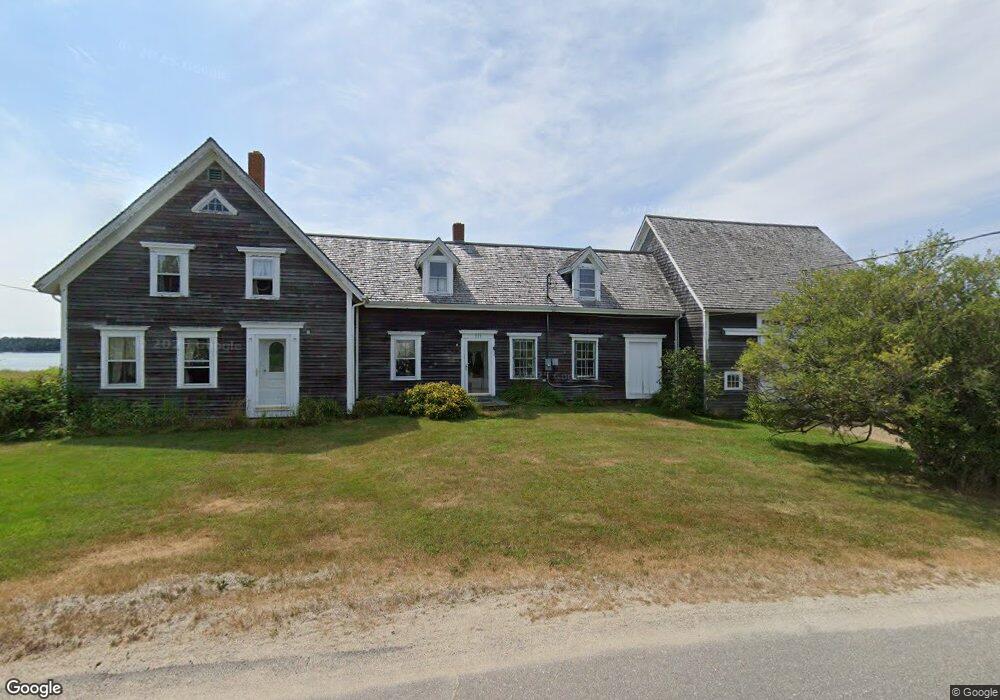
271 Mooseneck Rd Addison, ME 04606
Estimated Value: $392,535 - $580,000
4
Beds
1
Bath
1,725
Sq Ft
$274/Sq Ft
Est. Value
About This Home
This home is located at 271 Mooseneck Rd, Addison, ME 04606 and is currently estimated at $472,134, approximately $273 per square foot. 271 Mooseneck Rd is a home.
Create a Home Valuation Report for This Property
The Home Valuation Report is an in-depth analysis detailing your home's value as well as a comparison with similar homes in the area
Tax History
| Year | Tax Paid | Tax Assessment Tax Assessment Total Assessment is a certain percentage of the fair market value that is determined by local assessors to be the total taxable value of land and additions on the property. | Land | Improvement |
|---|---|---|---|---|
| 2025 | $4,478 | $232,000 | $131,900 | $100,100 |
| 2024 | $4,343 | $232,000 | $131,900 | $100,100 |
| 2023 | $3,995 | $232,000 | $131,900 | $100,100 |
| 2022 | $3,748 | $225,800 | $125,700 | $100,100 |
| 2021 | $3,748 | $225,800 | $125,700 | $100,100 |
| 2020 | $3,685 | $230,300 | $125,700 | $104,600 |
| 2019 | $3,662 | $230,300 | $125,700 | $104,600 |
| 2018 | $3,662 | $230,300 | $125,700 | $104,600 |
| 2017 | $3,662 | $230,300 | $125,700 | $104,600 |
| 2016 | $3,362 | $230,300 | $125,700 | $104,600 |
| 2015 | $3,305 | $230,300 | $125,700 | $104,600 |
| 2014 | $3,086 | $230,300 | $125,700 | $104,600 |
| 2013 | $2,879 | $230,300 | $125,700 | $104,600 |
Source: Public Records
Map
Nearby Homes
- 397 Cape Split Rd
- 00 Eagle Island
- M17L21 Basin Rd
- map 17 Basin Rd Unit lot 24
- 780 E Side Rd
- 0 Pomp Island Unit 1652405
- 29 Hotel Cove Rd
- 251 Ripley Neck Rd
- Lot 13 Reef Point Rd
- Lot 12 Reef Point Rd
- M20L2 E Side Rd
- 29 Reef Point Rd
- Lot 15-5 Fort Williams Rd
- Lot # 15-2 Fort Williams Rd
- Lot B Fort Williams Rd
- 16 & 18 Nelson Way
- Lot #8 Seaberry Landing Rd
- 33 Barneys Cove Rd
- 55 Wilders Way
- 60 W Wind Rd
- 278 Mooseneck Rd
- 274 Mooseneck Rd
- 284 Mooseneck Rd
- 287 Mooseneck Rd
- 286 Mooseneck Rd
- 259 Mooseneck Rd
- 291 Mooseneck Rd
- 291A Mooseneck Rd
- 294 Mooseneck Rd
- 296 Mooseneck Rd
- 297 Mooseneck Rd
- 300 Mooseneck Rd
- 300 Mooseneck Rd
- 242 Mooseneck Rd
- 238 Mooseneck Rd
- 305 Mooseneck Rd
- 243 Mooseneck Rd
- 308 Mooseneck Rd
- 282 Mooseneck Rd
- 309 Mooseneck Rd
Your Personal Tour Guide
Ask me questions while you tour the home.