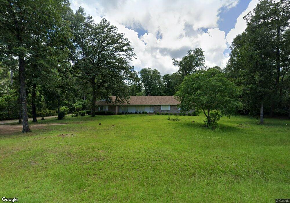
2711 Michael Rd Albany, GA 31721
Estimated Value: $222,000 - $275,007
4
Beds
2
Baths
2,425
Sq Ft
$102/Sq Ft
Est. Value
About This Home
This home is located at 2711 Michael Rd, Albany, GA 31721 and is currently estimated at $248,502, approximately $102 per square foot. 2711 Michael Rd is a home located in Dougherty County with nearby schools including Live Oak Elementary School, Merry Acres Middle School, and Westover High School.
Ownership History
Date
Name
Owned For
Owner Type
Purchase Details
Closed on
Feb 20, 2001
Sold by
Waldrop George A and Waldrop Lina A
Bought by
Jenkins Eva M
Current Estimated Value
Purchase Details
Closed on
Jun 30, 1993
Sold by
Waldrop George A
Bought by
Waldrop Lina A
Purchase Details
Closed on
Aug 2, 1982
Sold by
Vaserberg Morton
Bought by
Waldrop George A
Create a Home Valuation Report for This Property
The Home Valuation Report is an in-depth analysis detailing your home's value as well as a comparison with similar homes in the area
Purchase History
| Date | Buyer | Sale Price | Title Company |
|---|---|---|---|
| Jenkins Eva M | $154,800 | -- | |
| Waldrop Lina A | -- | -- | |
| Waldrop George A | -- | -- |
Source: Public Records
Tax History
| Year | Tax Paid | Tax Assessment Tax Assessment Total Assessment is a certain percentage of the fair market value that is determined by local assessors to be the total taxable value of land and additions on the property. | Land | Improvement |
|---|---|---|---|---|
| 2025 | $3,727 | $75,600 | $15,840 | $59,760 |
| 2024 | $3,727 | $75,600 | $15,840 | $59,760 |
| 2023 | $2,590 | $75,600 | $15,840 | $59,760 |
| 2022 | $3,442 | $75,600 | $15,840 | $59,760 |
| 2021 | $3,191 | $75,600 | $15,840 | $59,760 |
| 2020 | $3,198 | $75,600 | $15,840 | $59,760 |
| 2019 | $3,069 | $72,360 | $15,840 | $56,520 |
| 2018 | $3,201 | $75,080 | $15,840 | $59,240 |
| 2017 | $2,982 | $75,080 | $15,840 | $59,240 |
| 2016 | $2,984 | $75,080 | $15,840 | $59,240 |
| 2015 | $2,992 | $75,080 | $15,840 | $59,240 |
| 2014 | $2,879 | $73,200 | $13,960 | $59,240 |
Source: Public Records
Map
Nearby Homes
- 2713 Westmeade Rd
- 2806 N Doublegate Dr
- 2819 N Doublegate Dr
- N/A N Doublegate Dr
- 2707 Somerset Dr
- 112 Berkeley Rd
- 2705 Brittany Rd
- 3803 Gateway Ave
- 245 N Doublegate Dr
- 2720 Somerset Dr
- 2607 Lansing Dr
- 3705 Old Dawson Rd
- 2530 E Alberson Dr
- 2800 W Doublegate Dr
- 280 W Doublegate Dr
- 2710 Shannon Rd
- 2813 W Doublegate Dr
- 2600 E Doublegate Dr
- LOT 14 Make Ct
- Lot 12 Make Ct
- 2713 Michael Rd
- 2709 Michael Rd
- 2712 Westmeade Rd
- 2708 Michael Rd
- 2710 Westmeade Rd
- 2708 Westmeade Rd
- 2710 Michael Rd
- 2707 Michael Rd
- LOT 35 Michael Rd
- 2706 Michael Rd
- 2706 Westmeade Rd
- 3607 Shannon Rd
- 3605 Shannon Rd
- 2709 Cambridge Rd
- 2711 Cambridge Rd
- 3609 Shannon Rd
- 2705 Michael Rd
- 3603 Shannon Rd
- 2707 Cambridge Rd
- 2704 Michael Rd
Your Personal Tour Guide
Ask me questions while you tour the home.