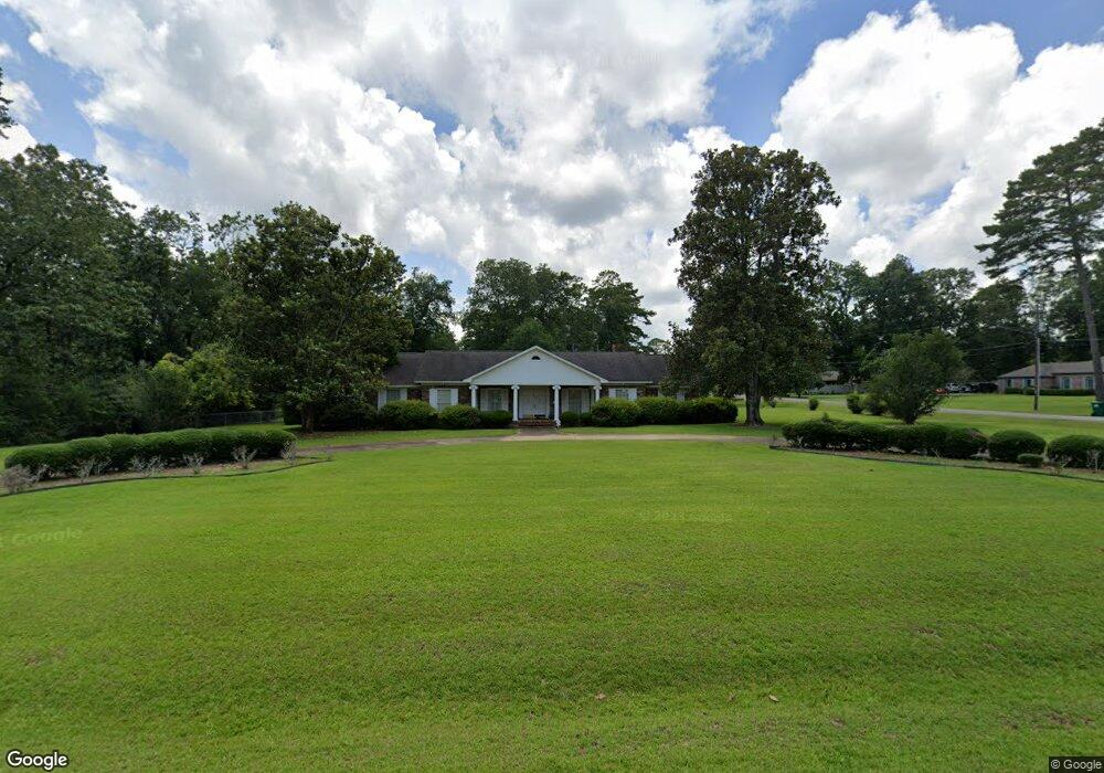
2713 Michael Rd Albany, GA 31721
Estimated Value: $263,000 - $368,000
4
Beds
3
Baths
4,128
Sq Ft
$79/Sq Ft
Est. Value
About This Home
This home is located at 2713 Michael Rd, Albany, GA 31721 and is currently estimated at $326,242, approximately $79 per square foot. 2713 Michael Rd is a home located in Dougherty County with nearby schools including Live Oak Elementary School, Merry Acres Middle School, and Westover High School.
Ownership History
Date
Name
Owned For
Owner Type
Purchase Details
Closed on
Jul 7, 2014
Sold by
Carter Fred Wayne
Bought by
Fred W Carter Jr As Trustee Of The Certa
Current Estimated Value
Purchase Details
Closed on
Jul 1, 2014
Sold by
Fred W Carter Sras Trustee Of
Bought by
Carter Fred W
Purchase Details
Closed on
Feb 25, 2014
Sold by
Carter Bobbie Oates
Bought by
Carter Fred Wayne
Purchase Details
Closed on
Oct 9, 1970
Sold by
Israel Wayne
Bought by
Carter Fred W Etal
Create a Home Valuation Report for This Property
The Home Valuation Report is an in-depth analysis detailing your home's value as well as a comparison with similar homes in the area
Purchase History
| Date | Buyer | Sale Price | Title Company |
|---|---|---|---|
| Fred W Carter Jr As Trustee Of The Certa | -- | -- | |
| Carter Fred W | -- | -- | |
| Carter Fred Wayne | -- | -- | |
| Carter Fred W Etal | -- | -- |
Source: Public Records
Tax History
| Year | Tax Paid | Tax Assessment Tax Assessment Total Assessment is a certain percentage of the fair market value that is determined by local assessors to be the total taxable value of land and additions on the property. | Land | Improvement |
|---|---|---|---|---|
| 2025 | $4,361 | $86,120 | $15,840 | $70,280 |
| 2024 | $4,361 | $86,120 | $15,840 | $70,280 |
| 2023 | $4,012 | $86,120 | $15,840 | $70,280 |
| 2022 | $4,027 | $86,120 | $15,840 | $70,280 |
| 2021 | $3,734 | $86,120 | $15,840 | $70,280 |
| 2020 | $3,742 | $86,120 | $15,840 | $70,280 |
| 2019 | $3,757 | $86,120 | $15,840 | $70,280 |
| 2018 | $3,773 | $86,120 | $15,840 | $70,280 |
| 2017 | $3,514 | $86,120 | $15,840 | $70,280 |
| 2016 | $3,516 | $86,120 | $15,840 | $70,280 |
| 2015 | $3,526 | $86,120 | $15,840 | $70,280 |
| 2014 | $3,297 | $84,240 | $13,960 | $70,280 |
Source: Public Records
Map
Nearby Homes
- 2713 Westmeade Rd
- 2806 N Doublegate Dr
- 2703 Cambridge Rd
- 2819 N Doublegate Dr
- N/A N Doublegate Dr
- 112 Berkeley Rd
- 2707 Somerset Dr
- 2705 Brittany Rd
- 245 N Doublegate Dr
- 2720 Somerset Dr
- 3602 Old Dawson Rd
- 222 N Doublegate Dr
- 2607 Lansing Dr
- 3705 Old Dawson Rd
- 2530 E Alberson Dr
- 280 W Doublegate Dr
- 2800 W Doublegate Dr
- 2813 W Doublegate Dr
- 2710 Shannon Rd
- LOT 14 Make Ct
- 2711 Michael Rd
- 2710 Westmeade Rd
- 2710 Michael Rd
- 3607 Shannon Rd
- 3605 Shannon Rd
- 2712 Westmeade Rd
- 2709 Michael Rd
- 3609 Shannon Rd
- 2708 Michael Rd
- 3603 Shannon Rd
- 2708 Westmeade Rd
- 2711 Cambridge Rd
- 156 Berkeley Rd
- 160 Berkeley Rd
- 2707 Michael Rd
- 150 Berkeley Rd
- 2709 Cambridge Rd
- 3601 Shannon Rd
- LOT 35 Michael Rd
- 2706 Michael Rd
Your Personal Tour Guide
Ask me questions while you tour the home.