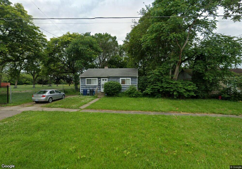
2715 Branch Rd Flint, MI 48506
Potter Longway NeighborhoodEstimated Value: $33,000 - $59,496
2
Beds
1
Bath
720
Sq Ft
$66/Sq Ft
Est. Value
About This Home
This home is located at 2715 Branch Rd, Flint, MI 48506 and is currently estimated at $47,374, approximately $65 per square foot. 2715 Branch Rd is a home located in Genesee County with nearby schools including Potter School, Richfield Public School Academy, and Richfield Early Learning Center.
Ownership History
Date
Name
Owned For
Owner Type
Purchase Details
Closed on
Apr 6, 2009
Sold by
Secretary Of Housing & Urban Development
Bought by
Dionne Aaron J
Current Estimated Value
Purchase Details
Closed on
Jul 22, 2008
Sold by
Countrywide Home Loans Inc
Bought by
The Secretary Of Housing & Urban Develop
Purchase Details
Closed on
May 8, 2008
Sold by
Mortgage Electronic Registration Systems
Bought by
Countrywide Home Loans Inc
Purchase Details
Closed on
Jan 2, 2008
Sold by
Warfield David
Bought by
Mortage Electronic Registration Systems
Purchase Details
Closed on
Aug 12, 2005
Sold by
Haack William L and Haack Mildred A
Bought by
Warfield David E
Create a Home Valuation Report for This Property
The Home Valuation Report is an in-depth analysis detailing your home's value as well as a comparison with similar homes in the area
Home Values in the Area
Average Home Value in this Area
Purchase History
We collect this data history from publicly available records. To have your information removed, we recommend requesting removal directly through your county’s website.
| Date | Buyer | Sale Price | Title Company |
|---|---|---|---|
| Dionne Aaron J | $3,850 | None Available | |
| The Secretary Of Housing & Urban Develop | -- | None Available | |
| Countrywide Home Loans Inc | -- | None Available | |
| Mortage Electronic Registration Systems | $36,461 | None Available | |
| Warfield David E | $35,000 | Guaranty Title Company |
Source: Public Records
Tax History
| Year | Tax Paid | Tax Assessment Tax Assessment Total Assessment is a certain percentage of the fair market value that is determined by local assessors to be the total taxable value of land and additions on the property. | Land | Improvement |
|---|---|---|---|---|
| 2025 | $460 | $17,000 | $0 | $0 |
| 2024 | $441 | $15,000 | $0 | $0 |
| 2023 | $444 | $11,700 | $0 | $0 |
| 2022 | $0 | $9,400 | $0 | $0 |
| 2021 | $442 | $8,700 | $0 | $0 |
| 2020 | $423 | $7,400 | $0 | $0 |
| 2019 | $425 | $6,400 | $0 | $0 |
| 2018 | $380 | $5,900 | $0 | $0 |
| 2017 | $375 | $0 | $0 | $0 |
| 2016 | $373 | $0 | $0 | $0 |
| 2015 | -- | $0 | $0 | $0 |
| 2014 | -- | $0 | $0 | $0 |
| 2012 | -- | $3,100 | $0 | $0 |
Source: Public Records
Map
Nearby Homes
- 3018 Dakota Ave
- 2701 Branch Rd
- 3243 Dakota Ave
- 3238 Leith St
- 3149 Whittier Ave
- 2616 Maryland Ave
- 2415 N Dort Hwy
- 2601 Dakota Ave
- 2426 Hoff St
- 2613 Woodrow Ave
- 3210 Wyoming Ave
- 2517 Leith St
- 3006 Arizona Ave
- 2429 Delaware Ave
- 2212 Hoff St
- 2906 Arizona Ave
- 2601 Bennett Ave
- 2321 Levern St
- 3232 Dale Ave
- 3137 Davison Rd
- 3020 Maryland Ave
- 3022 Maryland Ave
- 2801 Branch Rd
- 2714 Branch Rd
- 2710 Branch Rd
- 2718 Branch Rd
- 3029 Maryland Ave
- 2805 Branch Rd
- 3018 Maryland Ave
- 3109 Delaware Ave
- 3023 Maryland Ave
- 3103 Maryland Ave
- 3112 Maryland Ave
- 3017 Maryland Ave
- 3010 Maryland Ave
- 2808 Branch Rd
- 3013 Maryland Ave
- 3030 Dakota Ave
- 3111 Delaware Ave
- 3116 Maryland Ave
Your Personal Tour Guide
Ask me questions while you tour the home.