Estimated Value: $195,000 - $238,000
3
Beds
1
Bath
1,380
Sq Ft
$154/Sq Ft
Est. Value
About This Home
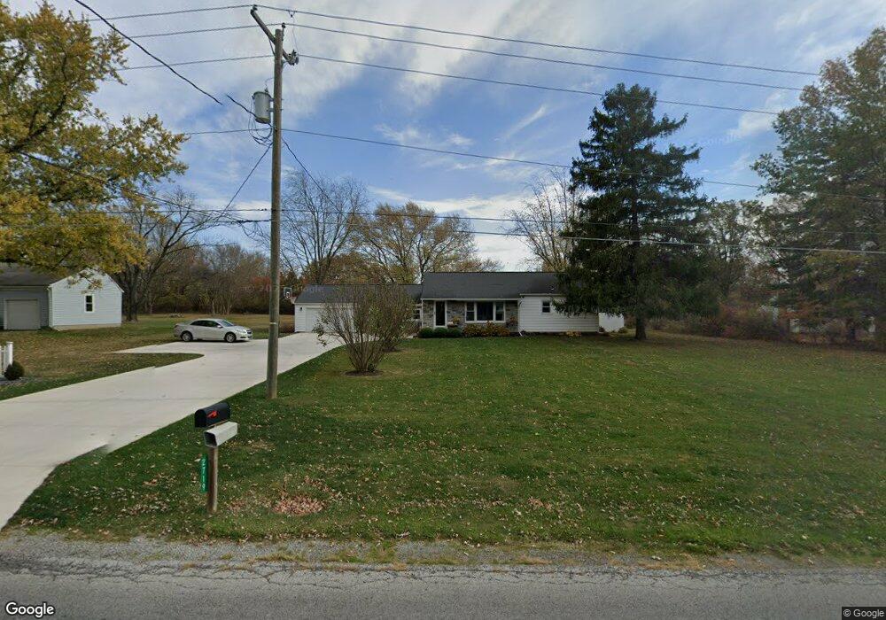
This home is located at 2719 Yoakam Rd, Lima, OH 45806 and is currently estimated at $212,314, approximately $153 per square foot. 2719 Yoakam Rd is a home located in Allen County with nearby schools including Maplewood Elementary School, Elmwood Elementary School, and Shawnee Middle School.
Ownership History
Date
Name
Owned For
Owner Type
Purchase Details
Closed on
Dec 28, 2001
Sold by
Stonehill Kathy S
Bought by
Hatfield David P
Current Estimated Value
Home Financials for this Owner
Home Financials are based on the most recent Mortgage that was taken out on this home.
Original Mortgage
$70,000
Interest Rate
6.25%
Mortgage Type
New Conventional
Purchase Details
Closed on
Nov 4, 1987
Bought by
Stonehill Michael Kent
Create a Home Valuation Report for This Property
The Home Valuation Report is an in-depth analysis detailing your home's value as well as a comparison with similar homes in the area
Home Values in the Area
Average Home Value in this Area
Purchase History
We collect this data history from publicly available records. To have your information removed, we recommend requesting removal directly through your county’s website.
| Date | Buyer | Sale Price | Title Company |
|---|---|---|---|
| Hatfield David P | $90,000 | -- | |
| Stonehill Michael Kent | $55,500 | -- |
Source: Public Records
Mortgage History
We collect this data history from publicly available records. To have your information removed, we recommend requesting removal directly through your county’s website.
| Date | Status | Borrower | Loan Amount |
|---|---|---|---|
| Closed | Hatfield David P | $70,000 |
Source: Public Records
Tax History
| Year | Tax Paid | Tax Assessment Tax Assessment Total Assessment is a certain percentage of the fair market value that is determined by local assessors to be the total taxable value of land and additions on the property. | Land | Improvement |
|---|---|---|---|---|
| 2025 | $2,871 | $57,610 | $22,610 | $35,000 |
| 2024 | $2,887 | $57,610 | $22,610 | $35,000 |
| 2023 | $2,339 | $40,290 | $15,820 | $24,470 |
| 2022 | $2,372 | $40,290 | $15,820 | $24,470 |
| 2021 | $2,300 | $40,290 | $15,820 | $24,470 |
| 2020 | $1,753 | $35,910 | $15,400 | $20,510 |
| 2019 | $1,753 | $35,910 | $15,400 | $20,510 |
| 2018 | $1,689 | $35,910 | $15,400 | $20,510 |
| 2017 | $1,609 | $30,940 | $15,400 | $15,540 |
| 2016 | $1,705 | $30,940 | $15,400 | $15,540 |
| 2015 | $2,107 | $30,940 | $15,400 | $15,540 |
| 2014 | $1,835 | $28,390 | $12,360 | $16,030 |
| 2013 | $1,812 | $28,390 | $12,360 | $16,030 |
Source: Public Records
Map
Nearby Homes
- 3136 Juliette Dr
- 2619 Gaithersburg Dr
- 4046 Cypress Ave
- 4054 Cypress Ave
- 4062 Cypress Ave
- 115 Lanes End
- 3200 Tawa Dr
- 4039 Magnolia
- 3065 Lakeshore Dr
- 2905 Oak Hill Ct
- 2175 Wyandot Dr
- 4422 Indian Hill Dr
- 3441 Winston Ln
- 4259 Blue Spruce Ln
- 4499 Indian Hill Dr
- 3061 Inwood Dr
- 3500 Woodhaven Ln
- 2975 Zurmehly Rd
- 3547 Woodhaven Ln
- 3618 Hiawatha Trail
- 2685 Yoakam Rd
- 2743 Yoakam Rd
- 2720 Yoakam Rd
- 2700 Yoakam Rd
- 2665 Yoakam Rd
- 2742 Yoakam Rd
- 2670 Yoakam Rd
- 2771 Yoakam Rd
- 2645 Yoakam Rd
- 2650 Yoakam Rd
- 2799 Yoakam Rd
- 3737 Fort Amanda Rd
- 3773 Fort Amanda Rd
- 2772 Yoakam Rd
- 3825 Fort Amanda Rd
- 2825 Yoakam Rd
- 3865 Fort Amanda Rd
- 3100 Juliette Dr
- N/A Ft Amanda Rd Hawthorne
- 2828 Yoakam Rd
Your Personal Tour Guide
Ask me questions while you tour the home.