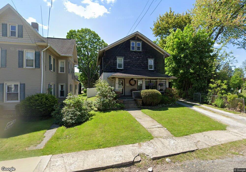
272 E Union St Canton, PA 17724
Estimated Value: $141,042 - $205,000
4
Beds
2
Baths
1,928
Sq Ft
$88/Sq Ft
Est. Value
About This Home
This home is located at 272 E Union St, Canton, PA 17724 and is currently estimated at $169,011, approximately $87 per square foot. 272 E Union St is a home located in Bradford County with nearby schools including Canton Area Elementary School and Canton Junior/Senior High School.
Ownership History
Date
Name
Owned For
Owner Type
Purchase Details
Closed on
Mar 31, 2016
Sold by
Raza Cody M and Raza Paige E
Bought by
Stone Cynthia L and Stone Jordan R
Current Estimated Value
Home Financials for this Owner
Home Financials are based on the most recent Mortgage that was taken out on this home.
Original Mortgage
$143,444
Interest Rate
3.59%
Mortgage Type
New Conventional
Purchase Details
Closed on
Feb 28, 2007
Sold by
Lash Gary
Bought by
Swain Nichole M and Raza Cody M
Home Financials for this Owner
Home Financials are based on the most recent Mortgage that was taken out on this home.
Original Mortgage
$87,111
Interest Rate
6.4%
Mortgage Type
FHA
Create a Home Valuation Report for This Property
The Home Valuation Report is an in-depth analysis detailing your home's value as well as a comparison with similar homes in the area
Purchase History
| Date | Buyer | Sale Price | Title Company |
|---|---|---|---|
| Stone Cynthia L | $135,000 | None Available | |
| Swain Nichole M | $87,800 | None Available |
Source: Public Records
Mortgage History
| Date | Status | Borrower | Loan Amount |
|---|---|---|---|
| Previous Owner | Stone Cynthia L | $143,444 | |
| Previous Owner | Swain Nichole M | $87,111 |
Source: Public Records
Tax History
| Year | Tax Paid | Tax Assessment Tax Assessment Total Assessment is a certain percentage of the fair market value that is determined by local assessors to be the total taxable value of land and additions on the property. | Land | Improvement |
|---|---|---|---|---|
| 2025 | $1,815 | $26,450 | $0 | $0 |
| 2024 | $1,705 | $26,450 | $0 | $0 |
| 2023 | $1,705 | $26,450 | $0 | $0 |
| 2022 | $1,703 | $26,450 | $0 | $0 |
| 2021 | $1,696 | $26,450 | $0 | $0 |
| 2020 | $1,681 | $26,450 | $0 | $0 |
| 2019 | $1,679 | $26,450 | $0 | $0 |
| 2018 | $1,633 | $26,450 | $0 | $0 |
| 2017 | $1,615 | $26,450 | $0 | $0 |
| 2016 | -- | $26,450 | $0 | $0 |
| 2015 | -- | $26,450 | $0 | $0 |
| 2014 | $827 | $26,450 | $0 | $0 |
Source: Public Records
Map
Nearby Homes
- 85 N Minnequa Ave
- 160 N Center St
- 94 N Center St
- 151 Montague St
- 108 S Washington St
- 386 Troy St
- 490 N Center St
- 49-51 T-329
- 55 Clinton St
- 374 S Minnequa Ave
- 20 E South Ave
- 203 De-Morgan Acres Ln
- 14751 Route 14
- 7129 Route 14
- 15130 Route 14
- 12240 Route 154
- 13632 Route 414
- 9 Farmall Ln
- PARCEL 030 Glory Ridge Rd
- Parc 030 Glory Ridge Rd
- 282 E Union St
- 294 E Union St
- 28 E Union St
- 0 E Union St
- 304 E Union St
- 289 E Main St
- 317 E Main St
- 255 E Union St
- 269 E Union St
- 241 E Union St
- 297 E Union St Unit 299
- 322 E Union St
- 345 E Main St
- 315 E Union St
- 237 E Union St
- 217 E Union St
- 325 E Union St
- 350 E Union St
- 286 E Main St
- 337 E Union St
Your Personal Tour Guide
Ask me questions while you tour the home.