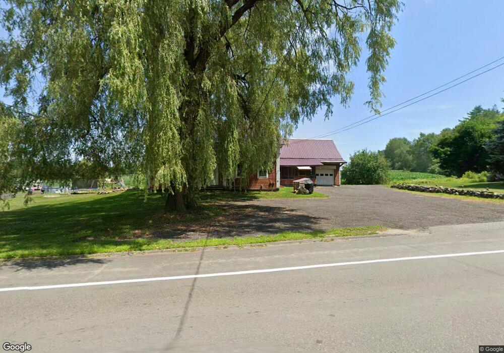
272 Mount View Rd Thorndike, ME 04986
Estimated Value: $54,000 - $300,000
4
Beds
2
Baths
--
Sq Ft
5
Acres Lot
About This Home
This home is located at 272 Mount View Rd, Thorndike, ME 04986 and is currently estimated at $222,323. 272 Mount View Rd is a home located in Waldo County with nearby schools including Mt. View Middle School, Mt. View High School, and Ecology Learning Center.
Ownership History
Date
Name
Owned For
Owner Type
Purchase Details
Closed on
Mar 31, 2021
Sold by
Santana Edwin
Bought by
Santana Edwin and Santana Amanda D
Current Estimated Value
Home Financials for this Owner
Home Financials are based on the most recent Mortgage that was taken out on this home.
Original Mortgage
$95,500
Outstanding Balance
$84,787
Interest Rate
2.8%
Mortgage Type
Purchase Money Mortgage
Estimated Equity
$137,536
Purchase Details
Closed on
Apr 4, 2013
Sold by
Santana Sean
Bought by
Santana Edwin
Create a Home Valuation Report for This Property
The Home Valuation Report is an in-depth analysis detailing your home's value as well as a comparison with similar homes in the area
Purchase History
We collect this data history from publicly available records. To have your information removed, we recommend requesting removal directly through your county’s website.
| Date | Buyer | Sale Price | Title Company |
|---|---|---|---|
| Santana Edwin | -- | None Available | |
| Santana Edwin | -- | -- |
Source: Public Records
Mortgage History
We collect this data history from publicly available records. To have your information removed, we recommend requesting removal directly through your county’s website.
| Date | Status | Borrower | Loan Amount |
|---|---|---|---|
| Open | Santana Edwin | $95,500 |
Source: Public Records
Tax History
| Year | Tax Paid | Tax Assessment Tax Assessment Total Assessment is a certain percentage of the fair market value that is determined by local assessors to be the total taxable value of land and additions on the property. | Land | Improvement |
|---|---|---|---|---|
| 2025 | $3,991 | $207,340 | $30,000 | $177,340 |
| 2024 | $3,836 | $207,340 | $30,000 | $177,340 |
| 2023 | $3,628 | $207,340 | $30,000 | $177,340 |
| 2022 | $3,628 | $207,340 | $30,000 | $177,340 |
| 2021 | $2,698 | $113,824 | $21,500 | $92,324 |
| 2020 | $2,811 | $113,824 | $21,500 | $92,324 |
| 2019 | $2,811 | $113,824 | $21,500 | $92,324 |
| 2018 | $2,732 | $113,824 | $21,500 | $92,324 |
| 2017 | $2,811 | $113,824 | $21,500 | $92,324 |
| 2016 | $2,163 | $113,824 | $21,500 | $92,324 |
| 2014 | $1,730 | $113,824 | $21,500 | $92,324 |
| 2013 | -- | $113,824 | $21,500 | $92,324 |
| 2010 | -- | $98,780 | $0 | $0 |
Source: Public Records
Map
Nearby Homes
- M11L10 Gordon Hill Rd
- 39 High St
- Lot 3-1 Bryant Rd
- 476 E Thorndike Rd
- 1535 Bailey Rd
- Lot 12 Moulton Hill Ln
- Lot 13 Moulton Hill Ln
- Lot 56 Bailey Rd
- 672 & 700 Brooks Rd
- Map6 Lot#1 Reid Rd
- M12 L31-3 Stage Coach Rd
- 149 Carey Ln
- 500 Goosepecker Ridge Rd
- 759 Brooks Rd
- Pond View Subdivision Us-202
- 12 Country View Ln
- 00 Ayer Ridge Rd
- 23 Bangor Rd
- 126 Newell Ct
- 194 E Gulch Rd
- 111 Town Farm Rd
- 103 Town Farm Rd
- 1 Bailey Rd
- 63 Bailey Rd
- 0 Bailey Rd Unit 851486
- 0 Bailey Rd Unit 851475
- 0 Bailey Rd Unit 653555
- 0 Bailey Rd Unit 653553
- 0 Bailey Rd Unit 557007
- 0 Bailey Rd Unit 252184
- 0 Bailey Rd Unit 476553
- 0 Bailey Rd Unit 850911
- 0 Bailey Rd Unit 164954
- 0 Bailey Rd Unit 954429
- 0 Bailey Rd Unit 954425
- 0 Bailey Rd Unit 1158657
- 75 Town Farm Rd
- 0 Town Farm Rd
- 181 Mount View Rd
- 160 Mount View Rd
Your Personal Tour Guide
Ask me questions while you tour the home.