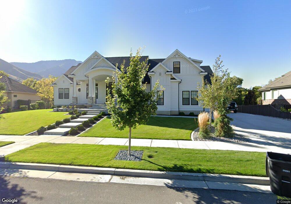
2726 E 1100 S Unit 21 Springville, UT 84663
East Hobble Creek NeighborhoodEstimated Value: $1,251,000 - $1,793,039
6
Beds
6
Baths
4,187
Sq Ft
$366/Sq Ft
Est. Value
About This Home
This home is located at 2726 E 1100 S Unit 21, Springville, UT 84663 and is currently estimated at $1,534,260, approximately $366 per square foot. 2726 E 1100 S Unit 21 is a home located in Utah County with nearby schools including Hobble Creek School, Springville High School, and Springville Junior High School.
Ownership History
Date
Name
Owned For
Owner Type
Purchase Details
Closed on
Jan 11, 2021
Sold by
Freeman Michael and Freeman Melinda
Bought by
Freeman Michael David and Freeman Melinda Jo
Current Estimated Value
Home Financials for this Owner
Home Financials are based on the most recent Mortgage that was taken out on this home.
Original Mortgage
$405,743
Outstanding Balance
$362,127
Interest Rate
2.71%
Mortgage Type
New Conventional
Estimated Equity
$1,172,133
Purchase Details
Closed on
Jul 26, 2019
Sold by
Freeman Michael and Freeman Melinda
Bought by
Freeman Michael David and Freeman Melinda Jo
Home Financials for this Owner
Home Financials are based on the most recent Mortgage that was taken out on this home.
Original Mortgage
$425,895
Interest Rate
3.8%
Mortgage Type
New Conventional
Purchase Details
Closed on
Sep 17, 2018
Sold by
Freeman Michael and Freeman Melinda
Bought by
Freeman Michael David and Freeman Melinda Jo
Home Financials for this Owner
Home Financials are based on the most recent Mortgage that was taken out on this home.
Original Mortgage
$425,000
Interest Rate
4.5%
Mortgage Type
New Conventional
Purchase Details
Closed on
Oct 1, 2015
Sold by
Bringhurst Belinda and Bringhurst David
Bought by
Freeman Michael and Freeman Melinda
Home Financials for this Owner
Home Financials are based on the most recent Mortgage that was taken out on this home.
Original Mortgage
$156,000
Interest Rate
3.86%
Mortgage Type
Purchase Money Mortgage
Purchase Details
Closed on
Jan 31, 2013
Sold by
Baf Foresclosed Properties Fund I Llc
Bought by
Bringhurst Belinda and Bringhurst David
Home Financials for this Owner
Home Financials are based on the most recent Mortgage that was taken out on this home.
Original Mortgage
$80,000
Interest Rate
3.33%
Mortgage Type
Future Advance Clause Open End Mortgage
Purchase Details
Closed on
Jan 30, 2012
Sold by
Bank Of American Fork
Bought by
Baf Foreclosed Properties Fund I Llc
Create a Home Valuation Report for This Property
The Home Valuation Report is an in-depth analysis detailing your home's value as well as a comparison with similar homes in the area
Home Values in the Area
Average Home Value in this Area
Purchase History
| Date | Buyer | Sale Price | Title Company |
|---|---|---|---|
| Freeman Michael David | -- | Trident Title Ins Agcy Llc | |
| Freeman Michael | -- | Trident Title Ins Agcy Llc | |
| Freeman Michael David | -- | Provo Land Title Company | |
| Freeman Michael | -- | Provo Land Title Company | |
| Freeman Michael David | -- | Provo Land Title Co | |
| Freeman Michael | -- | First American | |
| Bringhurst Belinda | -- | None Available | |
| Baf Foreclosed Properties Fund I Llc | -- | Backman | |
| Bank Of American Fork | -- | Backman |
Source: Public Records
Mortgage History
| Date | Status | Borrower | Loan Amount |
|---|---|---|---|
| Open | Freeman Michael | $405,743 | |
| Closed | Freeman Michael | $425,895 | |
| Closed | Freeman Michael David | $425,000 | |
| Closed | Freeman Michael | $156,000 | |
| Previous Owner | Bringhurst Belinda | $80,000 |
Source: Public Records
Tax History
| Year | Tax Paid | Tax Assessment Tax Assessment Total Assessment is a certain percentage of the fair market value that is determined by local assessors to be the total taxable value of land and additions on the property. | Land | Improvement |
|---|---|---|---|---|
| 2025 | $7,150 | $860,420 | -- | -- |
| 2024 | $7,150 | $732,490 | $0 | $0 |
| 2023 | $6,732 | $690,415 | $0 | $0 |
| 2022 | $6,294 | $633,930 | $0 | $0 |
| 2021 | $5,532 | $867,200 | $252,300 | $614,900 |
| 2020 | $5,268 | $800,600 | $219,400 | $581,200 |
| 2019 | $4,863 | $752,400 | $219,400 | $533,000 |
| 2018 | $2,584 | $209,800 | $209,800 | $0 |
| 2017 | $2,328 | $182,500 | $0 | $0 |
| 2016 | $2,018 | $155,100 | $0 | $0 |
| 2015 | $1,974 | $155,100 | $0 | $0 |
| 2014 | $1,905 | $148,700 | $0 | $0 |
Source: Public Records
Map
Nearby Homes
- 2881 Thirty Oaks Dr Unit 6
- 2881 Thirty Oaks Dr
- 1052 Cove Dr
- 2541 Stonebury Loop Rd
- 1447 N 1350 St E Unit 5
- 1577 N 1350 St E Unit 1
- 1477 N 1350 St E Unit 4
- 1547 N 1350 St E Unit 2
- 1548 N 1350 St E Unit 11
- 1578 N 1350 St E Unit 12
- 24 Quiet Meadow Ln
- 1564 N 1700 East St
- 829 S 2200 E
- 1567 N 600 E Unit MARS
- 1096 Valley Sage Dr
- 1096 N 1000 E
- 1092 Valley Sage Dr
- 1839 River Bottom Rd
- 59 E 775 S Unit 21
- 52 E 775 S Unit 19
- 2738 E 1100 S Unit 22
- 2738 E 1100 S
- 2714 E 1100 S
- 2727 E 1100 S Unit 4
- 2745 E 1100 S Unit 3
- 2762 E 1100 S Unit 23
- 2686 E 1100 S Unit 19
- 2709 E 1100 S Unit 5
- 2814 E 1100 S Unit 24
- 2814 River Bottom Rd Unit 24
- 2814 E 1100 S
- 2677 E 1100 S Unit 6
- 2677 E 1100 S
- 2658 E 1100 S Unit 18
- 2658 E 1100 S
- 1329 S 2650 E Unit 17
- 1086 S 2750 E
- 2811 E 1100 S Unit 25
- 2811 E 1100 S
- 1357 S 2650 E
Your Personal Tour Guide
Ask me questions while you tour the home.