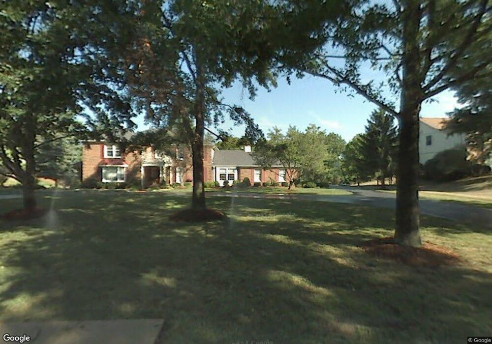
273 Pennington Ln Chesterfield, MO 63005
Estimated Value: $1,149,405 - $1,277,000
4
Beds
6
Baths
4,663
Sq Ft
$261/Sq Ft
Est. Value
About This Home
This home is located at 273 Pennington Ln, Chesterfield, MO 63005 and is currently estimated at $1,216,601, approximately $260 per square foot. 273 Pennington Ln is a home located in St. Louis County with nearby schools including Ellisville Elementary School, Crestview Middle School, and Marquette Sr. High School.
Ownership History
Date
Name
Owned For
Owner Type
Purchase Details
Closed on
Jan 3, 2023
Sold by
Sherre A Flavin Revocable Trust
Bought by
Michael And Sherre Flavin Revocable Trust
Current Estimated Value
Purchase Details
Closed on
Jun 12, 2012
Sold by
Flavin Michael A and Flavin Sherre A
Bought by
Flavin Sherre A and Flavin Michael A
Home Financials for this Owner
Home Financials are based on the most recent Mortgage that was taken out on this home.
Original Mortgage
$417,000
Interest Rate
2.5%
Mortgage Type
New Conventional
Purchase Details
Closed on
Nov 28, 2010
Sold by
Flavin Michael A and Flavin Sherre A
Bought by
Flavin Sherre A and Flavin Michael A
Purchase Details
Closed on
Sep 8, 2010
Sold by
Flavin Michael A and Flavin Sherre A
Bought by
Flavin Michael A and Flavin Sherre A
Home Financials for this Owner
Home Financials are based on the most recent Mortgage that was taken out on this home.
Original Mortgage
$417,000
Interest Rate
3.37%
Mortgage Type
New Conventional
Purchase Details
Closed on
May 14, 2003
Sold by
Cendant Mobility Financial Corp
Bought by
Flavin Michael A and Flavin Sherre A
Home Financials for this Owner
Home Financials are based on the most recent Mortgage that was taken out on this home.
Original Mortgage
$664,030
Interest Rate
5.51%
Mortgage Type
Purchase Money Mortgage
Purchase Details
Closed on
Mar 13, 2003
Sold by
Wild David R and Wild Cheryl
Bought by
Cendant Mobility Financial Corp
Purchase Details
Closed on
Oct 15, 2001
Sold by
Wild David R and Wild Cheryl
Bought by
The Cheryl Wild Trust
Purchase Details
Closed on
Aug 9, 2001
Sold by
Richard C Dean Agreement Of Trust
Bought by
Wild David R and Wild Cheryl
Home Financials for this Owner
Home Financials are based on the most recent Mortgage that was taken out on this home.
Original Mortgage
$150,000
Interest Rate
6.54%
Purchase Details
Closed on
Feb 24, 1999
Sold by
Dean Richard C and Dean Sally J
Bought by
Dean Richard C and Dean Sally J
Create a Home Valuation Report for This Property
The Home Valuation Report is an in-depth analysis detailing your home's value as well as a comparison with similar homes in the area
Home Values in the Area
Average Home Value in this Area
Purchase History
| Date | Buyer | Sale Price | Title Company |
|---|---|---|---|
| Michael And Sherre Flavin Revocable Trust | -- | -- | |
| Flavin Sherre A | -- | Title Partners Agency Llc | |
| Flavin Michael A | -- | Title Partners Agency Llc | |
| Flavin Sherre A | -- | None Available | |
| Flavin Michael A | -- | Clear Title | |
| Flavin Michael A | $673,500 | -- | |
| Cendant Mobility Financial Corp | $673,500 | -- | |
| The Cheryl Wild Trust | -- | -- | |
| Wild David R | $614,000 | -- | |
| Dean Richard C | -- | -- |
Source: Public Records
Mortgage History
| Date | Status | Borrower | Loan Amount |
|---|---|---|---|
| Previous Owner | Flavin Michael A | $417,000 | |
| Previous Owner | Flavin Michael A | $417,000 | |
| Previous Owner | Flavin Michael A | $664,030 | |
| Previous Owner | Wild David R | $150,000 |
Source: Public Records
Tax History
| Year | Tax Paid | Tax Assessment Tax Assessment Total Assessment is a certain percentage of the fair market value that is determined by local assessors to be the total taxable value of land and additions on the property. | Land | Improvement |
|---|---|---|---|---|
| 2025 | $11,172 | $174,190 | $50,770 | $123,420 |
| 2024 | $11,172 | $157,880 | $43,990 | $113,890 |
| 2023 | $11,162 | $157,880 | $43,990 | $113,890 |
| 2022 | $11,132 | $146,250 | $43,990 | $102,260 |
| 2021 | $11,053 | $146,250 | $43,990 | $102,260 |
| 2020 | $11,626 | $146,700 | $67,620 | $79,080 |
| 2019 | $11,670 | $146,700 | $67,620 | $79,080 |
| 2018 | $10,521 | $124,660 | $24,610 | $100,050 |
| 2017 | $10,274 | $124,660 | $24,610 | $100,050 |
| 2016 | $10,737 | $125,330 | $24,610 | $100,720 |
Source: Public Records
Map
Nearby Homes
- 156 Highgrove Ct
- 16200 Wynncrest Ridge Ct
- 16342 Clayton Rd
- 1 Rendina Ct
- 16354 Clayton Rd
- 1525 Virginia Dr
- 305 Berry Brook Ct
- 15911 Fairway Lake
- 16011 Clarkson Mill Cir
- 1504 Englebrook Dr
- 1509 Clayton Woods Ct
- 1576 Englebrook Dr
- 352 Strecker Rd
- 16403 Prestwick Place Ln
- 2221 Stonegate Manor Ct
- 211 Cobblefield Ct
- 2316 Picardy Place Dr
- 61 Picardy Hill Dr
- 1640 Timber Hollow Dr
- 15668 Coventry Farm Dr
- 267 Pennington Ln
- 277 Pennington Ln
- 272 Pennington Ln
- 261 Pennington Ln
- 276 Pennington Ln
- 281 Pennington Ln
- 280 Pennington Ln
- 266 Pennington Ln
- 2670 Valley Rd
- 255 Pennington Ln
- 260 Pennington Ln
- 2662 Valley Rd
- 254 Pennington Ln
- 16227 Quail Valley Dr
- 16205 Quail Valley Dr
- 249 Pennington Ln
- 16231 Quail Valley Dr
- 246 Whiting Ln
- 239 Whiting Ln
- 248 Pennington Ln
Your Personal Tour Guide
Ask me questions while you tour the home.