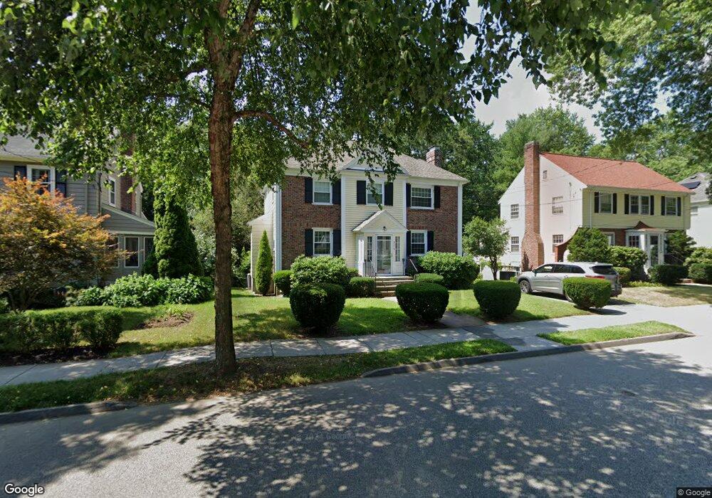
275 Beverly Rd Chestnut Hill, MA 02467
South Brookline NeighborhoodEstimated Value: $1,633,001 - $1,759,000
3
Beds
3
Baths
2,188
Sq Ft
$775/Sq Ft
Est. Value
About This Home
This home is located at 275 Beverly Rd, Chestnut Hill, MA 02467 and is currently estimated at $1,696,250, approximately $775 per square foot. 275 Beverly Rd is a home located in Norfolk County with nearby schools including Baker School, Brookline High School, and Dexter School.
Ownership History
Date
Name
Owned For
Owner Type
Purchase Details
Closed on
Sep 24, 1999
Sold by
Schlosberg William and Schlosberg Judith M
Bought by
Schlosberg Alan and Schlosberg Elizabeth
Current Estimated Value
Home Financials for this Owner
Home Financials are based on the most recent Mortgage that was taken out on this home.
Original Mortgage
$300,000
Outstanding Balance
$81,034
Interest Rate
8.1%
Mortgage Type
Purchase Money Mortgage
Estimated Equity
$1,615,216
Create a Home Valuation Report for This Property
The Home Valuation Report is an in-depth analysis detailing your home's value as well as a comparison with similar homes in the area
Home Values in the Area
Average Home Value in this Area
Purchase History
| Date | Buyer | Sale Price | Title Company |
|---|---|---|---|
| Schlosberg Alan | $325,000 | -- |
Source: Public Records
Mortgage History
| Date | Status | Borrower | Loan Amount |
|---|---|---|---|
| Open | Schlosberg Alan | $300,000 |
Source: Public Records
Tax History
| Year | Tax Paid | Tax Assessment Tax Assessment Total Assessment is a certain percentage of the fair market value that is determined by local assessors to be the total taxable value of land and additions on the property. | Land | Improvement |
|---|---|---|---|---|
| 2025 | $14,387 | $1,457,700 | $657,600 | $800,100 |
| 2024 | $13,717 | $1,404,000 | $632,300 | $771,700 |
| 2023 | $12,642 | $1,268,000 | $512,700 | $755,300 |
| 2022 | $12,305 | $1,207,600 | $488,300 | $719,300 |
| 2021 | $11,379 | $1,161,100 | $469,500 | $691,600 |
| 2020 | $10,477 | $1,108,700 | $426,800 | $681,900 |
| 2019 | $9,894 | $1,055,900 | $406,500 | $649,400 |
| 2018 | $9,913 | $1,047,900 | $406,600 | $641,300 |
| 2017 | $9,767 | $988,600 | $383,500 | $605,100 |
| 2016 | $9,627 | $923,900 | $358,500 | $565,400 |
| 2015 | $9,222 | $863,500 | $335,000 | $528,500 |
| 2014 | $9,373 | $822,900 | $304,600 | $518,300 |
Source: Public Records
Map
Nearby Homes
- 227 Bonad Rd
- 303 Russett Rd
- 16 Alberta Rd
- 170 Bonad Rd
- 55 Bellingham Rd
- 1125 W Roxbury Pkwy
- 91 Grove St
- 25 Clearwater Rd
- 71 Grove St
- 95 Beverly Rd
- 10 Hallwood Rd
- 367 Newton St
- 87 Bonad Rd
- 50-56 Broadlawn Park Unit 221
- 28 Westgate Rd Unit 3
- 134 Rangeley Rd
- 17 Fairgreen Place
- 55 Fairgreen Place
- 64 Bryon Rd Unit 1
- 42 Bryon Rd Unit 6
- 271 Beverly Rd
- 279 Beverly Rd
- 267 Beverly Rd
- 285 Beverly Rd
- 285 Beverly Rd Unit 2
- 280 Beverly Rd
- 274 Beverly Rd
- 263 Beverly Rd
- 286 Beverly Rd
- 291 Beverly Rd
- 268 Beverly Rd
- 203 Paine Ct
- 202 Paine Ct
- 202 Paine Ct Unit 1
- 101 Paine Ct Unit 1
- 33 Gerry Rd Unit 4
- 33 Gerry Rd
- 35 Gerry Rd Unit 2STD
- 35 Gerry Rd
- 257 Beverly Rd
Your Personal Tour Guide
Ask me questions while you tour the home.