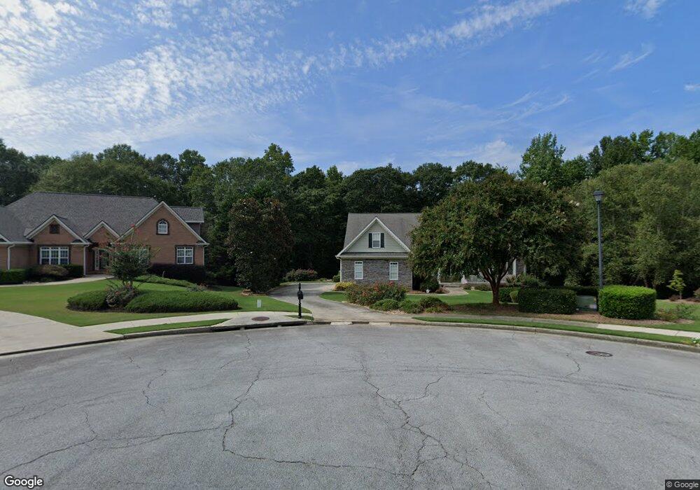
2758 Executive Ct Unit 1 Buford, GA 30519
Estimated Value: $575,000 - $671,000
4
Beds
4
Baths
3,082
Sq Ft
$206/Sq Ft
Est. Value
About This Home
This home is located at 2758 Executive Ct Unit 1, Buford, GA 30519 and is currently estimated at $635,526, approximately $206 per square foot. 2758 Executive Ct Unit 1 is a home located in Hall County with nearby schools including Friendship Elementary School, Cherokee Bluff Middle School, and Cherokee Bluff High School.
Ownership History
Date
Name
Owned For
Owner Type
Purchase Details
Closed on
Nov 30, 2006
Sold by
Fisher R Alan and Fisher Mary Grace
Bought by
Tardif Robert C and Tardif Mary E
Current Estimated Value
Home Financials for this Owner
Home Financials are based on the most recent Mortgage that was taken out on this home.
Original Mortgage
$312,000
Outstanding Balance
$182,421
Interest Rate
6.19%
Mortgage Type
New Conventional
Estimated Equity
$453,105
Purchase Details
Closed on
Nov 8, 2002
Sold by
Jordan-Hunter Llc
Bought by
Fisher Fisher R and Fisher Mary G
Home Financials for this Owner
Home Financials are based on the most recent Mortgage that was taken out on this home.
Original Mortgage
$190,000
Interest Rate
6.08%
Mortgage Type
New Conventional
Purchase Details
Closed on
Feb 11, 2002
Sold by
Chateau Corners Development Corp
Bought by
Jordan-Hunter Llc
Create a Home Valuation Report for This Property
The Home Valuation Report is an in-depth analysis detailing your home's value as well as a comparison with similar homes in the area
Home Values in the Area
Average Home Value in this Area
Purchase History
| Date | Buyer | Sale Price | Title Company |
|---|---|---|---|
| Tardif Robert C | $390,000 | -- | |
| Fisher Fisher R | $296,000 | -- | |
| Jordan-Hunter Llc | $792,000 | -- |
Source: Public Records
Mortgage History
| Date | Status | Borrower | Loan Amount |
|---|---|---|---|
| Open | Tardif Robert C | $312,000 | |
| Previous Owner | Fisher Fisher R | $190,000 |
Source: Public Records
Tax History
| Year | Tax Paid | Tax Assessment Tax Assessment Total Assessment is a certain percentage of the fair market value that is determined by local assessors to be the total taxable value of land and additions on the property. | Land | Improvement |
|---|---|---|---|---|
| 2025 | $1,727 | $279,800 | $70,960 | $208,840 |
| 2024 | $2,372 | $282,520 | $70,120 | $212,400 |
| 2023 | $1,663 | $214,640 | $29,200 | $185,440 |
| 2022 | $1,668 | $184,160 | $27,600 | $156,560 |
| 2021 | $1,517 | $159,160 | $17,000 | $142,160 |
| 2020 | $1,524 | $156,440 | $17,000 | $139,440 |
| 2019 | $1,477 | $148,000 | $16,000 | $132,000 |
| 2018 | $1,514 | $147,960 | $16,000 | $131,960 |
| 2017 | $1,500 | $141,120 | $14,280 | $126,840 |
| 2016 | $1,188 | $123,275 | $14,315 | $108,960 |
| 2015 | $3,438 | $123,275 | $14,315 | $108,960 |
| 2014 | $3,438 | $121,733 | $14,315 | $107,418 |
Source: Public Records
Map
Nearby Homes
- 2638 Democracy Dr Unit 1
- 2978 Legislative Ln
- 2244 Mayors Way
- 2342 Sparta Way
- 2209 Independence Ln
- 3088 Lantana Way
- 3138 Lantana Way
- 2824 Pleasant Oak Dr
- 2747 Pearl Ridge Trace
- 7413 Quinn Place Unit 146
- 7405 Quinn Place Unit LOT 148
- 7416 Quinn Place Unit LOT 198
- 7420 Quinn Place
- 7409 Quinn Place
- 7401 Quinn Place Unit LOT 149
- 7424 Quinn Place Unit LOT 193
- 7412 Quinn Place Unit LOT 197
- 7421 Quinn Place
- 7436 Quinn Place
- 7425 Quinn Place
- 2755 Executive Ct
- 2754 Executive Ct Unit 1
- 2751 Executive Ct
- 2750 Executive Ct Unit 1
- 2747 Executive Ct
- 2746 Executive Ct
- 2974 Legislative Ln Unit 1
- 2637 Democracy Dr
- 2735 Legislative Ln
- 2633 Democracy Dr
- 2805 Legislative Ln
- 2729 Legislative Ln
- 2623 Democracy Dr
- 2966 Legislative Ln
- 2243 Mayors Way
- 2811 Legislative Ln
- 2247 Mayors Way
- 2239 Mayors Way
- 2734 Legislative Ln
- 2804 Legislative Ln
Your Personal Tour Guide
Ask me questions while you tour the home.