2761 Brooks Range Prescott, AZ 86301
Estimated Value: $591,699 - $661,000
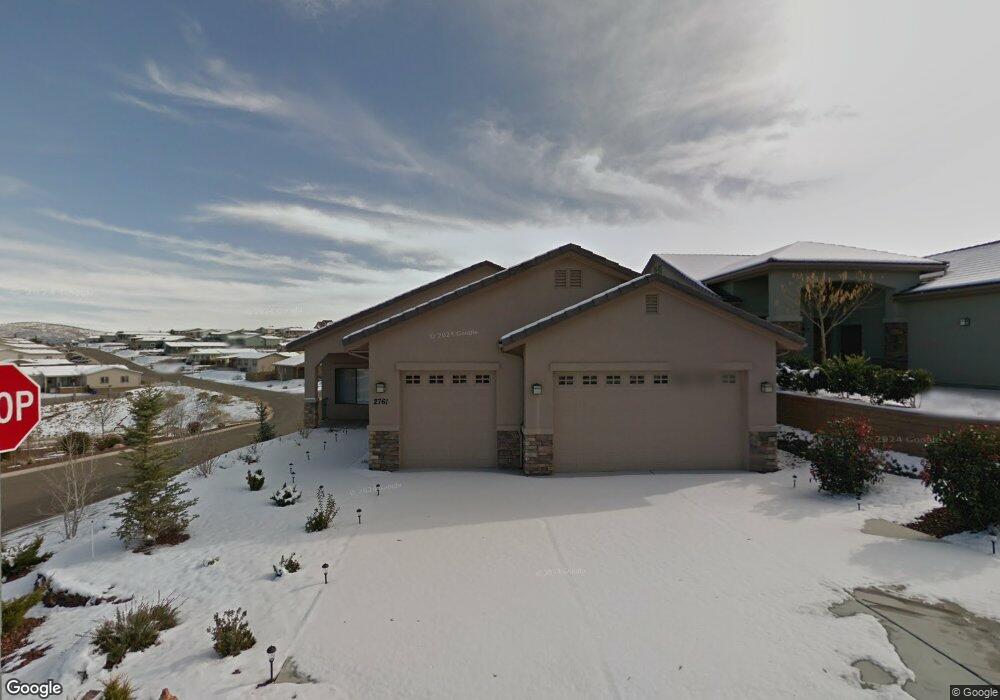
About This Home
This home is located at 2761 Brooks Range, Prescott, AZ 86301 and is currently estimated at $621,925, approximately $350 per square foot. 2761 Brooks Range is a home located in Yavapai County with nearby schools including Granite Mountain Middle School, Abia Judd Elementary School, and Prescott Mile High Middle School.
Ownership History
We collect this data history from publicly available records. To have your information removed, we recommend requesting removal directly through your county’s website.
Purchase Details
Purchase Details
Home Financials for this Owner
Home Financials are based on the most recent Mortgage that was taken out on this home.Purchase History
We collect this data history from publicly available records. To have your information removed, we recommend requesting removal directly through your county’s website.
| Date | Buyer | Sale Price | Title Company |
|---|---|---|---|
| -- | None Available | ||
| $300,045 | Lawyers Title Insurance Corp |
Mortgage History
We collect this data history from publicly available records. To have your information removed, we recommend requesting removal directly through your county’s website.
| Date | Status | Borrower | Loan Amount |
|---|---|---|---|
| Closed | $266,750 | ||
| Closed | $267,000 | ||
| Closed | $225,000 | ||
| Closed | $228,000 | ||
| Closed | $228,500 | ||
| Closed | $234,000 | ||
| Closed | $240,000 | ||
| Closed | $232,500 | ||
| Closed | $735,000 |
Tax History
We collect this data history from publicly available records. To have your information removed, we recommend requesting removal directly through your county’s website.
| Year | Tax Paid | Tax Assessment Tax Assessment Total Assessment is a certain percentage of the fair market value that is determined by local assessors to be the total taxable value of land and additions on the property. | Land | Improvement |
|---|---|---|---|---|
| 2027 | $1,497 | $47,504 | -- | -- |
| 2026 | $1,452 | $45,468 | -- | -- |
| 2024 | $1,421 | $48,157 | -- | -- |
| 2023 | $1,421 | $38,996 | $8,230 | $30,766 |
| 2022 | $1,401 | $32,610 | $6,817 | $25,793 |
| 2021 | $1,504 | $31,353 | $5,184 | $26,169 |
| 2020 | $1,510 | $0 | $0 | $0 |
| 2019 | $1,500 | $0 | $0 | $0 |
| 2018 | $1,433 | $0 | $0 | $0 |
| 2017 | $1,381 | $0 | $0 | $0 |
| 2016 | $1,375 | $0 | $0 | $0 |
| 2015 | $1,333 | $0 | $0 | $0 |
| 2014 | -- | $0 | $0 | $0 |
Map
- 1007 Craftsman Dr
- 5919 W Cir
- 5880 W Vesta (Lot 252) Cir
- 5909 W Cedron (Lot 276) Cir
- 6033 W Vesta (Lot 262) Cir
- 5928 W Cedron (Lot 265) Cir
- 1012 Craftsman Dr
- 1015 Queen Ann Dr
- 3115 Trail Walk
- 1215 Lago Vista
- 842 Westin Pass
- 3120 Trail Walk
- 3144 Trail Walk
- 865 Cameron Pass
- 850 Cameron Pass
- 1145 Trinity Ct
- 1751 Ascott St
- 2973 Noble Star Dr
- 1711 Trinity Rose Dr
- 1375 Lakeview Rd
- 1040 Louie St
- 1030 Louie St
- Lots 2-5 Lonesome Hawk Dr Unit 2-5
- Lots 2-5 Lonesome Hawk Dr
- 1052 Louie St
- 1022 Louie St
- 1064 Louie St
- 003 Undisclosed Way
- 1347 Crowning Point
- 000 Undsiclosed Way
- Na Na
- 1043 Bridgewater Dr
- 1033 Bridgewater Dr
- 1016 Louie St
- 1055 Bridgewater Dr
- 1021 Bridgewater Dr
- 1076 Louie St
- 1059 Bridgewater Dr
- 1017 Bridgewater Dr
- 1010 Louie St
Ask me questions while you tour the home.