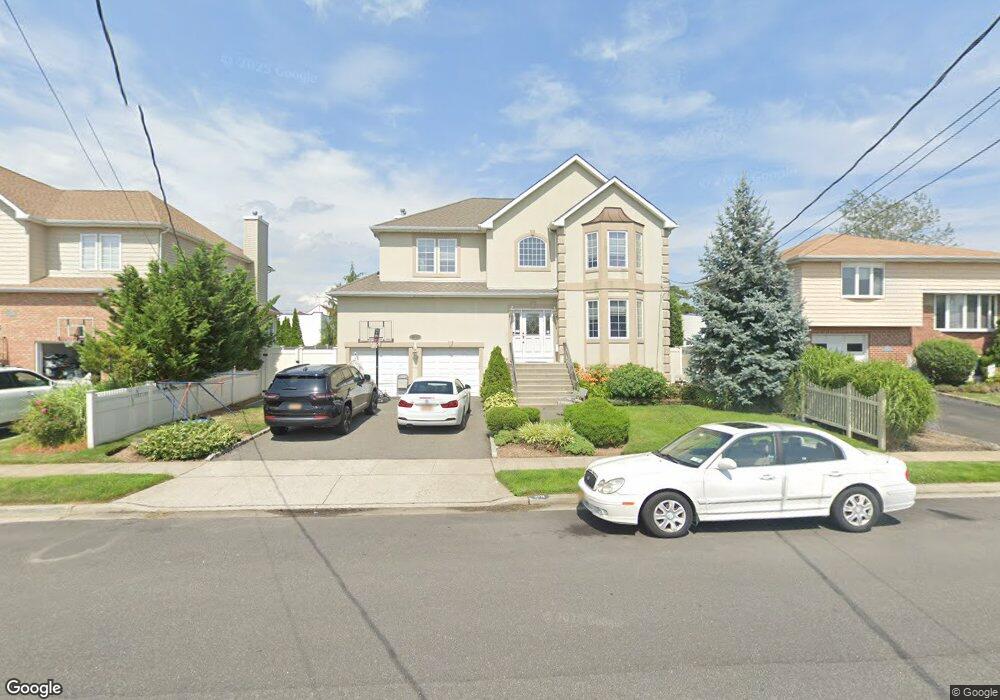
2771 Wynsum Ave Merrick, NY 11566
Estimated Value: $1,233,527 - $1,273,000
4
Beds
3
Baths
3,008
Sq Ft
$417/Sq Ft
Est. Value
About This Home
This home is located at 2771 Wynsum Ave, Merrick, NY 11566 and is currently estimated at $1,253,264, approximately $416 per square foot. 2771 Wynsum Ave is a home located in Nassau County with nearby schools including Merrick Avenue Middle School, John F. Kennedy High School, and St. Elizabeth Ann Seton Regional School.
Ownership History
Date
Name
Owned For
Owner Type
Purchase Details
Closed on
Feb 14, 2016
Sold by
Pennymac Corp
Bought by
Schiro James and Schiro Lauren
Current Estimated Value
Home Financials for this Owner
Home Financials are based on the most recent Mortgage that was taken out on this home.
Original Mortgage
$616,250
Interest Rate
3.79%
Mortgage Type
New Conventional
Purchase Details
Closed on
Mar 16, 2015
Sold by
Ricciardi Mark
Bought by
Pennymac Corp
Purchase Details
Closed on
Dec 28, 2006
Sold by
Eldar Kadyimov
Purchase Details
Closed on
Jul 1, 2005
Sold by
Sagamore Development Corp
Bought by
Kadymoff Eldar
Purchase Details
Closed on
Dec 24, 2003
Sold by
Ballich George
Bought by
Sagamore Development Corp
Create a Home Valuation Report for This Property
The Home Valuation Report is an in-depth analysis detailing your home's value as well as a comparison with similar homes in the area
Home Values in the Area
Average Home Value in this Area
Purchase History
| Date | Buyer | Sale Price | Title Company |
|---|---|---|---|
| Schiro James | $725,000 | None Available | |
| Pennymac Corp | $911,995 | None Available | |
| -- | -- | -- | |
| Kadymoff Eldar | $875,000 | -- | |
| Sagamore Development Corp | $393,750 | -- |
Source: Public Records
Mortgage History
| Date | Status | Borrower | Loan Amount |
|---|---|---|---|
| Previous Owner | Schiro James | $616,250 |
Source: Public Records
Tax History
| Year | Tax Paid | Tax Assessment Tax Assessment Total Assessment is a certain percentage of the fair market value that is determined by local assessors to be the total taxable value of land and additions on the property. | Land | Improvement |
|---|---|---|---|---|
| 2025 | $22,827 | $752 | $229 | $523 |
| 2024 | $5,032 | $756 | $231 | $525 |
Source: Public Records
Map
Nearby Homes
- 2794 Lincoln Blvd
- 2829 Frankel Blvd
- 110 Hampton Way
- 109 Elliot St
- 2072 Brighton Way
- 2070 Beverly Way
- 2845 Whaleneck Dr
- 23 Bay St
- 2066 Holland Way
- 2077 Byron Rd
- 217 Bayview Ave
- 2038 Berfond Ct
- 2522 Hewlett Ln
- 2884 Bay Dr
- 140 Frankel Blvd
- 2505 Walters Ct
- 2858 Shore Rd
- 2863 Harbor Rd
- 3042 Cheryl Rd
- 2542 Lefferts Place
- 2765 Wynsum Ave
- 2779 Wynsum Ave
- 2768 Frankel Blvd
- 2759 Wynsum Ave
- 396 Frankel Blvd
- 404 Frankel Blvd
- 390 Frankel Blvd
- 2768 Wynsum Ave
- 397 Wynsum Ave
- 2786 Frankel Blvd
- 2149 Shoreham Way
- 2150 Hampton Way
- 2753 Wynsum Ave
- 2752 Frankel Blvd
- 401 Wynsum Ave
- 408 Frankel Blvd
- 2754 Wynsum Ave
- 118 Hampton Way
- 119 Shoreham Way
- 2745 Wynsum Ave
Your Personal Tour Guide
Ask me questions while you tour the home.