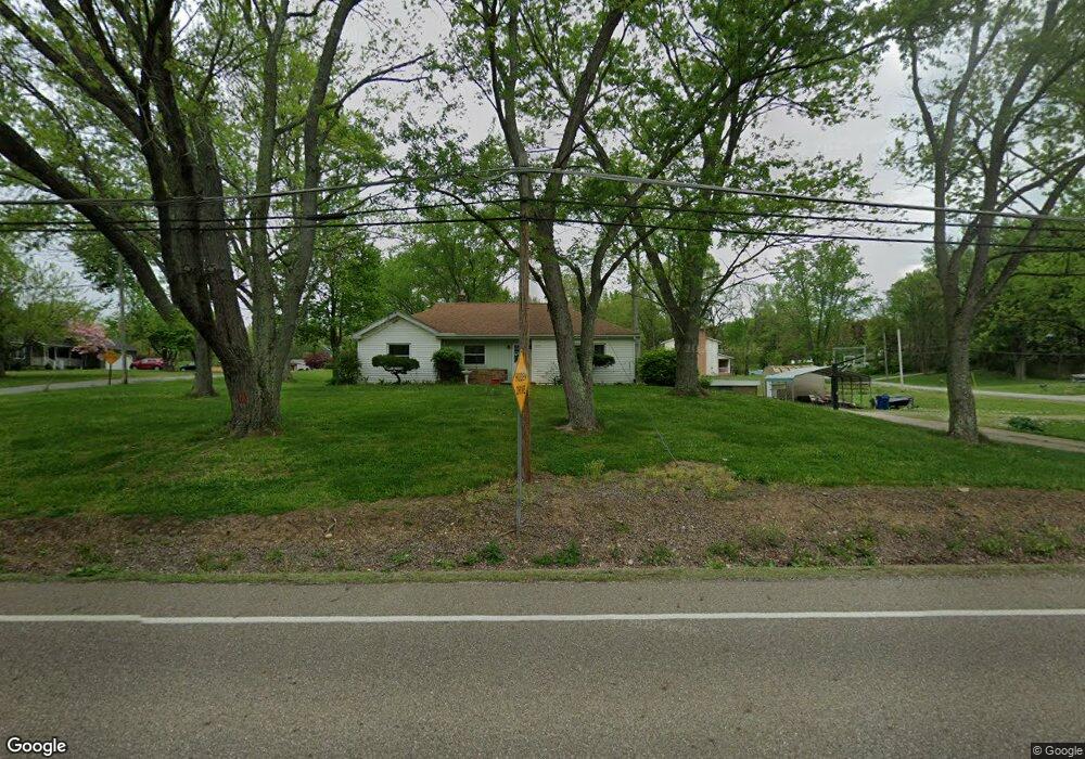
2775 Killian Rd Uniontown, OH 44685
Estimated Value: $172,000 - $221,439
3
Beds
2
Baths
1,376
Sq Ft
$149/Sq Ft
Est. Value
About This Home
This home is located at 2775 Killian Rd, Uniontown, OH 44685 and is currently estimated at $205,610, approximately $149 per square foot. 2775 Killian Rd is a home located in Summit County with nearby schools including Springfield High School, Chapel Hill Christian School-Green Campus, and Mayfair Christian School.
Ownership History
Date
Name
Owned For
Owner Type
Purchase Details
Closed on
Jul 30, 2004
Sold by
Dykes Jane L
Bought by
Nance Michael A
Current Estimated Value
Home Financials for this Owner
Home Financials are based on the most recent Mortgage that was taken out on this home.
Original Mortgage
$88,357
Outstanding Balance
$44,974
Interest Rate
6.4%
Mortgage Type
Purchase Money Mortgage
Estimated Equity
$160,636
Create a Home Valuation Report for This Property
The Home Valuation Report is an in-depth analysis detailing your home's value as well as a comparison with similar homes in the area
Purchase History
| Date | Buyer | Sale Price | Title Company |
|---|---|---|---|
| Nance Michael A | $102,124 | -- |
Source: Public Records
Mortgage History
| Date | Status | Borrower | Loan Amount |
|---|---|---|---|
| Open | Nance Michael A | $88,357 |
Source: Public Records
Tax History
| Year | Tax Paid | Tax Assessment Tax Assessment Total Assessment is a certain percentage of the fair market value that is determined by local assessors to be the total taxable value of land and additions on the property. | Land | Improvement |
|---|---|---|---|---|
| 2024 | $3,359 | $60,960 | $10,861 | $50,099 |
| 2023 | $3,359 | $60,960 | $10,861 | $50,099 |
| 2022 | $2,771 | $43,540 | $7,756 | $35,784 |
| 2021 | $2,705 | $43,540 | $7,756 | $35,784 |
| 2020 | $2,704 | $43,540 | $7,760 | $35,780 |
| 2019 | $2,527 | $38,270 | $7,760 | $30,510 |
| 2018 | $2,426 | $38,270 | $7,760 | $30,510 |
| 2017 | $2,172 | $38,270 | $7,760 | $30,510 |
| 2016 | $2,192 | $32,900 | $7,760 | $25,140 |
| 2015 | $2,172 | $32,900 | $7,760 | $25,140 |
| 2014 | $2,145 | $32,900 | $7,760 | $25,140 |
| 2013 | $2,241 | $34,230 | $7,760 | $26,470 |
Source: Public Records
Map
Nearby Homes
- 2190 Waterbury Dr
- 3025 Killian Rd
- 2903 Northview Rd
- 2575 Myersville Rd
- 2512 Twin Lakes Dr
- 2941 Sweitzer Rd
- V/L Westport Dr
- 1719 Wilson Rd
- 2020 Myersville Rd
- 3540 Bushwillow Dr
- 3544 Bushwillow Dr
- 2898 Canton Rd
- 2771 Superior Dr
- 2380 Igleheart Rd
- 1605 Pawnee Blvd
- 3411 Sweitzer St NW
- 2804 Osage Ave
- 2969 Premae Dr
- 1464 Blair Dr
- 13526 Glenvale Ave NW
- 2224 Plymouth Dr
- 2801 Killian Rd
- 2238 Manor Rd
- 2734 Killian Rd
- 2817 Killian Rd
- 2206 Plymouth Dr
- 2743 Killian Rd
- 2219 Manor Rd
- 2218 Manor Rd
- 2827 Killian Rd
- 2208 Manor Rd
- 2731 Killian Rd
- 2203 Plymouth Dr
- 2835 Killian Rd
- 2211 Manor Rd
- 2193 Plymouth Dr
- 2198 Manor Rd
- 2834 Killian Rd
- 2180 Manor Rd
- 2183 Plymouth Dr
Your Personal Tour Guide
Ask me questions while you tour the home.