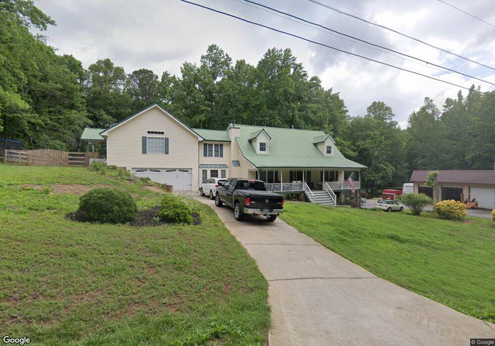
278 Peardon Rd Canton, GA 30115
Estimated Value: $722,986 - $1,093,000
About This Home
This home is located at 278 Peardon Rd, Canton, GA 30115 and is currently estimated at $921,247, approximately $201 per square foot. 278 Peardon Rd is a home located in Cherokee County with nearby schools including Holly Springs Elementary School, Dean Rusk Middle School, and Sequoyah High School.
Ownership History
We collect this data history from publicly available records. To have your information removed, we recommend requesting removal directly through your county’s website.
Purchase Details
Home Financials for this Owner
Home Financials are based on the most recent Mortgage that was taken out on this home.Purchase Details
Home Values in the Area
Average Home Value in this Area
Purchase History
We collect this data history from publicly available records. To have your information removed, we recommend requesting removal directly through your county’s website.
| Date | Buyer | Sale Price | Title Company |
|---|---|---|---|
| $575,000 | -- | ||
| -- | -- |
Mortgage History
We collect this data history from publicly available records. To have your information removed, we recommend requesting removal directly through your county’s website.
| Date | Status | Borrower | Loan Amount |
|---|---|---|---|
| Open | $460,000 |
Tax History
We collect this data history from publicly available records. To have your information removed, we recommend requesting removal directly through your county’s website.
| Year | Tax Paid | Tax Assessment Tax Assessment Total Assessment is a certain percentage of the fair market value that is determined by local assessors to be the total taxable value of land and additions on the property. | Land | Improvement |
|---|---|---|---|---|
| 2025 | $6,731 | $294,092 | $34,960 | $259,132 |
| 2024 | $6,687 | $294,092 | $34,960 | $259,132 |
| 2023 | $6,252 | $294,092 | $34,960 | $259,132 |
| 2022 | $4,846 | $203,856 | $34,960 | $168,896 |
| 2021 | $4,785 | $183,780 | $30,760 | $153,020 |
| 2020 | $3,208 | $112,900 | $17,600 | $95,300 |
| 2019 | $3,246 | $114,240 | $17,600 | $96,640 |
| 2018 | $3,130 | $109,480 | $17,600 | $91,880 |
| 2017 | $2,571 | $237,000 | $17,600 | $77,200 |
| 2016 | $2,571 | $220,800 | $16,880 | $71,440 |
| 2015 | $2,627 | $223,400 | $16,880 | $72,480 |
| 2014 | $2,492 | $211,500 | $13,920 | $70,680 |
Map
- 222 Woodford Dr
- 212 Woodford Dr
- 453 Etowah Cir
- 335 Etowah Cir
- 598 Roper Rd
- 1528 New Light Rd
- 214 Moore Valley Way
- 437 Twin Lakes Dr
- 524 Mason Knoll Dr
- 296 Holloway Dr
- 212 Knollwood Bend
- 101 Madison St
- 208 Knollwood Bend
- 216 Persimmon Dr
- 108 Madison St
- 202 Redbud Rd
- 206 Redbud Rd
- 210 Redbud Rd
- 204 Lynn Ln
- 454 Sugarberry Ln
- 834 Peardon Ct
- 834 Peardon Ct
- 259 Peardon Rd
- 247 Peardon Rd
- 791 Peardon Ct
- 184 Peardon Rd
- 111 Breckenridge Dr
- 113 Breckenridge Dr
- 109 Breckenridge Dr
- 224 Woodford Dr
- 220 Woodford Dr
- 722 Peardon Ct
- 222 Woodford Dr Unit 14
- 837 Peardon Ct
- 241 Peardon Rd
- 115 Breckenridge Dr
- 218 Woodford Dr Unit 14
- 218 Woodford Dr
- 107 Breckenridge Dr
- 216 Woodford Dr
Ask me questions while you tour the home.