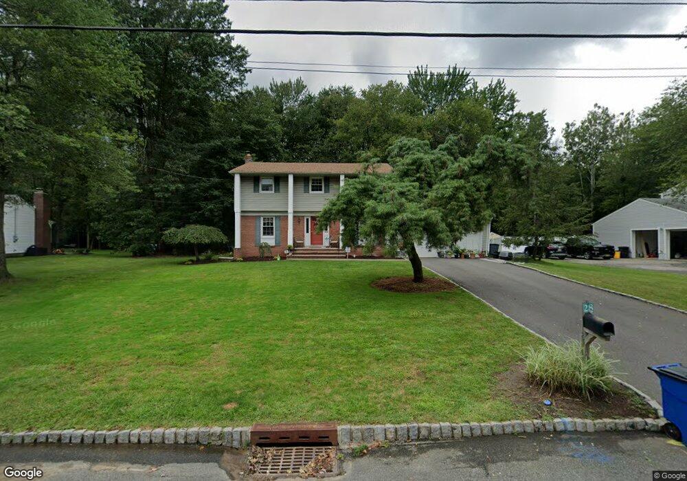
28 Cedar Ln Roseland, NJ 07068
Estimated Value: $737,000 - $919,421
Studio
--
Bath
2,325
Sq Ft
$365/Sq Ft
Est. Value
About This Home
This home is located at 28 Cedar Ln, Roseland, NJ 07068 and is currently estimated at $847,855, approximately $364 per square foot. 28 Cedar Ln is a home located in Essex County with nearby schools including Lester C. Noecker Elementary School, West Essex Middle School, and West Essex High School.
Ownership History
Date
Name
Owned For
Owner Type
Purchase Details
Closed on
Oct 30, 1996
Sold by
Reilly Robert
Bought by
Robertiello Michael and Robertiello Kathleen
Current Estimated Value
Home Financials for this Owner
Home Financials are based on the most recent Mortgage that was taken out on this home.
Original Mortgage
$231,000
Outstanding Balance
$22,564
Interest Rate
7.99%
Estimated Equity
$825,291
Create a Home Valuation Report for This Property
The Home Valuation Report is an in-depth analysis detailing your home's value as well as a comparison with similar homes in the area
Home Values in the Area
Average Home Value in this Area
Purchase History
| Date | Buyer | Sale Price | Title Company |
|---|---|---|---|
| Robertiello Michael | $305,000 | -- |
Source: Public Records
Mortgage History
| Date | Status | Borrower | Loan Amount |
|---|---|---|---|
| Open | Robertiello Michael | $231,000 |
Source: Public Records
Tax History
| Year | Tax Paid | Tax Assessment Tax Assessment Total Assessment is a certain percentage of the fair market value that is determined by local assessors to be the total taxable value of land and additions on the property. | Land | Improvement |
|---|---|---|---|---|
| 2025 | $13,334 | $738,700 | $361,200 | $377,500 |
| 2024 | $14,147 | $738,700 | $361,200 | $377,500 |
| 2022 | $14,269 | $611,100 | $355,500 | $255,600 |
| 2021 | $14,074 | $611,100 | $355,500 | $255,600 |
| 2020 | $14,025 | $611,100 | $355,500 | $255,600 |
| 2019 | $13,896 | $611,100 | $355,500 | $255,600 |
| 2018 | $13,774 | $611,100 | $355,500 | $255,600 |
| 2017 | $13,768 | $611,100 | $355,500 | $255,600 |
| 2016 | $13,554 | $611,100 | $355,500 | $255,600 |
| 2015 | $13,585 | $611,100 | $355,500 | $255,600 |
| 2014 | $13,206 | $611,100 | $355,500 | $255,600 |
Source: Public Records
Map
Nearby Homes
- 146 Passaic Ave
- 142 Passaic Ave
- 2 Holderith Rd
- 34 Brian Rd
- 48 Bovensiepen Ct
- 15 Paradise Place Unit C0008
- 16 Minnisink Dr
- 78 Glen Ave
- 30 Clements Ct Unit C0079
- 20 Conklin Ct Unit C0090
- 44 4th Ave
- 88 Kent Dr Unit C0176
- 192 Eagle Rock Ave
- 518 Eagle Rock Ave
- 492 Eagle Rock Ave
- 4 Reiher Ct
- 86 Deerfield Rd
- 36 Williamsburg Dr
- 19 Bond Place
- 34 Lincoln St
Your Personal Tour Guide
Ask me questions while you tour the home.