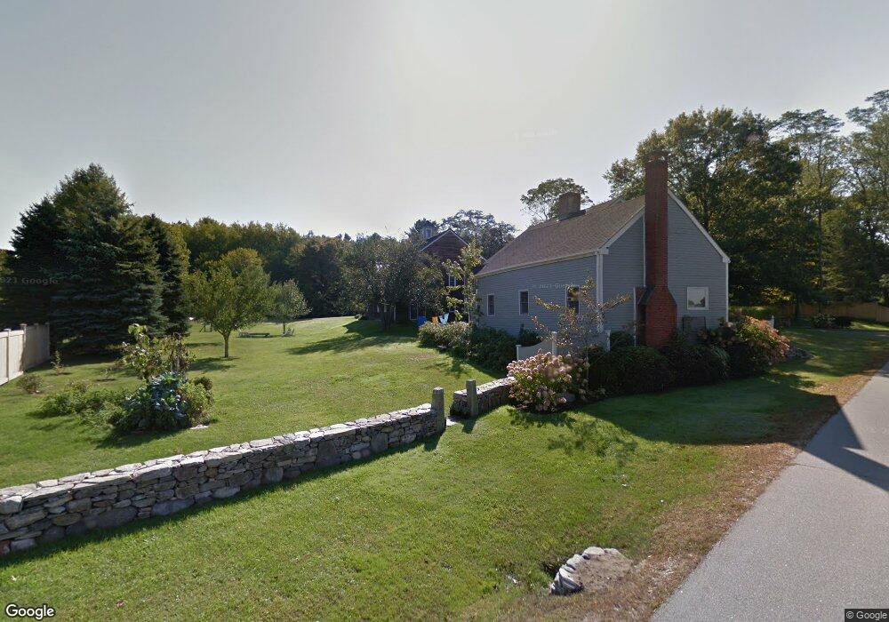
28 Sandy Hill Ln Eliot, ME 03903
South Eliot NeighborhoodEstimated Value: $792,000 - $1,569,000
4
Beds
2
Baths
4,450
Sq Ft
$246/Sq Ft
Est. Value
About This Home
This home is located at 28 Sandy Hill Ln, Eliot, ME 03903 and is currently estimated at $1,093,978, approximately $245 per square foot. 28 Sandy Hill Ln is a home located in York County with nearby schools including Marshwood High School and Seacoast Waldorf School.
Ownership History
Date
Name
Owned For
Owner Type
Purchase Details
Closed on
Mar 27, 2024
Sold by
Francis Joanne C and Egelston Peter R
Bought by
Egelston-Francis Ret and Francis
Current Estimated Value
Create a Home Valuation Report for This Property
The Home Valuation Report is an in-depth analysis detailing your home's value as well as a comparison with similar homes in the area
Home Values in the Area
Average Home Value in this Area
Purchase History
We collect this data history from publicly available records. To have your information removed, we recommend requesting removal directly through your county’s website.
| Date | Buyer | Sale Price | Title Company |
|---|---|---|---|
| Egelston-Francis Ret | -- | None Available | |
| Egelston-Francis Ret | -- | None Available |
Source: Public Records
Tax History
| Year | Tax Paid | Tax Assessment Tax Assessment Total Assessment is a certain percentage of the fair market value that is determined by local assessors to be the total taxable value of land and additions on the property. | Land | Improvement |
|---|---|---|---|---|
| 2025 | $8,773 | $779,800 | $381,800 | $398,000 |
| 2024 | $8,842 | $746,200 | $348,200 | $398,000 |
| 2023 | $8,902 | $726,700 | $343,400 | $383,300 |
| 2022 | $8,793 | $726,700 | $343,400 | $383,300 |
| 2021 | $8,695 | $644,100 | $270,800 | $373,300 |
| 2020 | $4,844 | $633,300 | $270,800 | $362,500 |
| 2019 | $9,310 | $633,300 | $270,800 | $362,500 |
| 2018 | $4,572 | $633,300 | $270,800 | $362,500 |
| 2017 | $4,419 | $639,700 | $270,800 | $368,900 |
| 2016 | $8,988 | $639,700 | $270,800 | $368,900 |
| 2015 | $8,956 | $639,700 | $270,800 | $368,900 |
| 2014 | $8,828 | $639,700 | $270,800 | $368,900 |
| 2013 | $8,425 | $639,700 | $270,800 | $368,900 |
Source: Public Records
Map
Nearby Homes
- 338 River Rd
- 293 River Rd
- 222 River Rd
- 0 Cote Dr Unit 55B
- 33 Little Bay Dr
- 348 Dover Point Rd
- 354 Dover Point Rd
- 3 Blue Heron Dr
- 21 Clearwater Dr
- 18 Little Bay Dr
- 28 Little Bay Dr
- SLIP 13 Little Bay Marina
- SLIP 28 Little Bay Marina
- 2 Blue Heron Dr
- Slip B18 Little Bay
- 18 Deborah Ln
- 18 Deborah Ln Unit 18
- 24 Deborah Ln
- 71 Shipwright Way
- 6 Roberta Dr
Your Personal Tour Guide
Ask me questions while you tour the home.