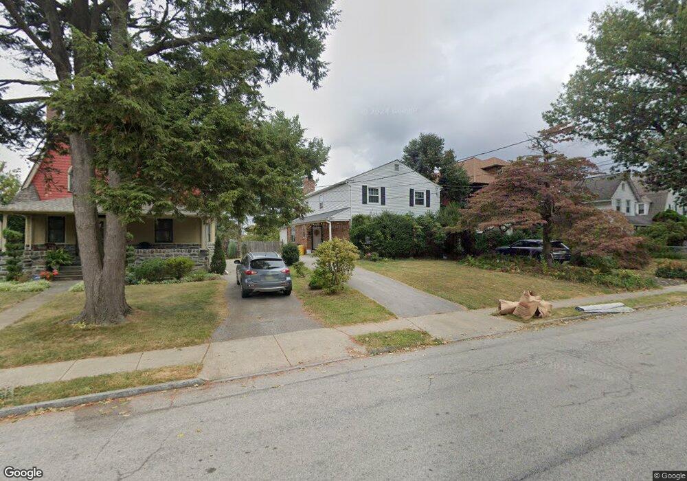
28 Simpson Rd Ardmore, PA 19003
Estimated Value: $1,019,057 - $1,276,000
About This Home
This home is located at 28 Simpson Rd, Ardmore, PA 19003 and is currently estimated at $1,116,264, approximately $452 per square foot. 28 Simpson Rd is a home located in Montgomery County with nearby schools including Penn Valley School, Welsh Valley Middle School, and Lower Merion High School.
Ownership History
We collect this data history from publicly available records. To have your information removed, we recommend requesting removal directly through your county’s website.
Purchase Details
Purchase Details
Home Financials for this Owner
Home Financials are based on the most recent Mortgage that was taken out on this home.Purchase Details
Home Values in the Area
Average Home Value in this Area
Purchase History
We collect this data history from publicly available records. To have your information removed, we recommend requesting removal directly through your county’s website.
| Date | Buyer | Sale Price | Title Company |
|---|---|---|---|
| -- | None Available | ||
| -- | None Available | ||
| -- | -- |
Mortgage History
We collect this data history from publicly available records. To have your information removed, we recommend requesting removal directly through your county’s website.
| Date | Status | Borrower | Loan Amount |
|---|---|---|---|
| Previous Owner | $150,000 |
Tax History
We collect this data history from publicly available records. To have your information removed, we recommend requesting removal directly through your county’s website.
| Year | Tax Paid | Tax Assessment Tax Assessment Total Assessment is a certain percentage of the fair market value that is determined by local assessors to be the total taxable value of land and additions on the property. | Land | Improvement |
|---|---|---|---|---|
| 2026 | $9,234 | $202,150 | -- | -- |
| 2025 | $8,443 | $202,150 | -- | -- |
| 2024 | $8,443 | $202,150 | -- | -- |
| 2023 | $8,091 | $202,150 | $0 | $0 |
| 2022 | $7,940 | $202,150 | $0 | $0 |
| 2021 | $7,760 | $202,150 | $0 | $0 |
| 2020 | $7,570 | $202,150 | $0 | $0 |
| 2019 | $7,436 | $202,150 | $0 | $0 |
| 2018 | $7,436 | $202,150 | $0 | $0 |
| 2017 | $7,163 | $202,150 | $0 | $0 |
| 2016 | $7,084 | $202,150 | $0 | $0 |
| 2015 | $6,605 | $202,150 | $0 | $0 |
| 2014 | $6,605 | $202,150 | $0 | $0 |
Map
- 111 Saint Pauls Rd
- 11 E Spring Ave
- 21 Chatham Rd
- 154 Grandview Rd
- 186 Lakeside Rd
- 1968 W Montgomery Ave
- 32 W Montgomery Ave Unit 329
- 213 Ardmore Ave
- 103 W Montgomery Ave Unit 2E
- 114 Llanfair Rd
- 221 Ardmore Ave
- 827 Aubrey Ave
- 210 Kent Rd
- 214 Kent Rd
- 264 W Montgomery Ave Unit 304
- 219 E Montgomery Ave Unit 6
- 818 Clifford Ave
- 1219 W Wynnewood Rd Unit 208
- 104 Woodside Rd Unit A102
- 201 Cobblestone Dr
- 26 Simpson Rd
- 30 Simpson Rd Unit 746
- 24 Simpson Rd
- 34 Simpson Rd
- 55 Rittenhouse Place
- 53 Rittenhouse Place
- 22 Simpson Rd Unit 749
- 51 Rittenhouse Place
- 43 Rittenhouse Place
- 43 Rittenhouse Place Unit 2F
- 43 Rittenhouse Place Unit 2R
- 36 Simpson Rd
- 20 Simpson Rd
- 29 Simpson Rd
- 31 Simpson Rd
- 27 Simpson Rd
- 33 Simpson Rd
- 25 Simpson Rd
- 35 Simpson Rd Unit 788
- 18 Simpson Rd
Ask me questions while you tour the home.