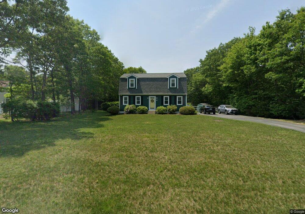
28 Winston Ave Bourne, MA 2532
Estimated Value: $573,725 - $661,000
3
Beds
2
Baths
1,728
Sq Ft
$350/Sq Ft
Est. Value
About This Home
This home is located at 28 Winston Ave, Bourne, MA 2532 and is currently estimated at $605,431, approximately $350 per square foot. 28 Winston Ave is a home located in Barnstable County with nearby schools including Bourne High School, Bridgeview Montessori School, and New Testament Christian School.
Ownership History
Date
Name
Owned For
Owner Type
Purchase Details
Closed on
Jul 2, 2008
Sold by
Murphy Deborah L and Murphy Robert E
Bought by
Barry Christopher and Barry Melissa J
Current Estimated Value
Purchase Details
Closed on
Jun 30, 1993
Sold by
Glynn Christopher J and Glynn Christine B
Bought by
Murphy Robert E and Murphy Deborah L
Purchase Details
Closed on
Dec 16, 1991
Sold by
Weldon Park Rt
Bought by
Glynn Christopher J and Branco-Glynn Chris
Create a Home Valuation Report for This Property
The Home Valuation Report is an in-depth analysis detailing your home's value as well as a comparison with similar homes in the area
Purchase History
| Date | Buyer | Sale Price | Title Company |
|---|---|---|---|
| Barry Christopher | $307,500 | -- | |
| Barry Christopher | $307,500 | -- | |
| Murphy Robert E | $96,000 | -- | |
| Murphy Robert E | $96,000 | -- | |
| Glynn Christopher J | $95,795 | -- |
Source: Public Records
Mortgage History
| Date | Status | Borrower | Loan Amount |
|---|---|---|---|
| Open | Glynn Christopher J | $299,133 | |
| Closed | Glynn Christopher J | $301,841 |
Source: Public Records
Tax History
| Year | Tax Paid | Tax Assessment Tax Assessment Total Assessment is a certain percentage of the fair market value that is determined by local assessors to be the total taxable value of land and additions on the property. | Land | Improvement |
|---|---|---|---|---|
| 2025 | $3,671 | $470,000 | $175,000 | $295,000 |
| 2024 | $3,438 | $428,700 | $166,700 | $262,000 |
| 2023 | $3,486 | $395,700 | $163,900 | $231,800 |
| 2022 | $3,321 | $329,100 | $145,100 | $184,000 |
| 2021 | $3,248 | $301,600 | $132,000 | $169,600 |
| 2020 | $3,115 | $290,000 | $130,800 | $159,200 |
| 2019 | $2,953 | $281,000 | $130,800 | $150,200 |
| 2018 | $2,841 | $269,500 | $124,600 | $144,900 |
| 2017 | $2,712 | $263,300 | $123,400 | $139,900 |
| 2016 | $2,643 | $260,100 | $123,400 | $136,700 |
| 2015 | $2,619 | $260,100 | $123,400 | $136,700 |
Source: Public Records
Map
Nearby Homes
- 3 Dover Ln
- 0 State Rd
- 16 Ocean Pines Dr Unit B
- 4 Carmela Ln
- 150 Herring Pond Rd
- 17 Andrew Rd
- 6 Aspen Rd
- 6 Aspen Rd
- 8 Driftwood Ln
- 29 Eagle Hill Dr
- 7 Swamp Rd
- 11 Village Green Dr Unit B
- 64 Hunters Brook Rd
- 17 Ridgehill Ln
- 21 Hillside Rd
- 10 Tecumseh Rd
- 18 Gibbs Rd
- 133 Phillips Rd
- 896 Sandwich Rd
- 56 Samoset Rd
Your Personal Tour Guide
Ask me questions while you tour the home.