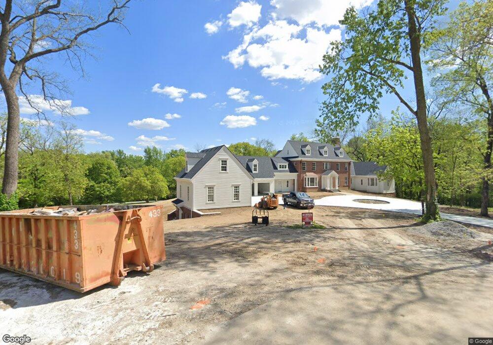
2800 Whitman Dr Saint Joseph, MO 64506
Lovers Lane NeighborhoodEstimated Value: $526,000 - $631,000
Studio
--
Bath
4,621
Sq Ft
$128/Sq Ft
Est. Value
About This Home
This home is located at 2800 Whitman Dr, Saint Joseph, MO 64506 and is currently estimated at $592,594, approximately $128 per square foot. 2800 Whitman Dr is a home located in Buchanan County with nearby schools including Field Elementary School, Bode Middle School, and Central High School.
Ownership History
Date
Name
Owned For
Owner Type
Purchase Details
Closed on
Dec 21, 2020
Sold by
Decelles Catherine A and Miller Amendment Billy P
Bought by
Smith J Michael J and Smith Kailee
Current Estimated Value
Home Financials for this Owner
Home Financials are based on the most recent Mortgage that was taken out on this home.
Original Mortgage
$430,000
Outstanding Balance
$382,639
Interest Rate
2.8%
Mortgage Type
Future Advance Clause Open End Mortgage
Estimated Equity
$209,955
Purchase Details
Closed on
Jan 27, 2012
Sold by
Miller Billy P
Bought by
Miller Billy P and Billy P Miller Declaration Of Trust
Create a Home Valuation Report for This Property
The Home Valuation Report is an in-depth analysis detailing your home's value as well as a comparison with similar homes in the area
Home Values in the Area
Average Home Value in this Area
Purchase History
We collect this data history from publicly available records. To have your information removed, we recommend requesting removal directly through your county’s website.
| Date | Buyer | Sale Price | Title Company |
|---|---|---|---|
| Smith J Michael J | $537,500 | First American Ttl Ins Compa | |
| Miller Billy P | -- | None Available |
Source: Public Records
Mortgage History
We collect this data history from publicly available records. To have your information removed, we recommend requesting removal directly through your county’s website.
| Date | Status | Borrower | Loan Amount |
|---|---|---|---|
| Open | Smith J Michael J | $430,000 |
Source: Public Records
Tax History
| Year | Tax Paid | Tax Assessment Tax Assessment Total Assessment is a certain percentage of the fair market value that is determined by local assessors to be the total taxable value of land and additions on the property. | Land | Improvement |
|---|---|---|---|---|
| 2025 | $5,412 | $75,890 | $6,900 | $68,990 |
| 2024 | $523 | $6,900 | $6,900 | $0 |
| 2023 | $523 | $6,900 | $6,900 | $0 |
| 2022 | $2,686 | $40,490 | $8,550 | $31,940 |
| 2021 | $2,698 | $40,490 | $8,550 | $31,940 |
| 2020 | $2,681 | $40,490 | $8,550 | $31,940 |
| 2019 | $2,590 | $40,490 | $8,550 | $31,940 |
| 2018 | $2,340 | $40,490 | $8,550 | $31,940 |
| 2017 | $2,318 | $40,490 | $0 | $0 |
| 2015 | $4 | $40,490 | $0 | $0 |
| 2014 | $2,540 | $40,490 | $0 | $0 |
Source: Public Records
Map
Nearby Homes
- 3015 Miller Rd
- 2718 Southwest Trail
- 3312 E Colony Square
- 2913 Gene Field Rd
- 3607 E Colony Square
- 2611 Parallel Ave
- 3117 Miller Ave
- 2910 Karnes Rd
- 2327 Goff Ave
- 2828 N 32nd St
- 2324 Goff Ave
- 3111 Carlisle Ct
- 3107 Carlisle Ct
- 2204 Ashland Ave
- 3109 Carlisle Ct
- 2119 Newport Rd
- 2306 W Circle Dr
- 2110 Ashland Ave
- 2521 Essex St
- 2238 N 22nd St
- 2801 Whitman Dr
- 2802 Whitman Dr
- 3002 Miller Rd
- 2807 Whitman Dr
- 2808 Whitman Dr
- 2709 Southeast Trail
- 3001 Miller Rd
- 3006 Miller Rd
- 2711 Southeast Trail
- 2707 Southeast Trail
- 104 Ridge Dr
- 102 Ridge Dr
- 2713 Southeast Trail
- 2702 Lovers Ln
- 100 Ridge Dr
- 2715 Southeast Trail
- 2707 Gene Field Rd
- 2705 Southeast Trail
- 106 Ridge Dr
- 2715 Gene Field Rd
Your Personal Tour Guide
Ask me questions while you tour the home.