2806 S Port Dr Unit 3E Bethlehem, GA 30620
Estimated Value: $373,000 - $393,000
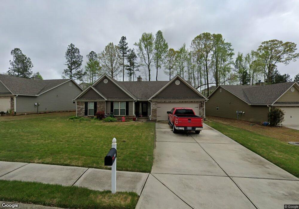
About This Home
This home is located at 2806 S Port Dr Unit 3E, Bethlehem, GA 30620 and is currently estimated at $383,489, approximately $169 per square foot. 2806 S Port Dr Unit 3E is a home located in Barrow County with nearby schools including Yargo Elementary School, Haymon-Morris Middle School, and Apalachee High School.
Ownership History
We collect this data history from publicly available records. To have your information removed, we recommend requesting removal directly through your county’s website.
Purchase Details
Purchase Details
Home Financials for this Owner
Home Financials are based on the most recent Mortgage that was taken out on this home.Purchase Details
Purchase Details
Purchase Details
Purchase Details
Home Values in the Area
Average Home Value in this Area
Purchase History
We collect this data history from publicly available records. To have your information removed, we recommend requesting removal directly through your county’s website.
| Date | Buyer | Sale Price | Title Company |
|---|---|---|---|
| -- | -- | ||
| $180,900 | -- | ||
| $137,500 | -- | ||
| $590,000 | -- | ||
| -- | -- | ||
| $1,950,000 | -- |
Mortgage History
We collect this data history from publicly available records. To have your information removed, we recommend requesting removal directly through your county’s website.
| Date | Status | Borrower | Loan Amount |
|---|---|---|---|
| Previous Owner | $144,720 |
Tax History
We collect this data history from publicly available records. To have your information removed, we recommend requesting removal directly through your county’s website.
| Year | Tax Paid | Tax Assessment Tax Assessment Total Assessment is a certain percentage of the fair market value that is determined by local assessors to be the total taxable value of land and additions on the property. | Land | Improvement |
|---|---|---|---|---|
| 2025 | $1,259 | $152,170 | $30,000 | $122,170 |
| 2024 | $2,363 | $148,522 | $30,000 | $118,522 |
| 2023 | $1,830 | $143,122 | $24,000 | $119,122 |
| 2022 | $2,665 | $110,623 | $24,000 | $86,623 |
| 2021 | $3,030 | $101,314 | $18,000 | $83,314 |
| 2020 | $2,334 | $78,038 | $18,000 | $60,038 |
| 2019 | $2,373 | $78,038 | $18,000 | $60,038 |
| 2018 | $2,346 | $78,038 | $18,000 | $60,038 |
| 2017 | $1,993 | $68,454 | $18,000 | $50,454 |
| 2016 | $179 | $5,940 | $5,940 | $0 |
| 2015 | $180 | $5,940 | $5,940 | $0 |
| 2014 | $88 | $2,800 | $2,800 | $0 |
| 2013 | -- | $4,914 | $4,914 | $0 |
Map
- 1978 Waterside Cir
- 1130 Lyndhurst Ln
- 1615 Newport Dr
- 233 Trail Winds Dr
- 183 Alexander Ln
- 337 Alexander Ln
- 1229 Lyndhurst Ln
- 16 Everly Way
- 1530 Blakewood Trail
- 1323 Hudson Ct
- 157 Casteel Ln
- 77 Gillis Ln
- 329 Kensington Trace
- 28 Elmarry Ln
- 60 Galilee Ln
- 88 Galilee Ln
- 18 Galilee Ln
- 46 Galilee Ln
- 32 Galilee Ln
- 188 Galilee Ln
- 1400 Nantucket Dr
- 1950 Waterside Cir
- 1952 Waterside Cir
- 1404 Nantucket Dr
- 1954 Waterside Cir
- 2800 S Port Dr
- 2802 S Port Dr
- 1403 Nantucket Dr
- 2806 S Port Dr
- 1956 Waterside Cir
- 1405 Nantucket Dr
- 2808 S Port Dr
- 1944 Waterside Cir
- 1947 Waterside Cir
- at
- at
- at
- 2310 Waterside Dr Unit 36440990
- 2310 Waterside Dr
- 1007 Nantucket Way
Ask me questions while you tour the home.