Estimated Value: $188,276 - $323,000
3
Beds
1
Bath
1,250
Sq Ft
$200/Sq Ft
Est. Value
About This Home
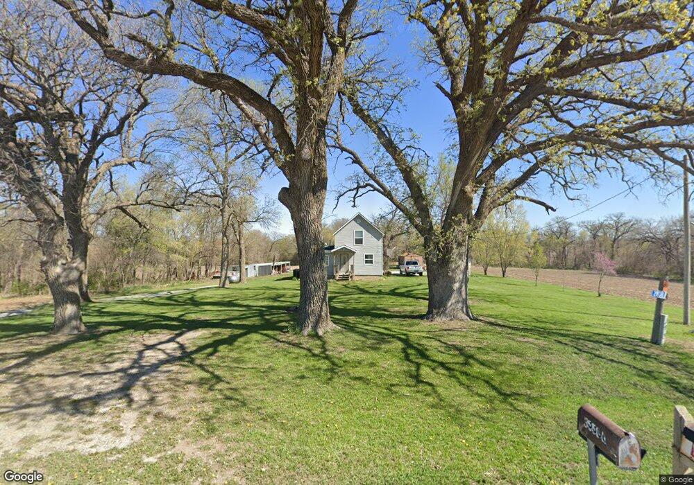
This home is located at 2808 A St, Union, NE 68455 and is currently estimated at $249,819, approximately $199 per square foot. 2808 A St is a home located in Cass County with nearby schools including Conestoga Elementary School and Conestoga Junior/Senior High School.
Ownership History
Date
Name
Owned For
Owner Type
Purchase Details
Closed on
May 12, 2008
Sold by
Wiley Peter Albert and Wiley Laurel Nell
Bought by
Jones Leonard E and Jones Michelle L
Current Estimated Value
Purchase Details
Closed on
Jun 15, 2006
Sold by
J J I Investments Llc
Bought by
Wiley Peter Albert
Home Financials for this Owner
Home Financials are based on the most recent Mortgage that was taken out on this home.
Original Mortgage
$63,757
Interest Rate
6.58%
Mortgage Type
Future Advance Clause Open End Mortgage
Purchase Details
Closed on
Mar 29, 2005
Sold by
Keene Delbert
Bought by
J J I Investments Llc
Create a Home Valuation Report for This Property
The Home Valuation Report is an in-depth analysis detailing your home's value as well as a comparison with similar homes in the area
Purchase History
| Date | Buyer | Sale Price | Title Company |
|---|---|---|---|
| Jones Leonard E | $130,000 | -- | |
| Wiley Peter Albert | $118,000 | -- | |
| J J I Investments Llc | $30,000 | -- |
Source: Public Records
Mortgage History
| Date | Status | Borrower | Loan Amount |
|---|---|---|---|
| Closed | Wiley Peter Albert | $63,757 |
Source: Public Records
Tax History
| Year | Tax Paid | Tax Assessment Tax Assessment Total Assessment is a certain percentage of the fair market value that is determined by local assessors to be the total taxable value of land and additions on the property. | Land | Improvement |
|---|---|---|---|---|
| 2025 | $1,821 | $153,290 | $40,000 | $113,290 |
| 2024 | $1,874 | $146,090 | $32,800 | $113,290 |
| 2023 | $1,823 | $132,610 | $19,320 | $113,290 |
| 2022 | $1,830 | $126,205 | $20,286 | $105,919 |
| 2021 | $1,774 | $118,375 | $17,500 | $100,875 |
| 2020 | $1,235 | $80,641 | $17,500 | $63,141 |
| 2019 | $1,310 | $80,641 | $17,500 | $63,141 |
| 2018 | $1,282 | $80,641 | $17,500 | $63,141 |
| 2017 | $1,298 | $80,641 | $17,500 | $63,141 |
| 2016 | $1,243 | $80,641 | $17,500 | $63,141 |
| 2015 | $1,237 | $80,641 | $17,500 | $63,141 |
| 2014 | $2,239 | $126,801 | $17,500 | $109,301 |
Source: Public Records
Map
Nearby Homes
- 136 W Main St
- 412 Washington St
- 320 North St
- 216 North St
- 2109 W Shore Dr
- 2166 E Lake Dr
- 910 Alt Hwy 75
- 11509 A St
- 7406 66th St
- 103 E Main St
- 415 & 401 Kaffenberger Dr
- 811 E Main St
- 509 W Young St
- 8769 24th St
- 1138 Beaver Lake Blvd
- 2018 Murray Rd
- 1220 Murray Rd
- 8520 Lake Ridge Dr
- 8611 12th Ave
- 8617 12th Ave
Your Personal Tour Guide
Ask me questions while you tour the home.