Estimated Value: $148,203 - $216,000
2
Beds
1
Bath
948
Sq Ft
$196/Sq Ft
Est. Value
About This Home
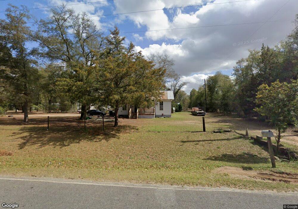
This home is located at 281 Todd Rd, Perry, GA 31069 and is currently estimated at $186,051, approximately $196 per square foot. 281 Todd Rd is a home located in Houston County with nearby schools including Langston Road Elementary School, Mossy Creek Middle School, and Perry High School.
Ownership History
Date
Name
Owned For
Owner Type
Purchase Details
Closed on
Aug 19, 2008
Sold by
Coffee Edwin M
Bought by
Coffee Tracy L and Coffee Thomas P
Current Estimated Value
Purchase Details
Closed on
Dec 21, 1993
Sold by
Coffee Edwin T Estate
Bought by
Coffee Martha P
Purchase Details
Closed on
Jul 28, 1989
Sold by
Robins Federal Credit Union
Bought by
Coffee Edwin T
Purchase Details
Closed on
May 2, 1989
Sold by
Scruggs Bryant
Bought by
Robins Federal Credit Union
Purchase Details
Closed on
May 23, 1984
Sold by
Coffee Edwin T and Coffee Martha A
Bought by
Scruggs Bryant
Purchase Details
Closed on
Feb 3, 1978
Sold by
Coffee E T
Bought by
Coffee Edwin T and Coffee Martha A
Purchase Details
Closed on
Dec 2, 1976
Bought by
Coffee E T
Create a Home Valuation Report for This Property
The Home Valuation Report is an in-depth analysis detailing your home's value as well as a comparison with similar homes in the area
Home Values in the Area
Average Home Value in this Area
Purchase History
| Date | Buyer | Sale Price | Title Company |
|---|---|---|---|
| Coffee Tracy L | -- | None Available | |
| Coffee Martha P | -- | -- | |
| Coffee Edwin T | -- | -- | |
| Robins Federal Credit Union | -- | -- | |
| Scruggs Bryant | -- | -- | |
| Coffee Edwin T | -- | -- | |
| Coffee E T | -- | -- |
Source: Public Records
Tax History
| Year | Tax Paid | Tax Assessment Tax Assessment Total Assessment is a certain percentage of the fair market value that is determined by local assessors to be the total taxable value of land and additions on the property. | Land | Improvement |
|---|---|---|---|---|
| 2025 | $619 | $28,320 | $10,480 | $17,840 |
| 2024 | $604 | $25,240 | $9,480 | $15,760 |
| 2023 | $416 | $17,200 | $6,440 | $10,760 |
| 2022 | $406 | $16,800 | $5,160 | $11,640 |
| 2021 | $250 | $10,280 | $3,720 | $6,560 |
| 2020 | $244 | $10,000 | $3,600 | $6,400 |
| 2019 | $244 | $10,000 | $3,600 | $6,400 |
| 2018 | $244 | $10,000 | $3,600 | $6,400 |
| 2017 | $244 | $10,000 | $3,600 | $6,400 |
| 2016 | $245 | $10,000 | $3,600 | $6,400 |
| 2015 | $245 | $10,000 | $3,600 | $6,400 |
| 2014 | -- | $10,000 | $3,600 | $6,400 |
| 2013 | -- | $10,000 | $3,600 | $6,400 |
Source: Public Records
Map
Nearby Homes
- 0 Todd Rd Unit 253674
- 309 Bermuda Ridge
- 105 Senimor Ct
- 101 Chaparral Dr
- 501 Longhorn Trail
- 108 Tahoma Dr
- 2327 Us Hwy 41
- 2327 U S 41
- 113 Lake Lillian Dr
- 150 MacK Thompson Rd
- 0 MacK Thompson Rd Unit 253661
- 149 MacK Thompson Road Common
- 119 Bramblewood Ln
- 117 Bramblewood Ln
- 115 Bramblewood Ln
- 0 Hwy 41 & Langston Rd Unit M170042
- 0 Langston Rd Unit 16828609
- 115 Woody Dr
- 111 Breakwater Way
- 118 Bramblewood Way
- 279 Todd Rd
- 279A Todd Rd
- 287 Todd Rd
- 277 Todd Rd
- 7400 Buckeye Rd
- 249 Todd Rd
- 0 Buckeye Rd Unit PAR C 3185634
- 0 Buckeye Rd Unit L2A,AC9000 7439580
- 0 Buckeye Rd Unit L2b 8048500
- 0 Buckeye Rd Unit 8065245
- 0 Buckeye Rd Unit 214166
- 0 Buckeye Rd Unit Tract A 8079804
- 0 Buckeye Rd Unit M136761
- 0 Buckeye Rd Unit M137165
- 0 Buckeye Rd Unit 8743545
- 0 Buckeye Rd Unit 201195
- 0 Buckeye Rd Unit 122838
- 0 Buckeye Rd Unit Parcel D 185411
- 7409 Buckeye Rd
- 7314 Buckeye Rd
Your Personal Tour Guide
Ask me questions while you tour the home.