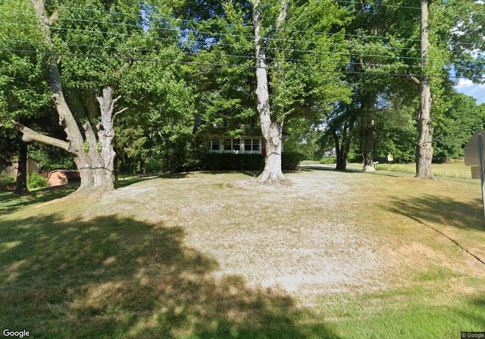
2810 State Route 43 Mogadore, OH 44260
Estimated Value: $281,866 - $317,000
3
Beds
2
Baths
1,712
Sq Ft
$173/Sq Ft
Est. Value
About This Home
This home is located at 2810 State Route 43, Mogadore, OH 44260 and is currently estimated at $295,717, approximately $172 per square foot. 2810 State Route 43 is a home located in Portage County with nearby schools including Suffield Elementary School, Field Middle School, and Field High School.
Ownership History
Date
Name
Owned For
Owner Type
Purchase Details
Closed on
Dec 13, 2010
Sold by
Kuss Timothy M
Bought by
Marino Donald J
Current Estimated Value
Home Financials for this Owner
Home Financials are based on the most recent Mortgage that was taken out on this home.
Original Mortgage
$148,146
Outstanding Balance
$97,356
Interest Rate
4.5%
Mortgage Type
FHA
Estimated Equity
$198,361
Purchase Details
Closed on
May 9, 2007
Sold by
Kuss Timothy M and Sinning Nancy M
Bought by
Kuss Timothy M
Purchase Details
Closed on
Apr 8, 1994
Bought by
Kuss Timothy M and Kuss Nancy M
Create a Home Valuation Report for This Property
The Home Valuation Report is an in-depth analysis detailing your home's value as well as a comparison with similar homes in the area
Home Values in the Area
Average Home Value in this Area
Purchase History
We collect this data history from publicly available records. To have your information removed, we recommend requesting removal directly through your county’s website.
| Date | Buyer | Sale Price | Title Company |
|---|---|---|---|
| Marino Donald J | $152,000 | Chicago Title Insurance Co | |
| Kuss Timothy M | -- | None Available | |
| Kuss Timothy M | $83,000 | -- |
Source: Public Records
Mortgage History
We collect this data history from publicly available records. To have your information removed, we recommend requesting removal directly through your county’s website.
| Date | Status | Borrower | Loan Amount |
|---|---|---|---|
| Open | Marino Donald J | $148,146 |
Source: Public Records
Tax History
| Year | Tax Paid | Tax Assessment Tax Assessment Total Assessment is a certain percentage of the fair market value that is determined by local assessors to be the total taxable value of land and additions on the property. | Land | Improvement |
|---|---|---|---|---|
| 2025 | $3,833 | $79,000 | $14,670 | $64,330 |
| 2024 | $3,769 | $79,000 | $14,670 | $64,330 |
| 2023 | $3,723 | $62,830 | $9,170 | $53,660 |
| 2022 | $3,734 | $62,830 | $9,170 | $53,660 |
| 2021 | $3,640 | $62,830 | $9,170 | $53,660 |
| 2020 | $3,161 | $49,210 | $9,170 | $40,040 |
| 2019 | $3,120 | $49,210 | $9,170 | $40,040 |
| 2018 | $2,513 | $46,940 | $9,170 | $37,770 |
| 2017 | $2,513 | $46,940 | $9,170 | $37,770 |
| 2016 | $2,507 | $46,940 | $9,170 | $37,770 |
| 2015 | $2,426 | $46,940 | $9,170 | $37,770 |
| 2014 | $2,341 | $46,940 | $9,170 | $37,770 |
| 2013 | $2,287 | $46,940 | $9,170 | $37,770 |
Source: Public Records
Map
Nearby Homes
- 2981 Reservoir Dr
- 3415 Hanover Dr
- 3502 Ivanhoe Dr
- 3312 Woods Trail
- 3532 Gary Dr
- 2196 Congress Lake Rd
- 0 Randolph Rd Unit 5189131
- 3665 Elmhurst Ct
- 1346 Arcadia Rd
- 460 Arehart Dr
- 1941 Congress Lake Rd
- 3771 Selnik Rd
- 3800 Grace Dr
- 3834 Morley Dr
- 93 Sunrise Blvd E
- 3937 Mctaggart Blvd
- 258 Randolph Rd
- 112 West Ave
- 4138 Whispering Springs Ln
- 3998 Highland Dr
- 2824 State Route 43
- 2788 State Route 43
- 2848 State Route 43
- 2811 State Route 43
- 2770 State Route 43
- 1324 Saxe Rd
- 2854 State Route 43
- 2758 State Route 43
- 1329 Saxe Rd
- 2859 State Route 43
- 1233 Saxe Rd
- 2867 State Route 43
- 2745 State Route 43
- 2878 State Route 43
- 2742 State Route 43
- 1226 Saxe Rd
- 1346 Saxe Rd
- 2732 State Route 43
- 2877 State Route 43
- 1358 Saxe Rd
Your Personal Tour Guide
Ask me questions while you tour the home.