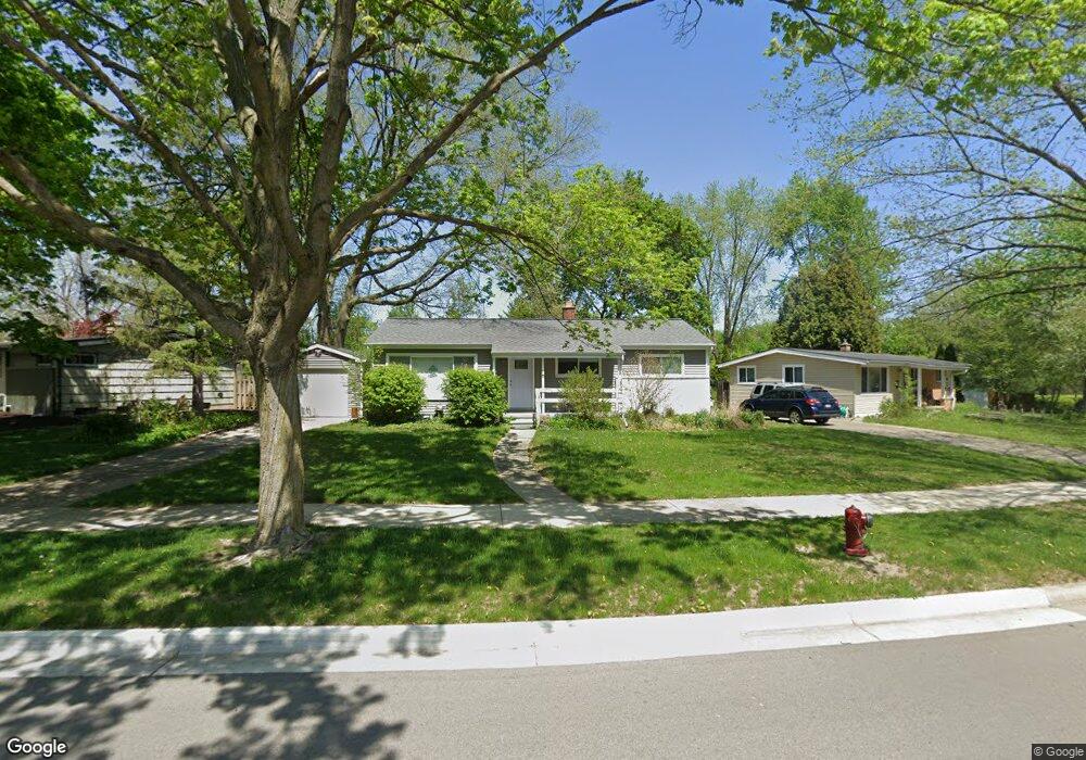
2815 Cranbrook Rd Ann Arbor, MI 48104
Allen NeighborhoodEstimated Value: $337,957 - $382,000
4
Beds
2
Baths
1,032
Sq Ft
$345/Sq Ft
Est. Value
About This Home
This home is located at 2815 Cranbrook Rd, Ann Arbor, MI 48104 and is currently estimated at $356,239, approximately $345 per square foot. 2815 Cranbrook Rd is a home located in Washtenaw County with nearby schools including Allen Elementary School, Tappan Middle School, and Pioneer High School.
Ownership History
Date
Name
Owned For
Owner Type
Purchase Details
Closed on
Aug 14, 1998
Sold by
Kennedy Stephen M
Bought by
Lawson Margaret A
Current Estimated Value
Home Financials for this Owner
Home Financials are based on the most recent Mortgage that was taken out on this home.
Original Mortgage
$109,200
Outstanding Balance
$23,079
Interest Rate
7.07%
Mortgage Type
New Conventional
Estimated Equity
$333,160
Create a Home Valuation Report for This Property
The Home Valuation Report is an in-depth analysis detailing your home's value as well as a comparison with similar homes in the area
Home Values in the Area
Average Home Value in this Area
Purchase History
| Date | Buyer | Sale Price | Title Company |
|---|---|---|---|
| Lawson Margaret A | $136,500 | -- |
Source: Public Records
Mortgage History
| Date | Status | Borrower | Loan Amount |
|---|---|---|---|
| Open | Lawson Margaret A | $109,200 |
Source: Public Records
Tax History
| Year | Tax Paid | Tax Assessment Tax Assessment Total Assessment is a certain percentage of the fair market value that is determined by local assessors to be the total taxable value of land and additions on the property. | Land | Improvement |
|---|---|---|---|---|
| 2025 | $4,207 | $169,100 | $0 | $0 |
| 2024 | $4,103 | $156,100 | $0 | $0 |
| 2023 | $3,783 | $143,700 | $0 | $0 |
| 2022 | $4,122 | $130,400 | $0 | $0 |
| 2021 | $4,025 | $124,700 | $0 | $0 |
| 2020 | $3,944 | $109,900 | $0 | $0 |
| 2019 | $3,753 | $104,100 | $104,100 | $0 |
| 2018 | $3,701 | $96,600 | $0 | $0 |
| 2017 | $3,600 | $92,300 | $0 | $0 |
| 2016 | $3,473 | $71,986 | $0 | $0 |
| 2015 | $3,307 | $71,771 | $0 | $0 |
| 2014 | $3,307 | $69,529 | $0 | $0 |
| 2013 | -- | $69,529 | $0 | $0 |
Source: Public Records
Map
Nearby Homes
- 2890 Butternut St
- 2851 Elmwood Ave
- 2840 Canterbury Rd
- 2292 Greenway Trail
- 2900 Sharon Dr
- 3325 Packard St
- 2910 Marshall St
- 2663 Pittsfield Blvd
- 2233 S Huron Pkwy Unit 2
- 3005 Fernwood Ave Unit 103
- 2468 Fernwood Ave
- 2225 S Huron Pkwy Unit 2
- 2540 Pittsfield Blvd
- 2153 Independence Blvd
- 2650 Kimberley Rd
- 2318 Pittsfield Blvd
- 3604 Platt Rd
- 12 Trowbridge Ct
- 3393 Williamsburg Rd
- 3076 Wolverine Dr
- 2811 Cranbrook Rd
- 2821 Hampshire Rd
- 2814 Hampshire Rd
- 2807 Cranbrook Rd
- 2732 Radcliffe Ave
- 2816 Cranbrook Rd
- 2814 Cranbrook Rd
- 2734 Radcliffe Ave
- 2730 Radcliffe Ave
- 2801 Cranbrook Rd
- 2810 Cranbrook Rd
- 2817 Hampshire Rd
- 2810 Hampshire Rd
- 2906 Chesterfield St
- 2808 Cranbrook Rd
- 2729 Cranbrook Rd
- 2728 Radcliffe Ave
- 2907 Chesterfield St
- 2804 Cranbrook Rd
- 2910 Chesterfield St
Your Personal Tour Guide
Ask me questions while you tour the home.