NOT LISTED FOR SALE

2839 E Ash Ridge Rd Firth, NE 68358

Estimated Value: $693,000

9 Acres
$73,411 Price per Acre
411,206 Sq Ft Lot

Last Sold November 12, 2015

Last sale price $86,900

Est. 697% increase in value since last sale

Current estimated payment $4,591/month

154 Days on Market

Highlights

  • No HOA
  • Norris Elementary School Rated A-
  • Lot Has A Rolling Slope

About This Lot

As of November 2015

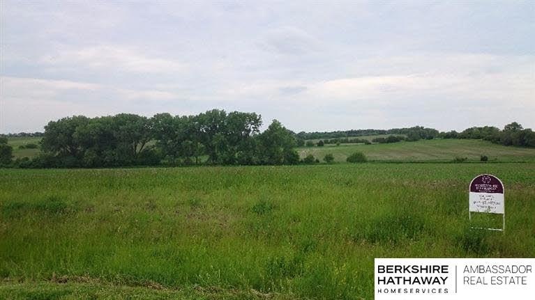
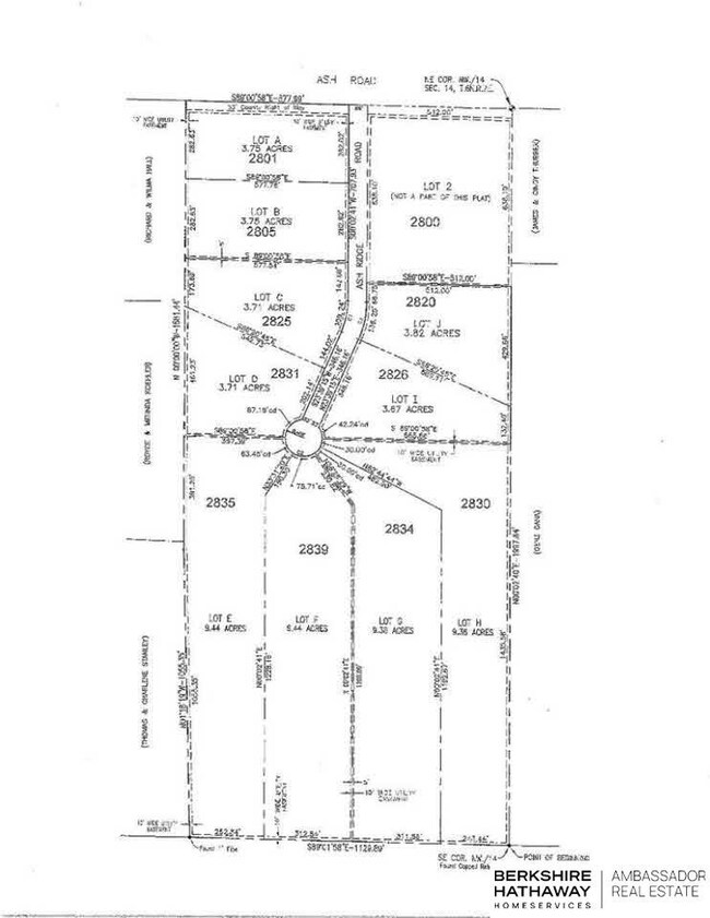
This home is located at 2839 E Ash Ridge Rd, Firth, NE 68358 since 13 May 2015 and is currently estimated at $693,000. This property was built in 2018. 2839 E Ash Ridge Rd is a home located in Gage County with nearby schools including Norris Elementary School, Norris Middle School, and Norris High School.

Last Listed By

Drew Topp

BHHS Ambassador Real Estate License #20100340 Listed on: 05/13/2015

BHHS Ambassador Real Estate

Property Details

Property Type

  • Land

Est. Annual Taxes

  • $548

Year Built

  • 2018

Lot Details

  • 9.44 Acre Lot
  • Lot Has A Rolling Slope
  • Property is zoned AGR

Schools

  • Norris Elementary And Middle School
  • Norris High School

Utilities

  • Sewer Not Available

Community Details

  • No Home Owners Association
  • Ash Ridge Association

Listing and Financial Details

  • Assessor Parcel Number 004654012

Property Details

Property Type

Land

Est. Annual Taxes

$548

Year Built

2018

Lot Details

0

Listing Details

  • Parcel Number: 004654012
  • Property Sub Type: Unimproved Land
  • Topography: Rolling
  • Zoning: AGR
  • Prop. Type: Land
  • Lot Size Acres: 9.44
  • Lot Size: 180' x 1228' 230 x 1200 | 312' x 75'
  • Co List Office Mls Id: LPRUD02
  • Directions: Hwy 43 and Ash Rd
  • Habitable Residence: No
  • Special Features: None
  • Year Built (Public Record): 2018

Exterior Features

  • Road Surface Type: Other

Utilities

  • Sewer: None

Condo/Co-op/Association

  • Association Name: Ash Ridge
  • Association: No

Schools

  • High School: Norris
  • Elementary School: Norris
  • Junior High Dist: Norris
  • Middle Or Junior School: Norris

Lot Info

  • Lot Features: Mixed Soil, 5 to 10 Acres, Rolling Slope
  • Land Lease: No
  • Lot Size Sq Ft: 411206
  • ResoLotSizeUnits: SquareFeet

Tax Info

  • Tax Year: 2014
  • Tax Annual Amount: 547.74

Range of Values:

Collateral Analytics

Collateral Analytics Collateral Analytics AVMs (Automated Valuation Model) employ a number of statistical approaches combined with neighborhood-specific comparable selection guarantees the most up-to-date and precise valuations.

Not Available

Collateral Analytics does not have data for the current month. Please view the chart for historical values.

ICE

ICE Mortgage Technology ICE Mortgage Technology’s AVM (Automated Valuation Model) is a state-of-the-art online residential property valuation tool that provides a quick and accurate estimate of the value of almost any home in the U.S.

Not Available

ICE Mortgage Technology does not have data for the current month. Please view the chart for historical values.

First American

First American First American Data & Analytics’ next-generation AVM combines unrivaled data assets with a blended ensemble of valuation models to produce highly accurate, reliable valuations you can trust.

Not Available

First American does not have data for the current month. Please view the chart for historical values.

Quantarium

Quantarium Quantarium’s valuation service, repeatedly proven the industry’s most accurate and comprehensive, is supercharged with a self-learning and auto-tuning AI engine that continually becomes smarter and more accurate as it processes daily inputs from the industry’s leading RE data lake.

Not Available

Quantarium does not have data for the current month. Please view the chart for historical values.

Average Value
Not Available
List Price
Sold Price
Create a Home Valuation Report for This Property
The Home Valuation Report is an in-depth analysis detailing your home's value as well as a comparison with similar homes in the area

Home Values in the Area

Source: Public Records

Average Home Value in this Area


Source: Public Records

Property History

Date Event Price Change Sq Ft Price
11/12/2015 11/12/15 Sold $86,900 -2.2% --
10/13/2015 10/13/15 Pending -- -- --
05/12/2015 05/12/15 For Sale $88,900 -- --
Source: Great Plains Regional MLS

Tax History Compared to Growth

Source: Public Records

Tax History

Year Tax Paid Tax Assessment Tax Assessment Total Assessment is a certain percentage of the fair market value that is determined by local assessors to be the total taxable value of land and additions on the property. Land Improvement
2023 $8,974 $665,760 $85,000 $580,760
2022 $9,647 $594,440 $85,000 $509,440
2021 $9,875 $594,440 $85,000 $509,440
2020 $9,953 $594,440 $85,000 $509,440
2019 $10,132 $594,440 $85,000 $509,440
2018 $1,834 $106,600 $85,000 $21,600
2017 $1,358 $85,000 $85,000 $0
2016 $555 $35,460 $35,460 $0
2015 $522 $33,060 $33,060 $0
Source: Public Records

Agents Affiliated with this Home

  • Section Image
  • Section Image
See All Agents

Map

Source: Great Plains Regional MLS

MLS Number: L10121846

Great Plains Regional MLS

APN: 004654012