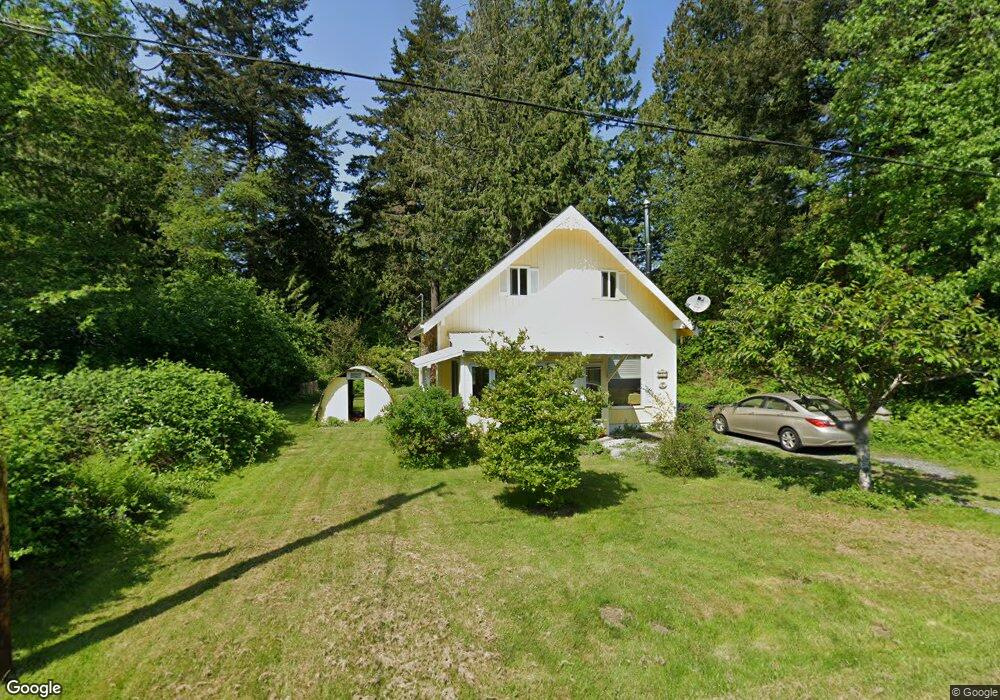
285 Mill Rd Point Roberts, WA 98281
Estimated Value: $344,842 - $427,000
About This Home
This home is located at 285 Mill Rd, Point Roberts, WA 98281 and is currently estimated at $372,461, approximately $344 per square foot. 285 Mill Rd is a home located in Whatcom County with nearby schools including Point Roberts Primary School, Blaine Middle School, and Blaine High School.
Ownership History
We collect this data history from publicly available records. To have your information removed, we recommend requesting removal directly through your county’s website.
Purchase Details
Home Financials for this Owner
Home Financials are based on the most recent Mortgage that was taken out on this home.Home Values in the Area
Average Home Value in this Area
Purchase History
We collect this data history from publicly available records. To have your information removed, we recommend requesting removal directly through your county’s website.
| Date | Buyer | Sale Price | Title Company |
|---|---|---|---|
| -- | Chicago Title Insurance |
Mortgage History
We collect this data history from publicly available records. To have your information removed, we recommend requesting removal directly through your county’s website.
| Date | Status | Borrower | Loan Amount |
|---|---|---|---|
| Open | $88,000 |
Tax History
We collect this data history from publicly available records. To have your information removed, we recommend requesting removal directly through your county’s website.
| Year | Tax Paid | Tax Assessment Tax Assessment Total Assessment is a certain percentage of the fair market value that is determined by local assessors to be the total taxable value of land and additions on the property. | Land | Improvement |
|---|---|---|---|---|
| 2025 | $248 | $303,711 | $133,815 | $169,896 |
| 2024 | $248 | $300,701 | $132,495 | $168,206 |
| 2023 | $248 | $288,656 | $120,450 | $168,206 |
| 2022 | $224 | $263,613 | $110,000 | $38,320 |
| 2021 | $224 | $187,835 | $65,542 | $38,320 |
| 2020 | $232 | $173,919 | $60,687 | $113,232 |
| 2019 | $232 | $166,827 | $58,212 | $108,615 |
| 2018 | $19 | $149,976 | $52,332 | $97,644 |
| 2017 | $19 | $143,236 | $49,980 | $93,256 |
| 2016 | $19 | $140,427 | $49,000 | $91,427 |
| 2015 | $19 | $137,978 | $48,305 | $89,673 |
| 2014 | -- | $144,245 | $50,500 | $93,745 |
| 2013 | -- | $137,959 | $48,500 | $89,459 |
Map
- 2 Mill Rd
- 245 Shady Glen Ave
- 16 Burns Way
- 0 Lot 1 Mill Rd
- 1852 Washington Dr
- 1857 Washington Dr
- 1885 Province Rd
- 1953 Province Rd
- 151 Park Dr
- 168 Tyee Dr
- 167 Northwood Dr
- 158 Tyee Dr
- 157 Northwood Dr
- 0 Lot 67 Province Rd
- 1940 Cedar Park Dr
- 511 S Beach Rd
- 41 Manitoba Way
- 1967 N Cedar Park Dr
- 25 Roosevelt Way
- 1983 Cedar Park Dr
Ask me questions while you tour the home.