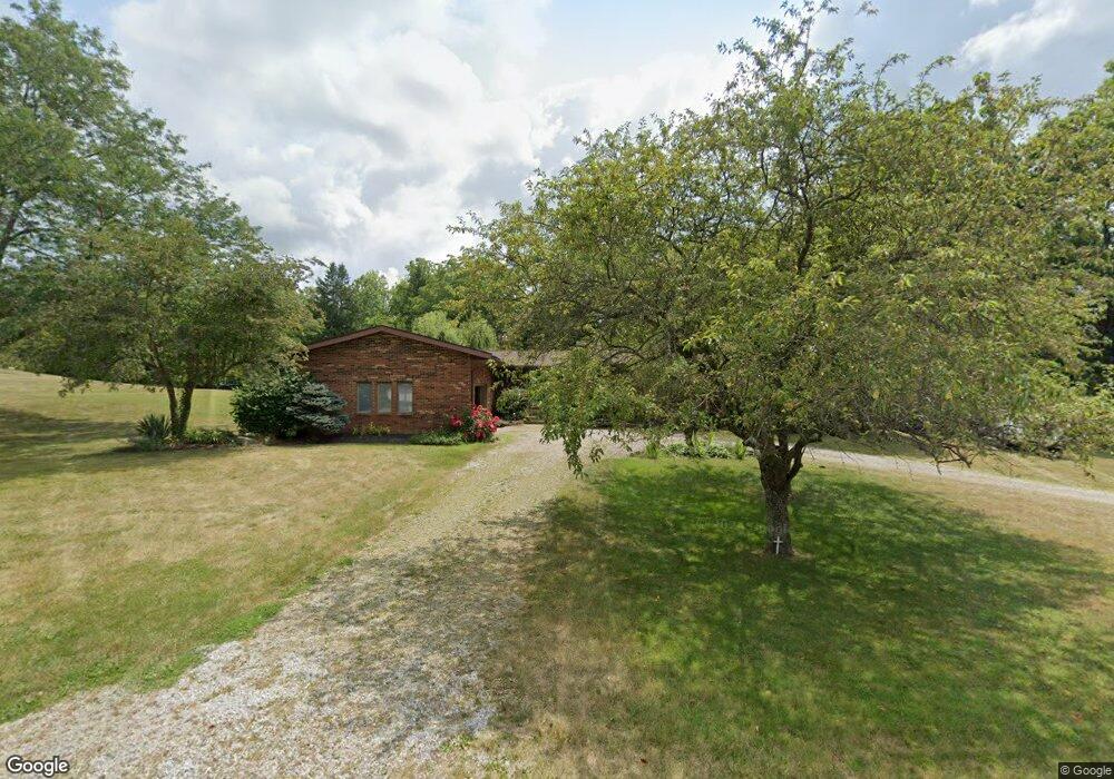
2850 Stringtown Rd NE Lancaster, OH 43130
Estimated Value: $412,000 - $584,000
4
Beds
3
Baths
4,000
Sq Ft
$126/Sq Ft
Est. Value
About This Home
This home is located at 2850 Stringtown Rd NE, Lancaster, OH 43130 and is currently estimated at $504,085, approximately $126 per square foot. 2850 Stringtown Rd NE is a home located in Fairfield County with nearby schools including Fairfield Christian Academy and William V Fisher Catholic High School.
Ownership History
Date
Name
Owned For
Owner Type
Purchase Details
Closed on
May 20, 2005
Sold by
Snead Alan R and Snead Rosemarie
Bought by
Putinski Mark and Putinski Laura
Current Estimated Value
Home Financials for this Owner
Home Financials are based on the most recent Mortgage that was taken out on this home.
Original Mortgage
$160,000
Outstanding Balance
$81,635
Interest Rate
5.91%
Mortgage Type
Fannie Mae Freddie Mac
Estimated Equity
$422,450
Create a Home Valuation Report for This Property
The Home Valuation Report is an in-depth analysis detailing your home's value as well as a comparison with similar homes in the area
Purchase History
| Date | Buyer | Sale Price | Title Company |
|---|---|---|---|
| Putinski Mark | $200,000 | -- |
Source: Public Records
Mortgage History
| Date | Status | Borrower | Loan Amount |
|---|---|---|---|
| Open | Putinski Mark | $160,000 |
Source: Public Records
Tax History
| Year | Tax Paid | Tax Assessment Tax Assessment Total Assessment is a certain percentage of the fair market value that is determined by local assessors to be the total taxable value of land and additions on the property. | Land | Improvement |
|---|---|---|---|---|
| 2025 | $10,812 | $138,260 | $28,550 | $109,710 |
| 2024 | $10,812 | $111,350 | $19,370 | $91,980 |
| 2023 | $4,479 | $111,350 | $19,370 | $91,980 |
| 2022 | $4,535 | $111,350 | $19,370 | $91,980 |
| 2021 | $3,612 | $86,250 | $17,610 | $68,640 |
| 2020 | $3,472 | $86,250 | $17,610 | $68,640 |
| 2019 | $3,313 | $86,250 | $17,610 | $68,640 |
| 2018 | $3,189 | $78,450 | $17,610 | $60,840 |
| 2017 | $3,191 | $78,450 | $17,610 | $60,840 |
| 2016 | $2,958 | $78,450 | $17,610 | $60,840 |
| 2015 | $2,945 | $75,730 | $17,610 | $58,120 |
| 2014 | $2,810 | $75,730 | $17,610 | $58,120 |
| 2013 | $2,810 | $75,730 | $17,610 | $58,120 |
Source: Public Records
Map
Nearby Homes
- 245 Rainbow Dr NE
- 0 Tschopp Rd NE Unit Lot 17 225027320
- 0 Tschopp Rd NE Unit Lot 33 225027324
- 2927 Lancaster-Kirkersville Rd NW
- 3485 Lancaster-Kirkersville Rd NW
- 0 Stringtown Rd NW
- 0 Fremar Rd NE Unit Lot1 225007256
- 1826 Pleasantview Dr NE
- 850 Marquette Dr NE
- 0 Marquette Dr NE Unit Lot 16 225027323
- 0 Marquette Dr NE Unit Lot 5
- 0 Marquette Dr NE Unit Lot 4 225007276
- 1916 Country Place
- 1289 Rainbow Dr NE
- 1908 Branch Place
- 4070 Tschopp Rd NE
- 0 Old Millersport Rd NE Unit 225010386
- 1101 Beechwood Dr NE
- 1540 N High St
- 1167 Ridge Rd NE
- 2873 Stringtown Rd NW
- 2890 Stringtown Rd NE
- 2915 Stringtown Rd NW
- 55 Coonpath Rd NE
- 55 Coonpath Rd NE
- 2730 Stringtown Rd NE
- 2958 Coonpath Rd NE
- 2690 Stringtown Rd NE
- 4 Coonpath Rd NE
- 3 Coonpath Rd NE
- 2 Coonpath Rd NE
- 1 Coonpath Rd NE
- 0 Coonpath Rd NW
- 0 Coonpath Rd NW Unit 2623828
- 0 Coonpath Rd NW Unit 2447344
- 0 Coonpath Rd NW Unit 2432775
- 0 Coonpath Rd NW Unit 2131582
- 0 Coonpath Rd NW Unit 7 9707259
- 0 Coonpath Rd NW Unit 31938
- 0 Coonpath Rd NW Unit Tract 7 224028097
Your Personal Tour Guide
Ask me questions while you tour the home.