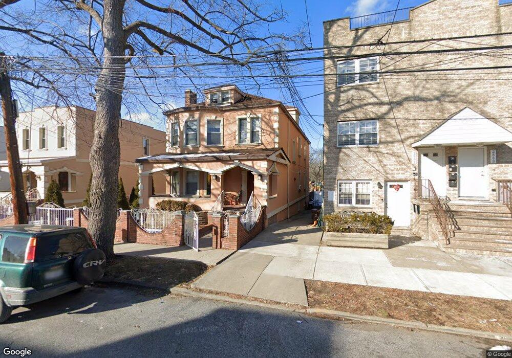
2879 E 197th St Bronx, NY 10461
Middletown-Pelham Bay NeighborhoodEstimated Value: $948,000 - $1,074,490
Studio
--
Bath
2,248
Sq Ft
$455/Sq Ft
Est. Value
About This Home
This home is located at 2879 E 197th St, Bronx, NY 10461 and is currently estimated at $1,023,123, approximately $455 per square foot. 2879 E 197th St is a home located in Bronx County with nearby schools including P.S. 71 Rose E Scala, Herbert H Lehman High School, and Equality Charter School.
Ownership History
Date
Name
Owned For
Owner Type
Purchase Details
Closed on
Dec 11, 2002
Sold by
Celis Ruben and Morales Hilario R
Bought by
Morales Hilario R
Current Estimated Value
Purchase Details
Closed on
Jun 23, 1999
Sold by
Nickoletos George and Nickoletos Lauren
Bought by
Morales Hilario R and Celis Ruben
Home Financials for this Owner
Home Financials are based on the most recent Mortgage that was taken out on this home.
Original Mortgage
$249,600
Interest Rate
7.73%
Create a Home Valuation Report for This Property
The Home Valuation Report is an in-depth analysis detailing your home's value as well as a comparison with similar homes in the area
Home Values in the Area
Average Home Value in this Area
Purchase History
| Date | Buyer | Sale Price | Title Company |
|---|---|---|---|
| Morales Hilario R | -- | -- | |
| Morales Hilario R | $312,000 | Commonwealth Land Title Ins |
Source: Public Records
Mortgage History
| Date | Status | Borrower | Loan Amount |
|---|---|---|---|
| Previous Owner | Morales Hilario R | $249,600 |
Source: Public Records
Tax History
| Year | Tax Paid | Tax Assessment Tax Assessment Total Assessment is a certain percentage of the fair market value that is determined by local assessors to be the total taxable value of land and additions on the property. | Land | Improvement |
|---|---|---|---|---|
| 2025 | $8,308 | $43,847 | $8,785 | $35,062 |
| 2024 | $8,308 | $41,365 | $8,727 | $32,638 |
| 2023 | $7,925 | $39,024 | $9,608 | $29,416 |
| 2022 | $7,790 | $50,580 | $13,620 | $36,960 |
| 2021 | $8,151 | $45,480 | $13,620 | $31,860 |
| 2020 | $7,734 | $48,180 | $13,620 | $34,560 |
| 2019 | $7,211 | $42,660 | $13,620 | $29,040 |
| 2018 | $6,629 | $32,520 | $13,620 | $18,900 |
| 2017 | $7,033 | $34,503 | $12,353 | $22,150 |
| 2016 | $6,853 | $34,280 | $11,972 | $22,308 |
| 2015 | $3,926 | $32,340 | $15,120 | $17,220 |
| 2014 | $3,926 | $30,550 | $13,554 | $16,996 |
Source: Public Records
Map
Nearby Homes
- 2849 E 195th St
- 1874 Pelham Pkwy S Unit 5C
- 1874 Pelham Pkwy S Unit 6M
- 1874 Pelham Pkwy S Unit 3B
- 1874 Pelham Pkwy S Unit 5B
- 1874 Pelham Pkwy S Unit 6E
- 1874 Pelham Pkwy S Unit 4R
- 2054 Saint Paul Ave
- 2032 Hobart Ave
- 2025 Hobart Ave
- 2027 Mayflower Ave
- 1910 Pelham Pkwy S Unit 3G
- 1910 Pelham Pkwy S Unit 3H
- 2024 Continental Ave
- 2010 Hobart Ave
- 2857 Wilkinson Ave
- 2015 St Paul Ave Unit 3G
- 2015 Saint Paul Ave Unit 6I
- 2931 Wilkinson Ave
- 1969 Edison Ave
- 2881 E 197th St
- 2875 E 197th St
- 2883 E 197th St
- 2873 E 197th St
- 2137 Continental Ave
- 2135 Continental Ave
- 2889 E 197th St
- 2866 E 197th St
- 2866 E 197th St Unit 1
- 2866 E 197th St Unit 3
- 2876 E 197th St
- 2864 E 197th St Unit 2
- 2864 E 197th St Unit 1
- 2864 E 197th St
- 2880 E 197th St
- 2860 E 197th St
- 2882 E 197th St
- 2890 E 197th St
- 2858 E 197th St
- 2856 E 197th St Unit 2F
Your Personal Tour Guide
Ask me questions while you tour the home.