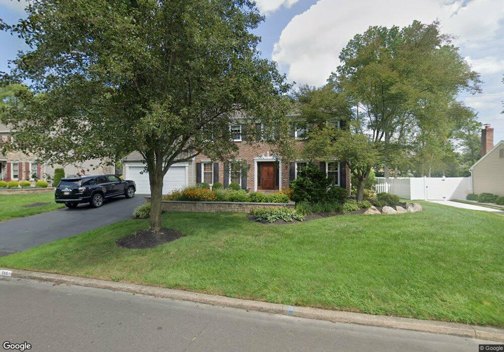
288 Flint Rd Langhorne, PA 19047
Estimated Value: $673,000 - $741,000
4
Beds
3
Baths
2,602
Sq Ft
$271/Sq Ft
Est. Value
About This Home
This home is located at 288 Flint Rd, Langhorne, PA 19047 and is currently estimated at $706,193, approximately $271 per square foot. 288 Flint Rd is a home located in Bucks County with nearby schools including Pearl S. Buck Elementary School, Maple Point Middle School, and Neshaminy High School.
Ownership History
Date
Name
Owned For
Owner Type
Purchase Details
Closed on
Aug 12, 2025
Sold by
Innocenzi John R and Innocenzi Mary C
Bought by
Mary C Innocenzi And John R Innocenzi Revocab and Innocenzi
Current Estimated Value
Purchase Details
Closed on
Jan 28, 1986
Sold by
Maple Pt Inc
Bought by
Innocenzi John R and Innocenzi Mary C
Create a Home Valuation Report for This Property
The Home Valuation Report is an in-depth analysis detailing your home's value as well as a comparison with similar homes in the area
Home Values in the Area
Average Home Value in this Area
Purchase History
| Date | Buyer | Sale Price | Title Company |
|---|---|---|---|
| Mary C Innocenzi And John R Innocenzi Revocab | -- | None Listed On Document | |
| Innocenzi John R | $132,500 | -- |
Source: Public Records
Tax History
| Year | Tax Paid | Tax Assessment Tax Assessment Total Assessment is a certain percentage of the fair market value that is determined by local assessors to be the total taxable value of land and additions on the property. | Land | Improvement |
|---|---|---|---|---|
| 2025 | $8,956 | $41,140 | $6,680 | $34,460 |
| 2024 | $8,956 | $41,140 | $6,680 | $34,460 |
| 2023 | $2,171 | $41,140 | $6,680 | $34,460 |
| 2022 | $8,583 | $41,140 | $6,680 | $34,460 |
| 2021 | $8,583 | $41,140 | $6,680 | $34,460 |
| 2020 | $8,480 | $41,140 | $6,680 | $34,460 |
| 2019 | $8,291 | $41,140 | $6,680 | $34,460 |
| 2018 | $8,138 | $41,140 | $6,680 | $34,460 |
| 2017 | $7,931 | $41,140 | $6,680 | $34,460 |
| 2016 | $7,931 | $41,140 | $6,680 | $34,460 |
| 2015 | $8,120 | $41,140 | $6,680 | $34,460 |
| 2014 | $8,120 | $41,140 | $6,680 | $34,460 |
Source: Public Records
Map
Nearby Homes
- 476 Gladstone Rd
- 11104 Cornerstone Dr Unit 23
- 1004 Waterford Rd
- 13202 Cornerstone Dr Unit 30
- 14304 Cornerstone Dr Unit 169
- 2406 Lynbrooke Dr Unit 174
- 548 Palmer Farm Dr
- 475 Franklin Cir
- 8504 Spruce Mill Dr Unit 707
- 7703 Spruce Mill Dr
- 34 Griffin Way
- 4202 Waltham Ct Unit 270
- 7403 Spruce Mill Dr Unit 582
- 24114 Hickory Ln
- 183 Fillmore Way
- 1693 Pierce Way
- 483 Cedar Hollow Dr
- 1680 Hickory Ln
- 41 Griffin Way
- 235 Argyle Rd
Your Personal Tour Guide
Ask me questions while you tour the home.