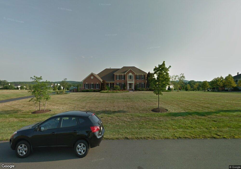
29 Baker Way Pennington, NJ 08534
Estimated Value: $1,271,676 - $1,577,000
Studio
--
Bath
4,862
Sq Ft
$288/Sq Ft
Est. Value
About This Home
This home is located at 29 Baker Way, Pennington, NJ 08534 and is currently estimated at $1,399,669, approximately $287 per square foot. 29 Baker Way is a home located in Mercer County with nearby schools including Hopewell Valley Central High School, Pennington Montessori School, and The Laurel School of Princeton.
Ownership History
Date
Name
Owned For
Owner Type
Purchase Details
Closed on
Sep 21, 2005
Sold by
Konzelman Christopher
Bought by
Lubart Matthew and Lubart Ann Zang
Current Estimated Value
Home Financials for this Owner
Home Financials are based on the most recent Mortgage that was taken out on this home.
Original Mortgage
$872,000
Outstanding Balance
$466,229
Interest Rate
5.84%
Estimated Equity
$933,440
Create a Home Valuation Report for This Property
The Home Valuation Report is an in-depth analysis detailing your home's value as well as a comparison with similar homes in the area
Home Values in the Area
Average Home Value in this Area
Purchase History
| Date | Buyer | Sale Price | Title Company |
|---|---|---|---|
| Lubart Matthew | $1,090,000 | -- |
Source: Public Records
Mortgage History
| Date | Status | Borrower | Loan Amount |
|---|---|---|---|
| Open | Lubart Matthew | $872,000 |
Source: Public Records
Tax History
| Year | Tax Paid | Tax Assessment Tax Assessment Total Assessment is a certain percentage of the fair market value that is determined by local assessors to be the total taxable value of land and additions on the property. | Land | Improvement |
|---|---|---|---|---|
| 2025 | $24,947 | $790,200 | $258,300 | $531,900 |
| 2024 | $24,149 | $790,200 | $258,300 | $531,900 |
| 2023 | $24,149 | $790,200 | $258,300 | $531,900 |
| 2022 | $23,651 | $790,200 | $258,300 | $531,900 |
| 2021 | $24,172 | $790,200 | $258,300 | $531,900 |
| 2020 | $23,587 | $790,200 | $258,300 | $531,900 |
| 2019 | $23,768 | $816,200 | $284,300 | $531,900 |
| 2018 | $24,673 | $863,300 | $284,300 | $579,000 |
| 2017 | $24,000 | $863,300 | $284,300 | $579,000 |
| 2016 | $22,688 | $863,300 | $284,300 | $579,000 |
| 2015 | $22,921 | $863,300 | $284,300 | $579,000 |
| 2014 | $22,446 | $863,300 | $284,300 | $579,000 |
Source: Public Records
Map
Nearby Homes
- 9 Hallett Dr
- 11 Baker Way
- 22 Hallett Dr
- 329 Penn Titusville Rd
- 309 Pennington - Harbourton Rd
- 6 Michael Way
- 10 Madaket Ln
- 133 Woosamonsa Rd
- 186 Penn Harbourton Rd
- 88 Woosamonsa Rd
- 245 Wash Cross Penn
- 172 Pennington Harbourton Rd
- 72 Poor Farm Rd
- 1212 Bear Tavern Rd
- 259 Aaron Truehart Way
- 20 Route 31 S
- 1442 Trenton Harbourton Rd
- 43 Aaron Truehart Way
- 45 Aaron Truehart Way
- 47 Aaron Truehart Way
Your Personal Tour Guide
Ask me questions while you tour the home.