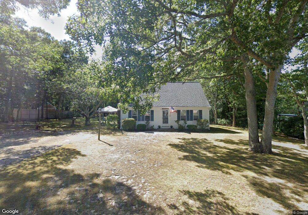
29 Captain Prestons Rd Dennis, MA 02638
Dennis Village NeighborhoodEstimated Value: $638,984 - $1,097,000
3
Beds
2
Baths
1,201
Sq Ft
$655/Sq Ft
Est. Value
About This Home
This home is located at 29 Captain Prestons Rd, Dennis, MA 02638 and is currently estimated at $786,996, approximately $655 per square foot. 29 Captain Prestons Rd is a home located in Barnstable County with nearby schools including Dennis-Yarmouth Regional High School.
Ownership History
Date
Name
Owned For
Owner Type
Purchase Details
Closed on
Jan 28, 2019
Sold by
Sullivan Timothy E and Sullivan Patricia A
Bought by
Piece Of Heaven Rt
Current Estimated Value
Purchase Details
Closed on
Sep 20, 1995
Sold by
Quinlan Bernard K and Quinlan Catherine M
Bought by
Coyne William G and Coyne Tamralyn K
Home Financials for this Owner
Home Financials are based on the most recent Mortgage that was taken out on this home.
Original Mortgage
$65,700
Interest Rate
7.81%
Mortgage Type
Purchase Money Mortgage
Create a Home Valuation Report for This Property
The Home Valuation Report is an in-depth analysis detailing your home's value as well as a comparison with similar homes in the area
Home Values in the Area
Average Home Value in this Area
Purchase History
| Date | Buyer | Sale Price | Title Company |
|---|---|---|---|
| Piece Of Heaven Rt | -- | -- | |
| Coyne William G | $115,700 | -- |
Source: Public Records
Mortgage History
| Date | Status | Borrower | Loan Amount |
|---|---|---|---|
| Previous Owner | Coyne William G | $65,700 |
Source: Public Records
Tax History
| Year | Tax Paid | Tax Assessment Tax Assessment Total Assessment is a certain percentage of the fair market value that is determined by local assessors to be the total taxable value of land and additions on the property. | Land | Improvement |
|---|---|---|---|---|
| 2025 | $2,332 | $538,600 | $177,700 | $360,900 |
| 2024 | $2,303 | $524,700 | $179,000 | $345,700 |
| 2023 | $2,228 | $477,100 | $162,800 | $314,300 |
| 2022 | $2,055 | $367,000 | $133,300 | $233,700 |
| 2021 | $1,872 | $310,400 | $130,700 | $179,700 |
| 2020 | $1,831 | $300,100 | $130,700 | $169,400 |
| 2019 | $1,799 | $291,600 | $140,900 | $150,700 |
| 2018 | $1,701 | $268,300 | $122,000 | $146,300 |
| 2017 | $1,715 | $278,800 | $122,000 | $156,800 |
| 2016 | $1,849 | $283,100 | $152,400 | $130,700 |
| 2015 | $1,812 | $283,100 | $152,400 | $130,700 |
| 2014 | $1,578 | $248,500 | $122,000 | $126,500 |
Source: Public Records
Map
Nearby Homes
- 14 S Yarmouth Rd
- 59 Main St Unit 7-3
- 59 Main St Unit 19-2
- 59 Route 6a Unit 9-2
- 59 Route 6a Unit 7-3
- 59 Massachusetts 6a Unit 19-2
- 568 Route 6a
- 39 Whittier Dr
- 26 S West Dr
- 20 Bray Farm Rd S
- 268 Main St
- 15 Jonquil Rd
- 15 Musket Ln
- 54 Kates Path Unit 54
- 16 Hazelwood Rd
- 15 John Hall Cartway Unit 15
- 10 Uncle Bills Way
- 480 Main St
- 3212 Heatherwood Unit 3212
- 86 Pompano Rd
- 37 Captain Prestons Rd
- 23 Captain Prestons Rd
- 23 Capt Prestons Rd
- 26 Captain Prestons Rd
- 32 Captain Prestons Rd
- 20 Captain Prestons Rd
- 3 Marian Way
- 43 Captain Prestons Rd
- 10 Captain Prestons Rd
- 53 S Yarmouth Rd
- 17 Captain Prestons Rd
- 1 Marian Way
- 47 S Yarmouth Rd
- 38 Captain Prestons Rd
- 61 S Yarmouth Rd
- 5 Marian Way
- 11 Capt Prestons Rd
- 41 S Yarmouth Rd
- 11 Captain Prestons Rd
- 44 Captain Preston's Rd
Your Personal Tour Guide
Ask me questions while you tour the home.