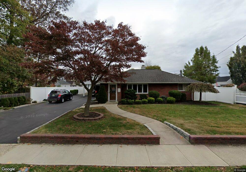
29 E John St Lindenhurst, NY 11757
Estimated Value: $504,000 - $607,000
2
Beds
1
Bath
876
Sq Ft
$624/Sq Ft
Est. Value
About This Home
This home is located at 29 E John St, Lindenhurst, NY 11757 and is currently estimated at $546,833, approximately $624 per square foot. 29 E John St is a home located in Suffolk County with nearby schools including Daniel Street School, Lindenhurst Middle School, and Lindenhurst Senior High School.
Ownership History
Date
Name
Owned For
Owner Type
Purchase Details
Closed on
Mar 30, 2015
Sold by
Larocca Steve
Bought by
Sarli Anthony and Sarli Georgiann
Current Estimated Value
Home Financials for this Owner
Home Financials are based on the most recent Mortgage that was taken out on this home.
Original Mortgage
$265,590
Interest Rate
3.88%
Mortgage Type
VA
Purchase Details
Closed on
Aug 15, 2005
Sold by
Busa Peter
Bought by
Larocca Steve
Purchase Details
Closed on
Jul 1, 1999
Sold by
Otto Douglas M and Otto Kathleen A
Bought by
Busa Peter
Home Financials for this Owner
Home Financials are based on the most recent Mortgage that was taken out on this home.
Original Mortgage
$111,000
Interest Rate
7.39%
Mortgage Type
Purchase Money Mortgage
Create a Home Valuation Report for This Property
The Home Valuation Report is an in-depth analysis detailing your home's value as well as a comparison with similar homes in the area
Home Values in the Area
Average Home Value in this Area
Purchase History
| Date | Buyer | Sale Price | Title Company |
|---|---|---|---|
| Sarli Anthony | $260,000 | First American Title | |
| Larocca Steve | $332,000 | Nicholas Diroio | |
| Busa Peter | $131,000 | Commonwealth Land Title Ins |
Source: Public Records
Mortgage History
| Date | Status | Borrower | Loan Amount |
|---|---|---|---|
| Previous Owner | Sarli Anthony | $265,590 | |
| Previous Owner | Busa Peter | $111,000 |
Source: Public Records
Tax History
| Year | Tax Paid | Tax Assessment Tax Assessment Total Assessment is a certain percentage of the fair market value that is determined by local assessors to be the total taxable value of land and additions on the property. | Land | Improvement |
|---|---|---|---|---|
| 2024 | $10,942 | $2,940 | $380 | $2,560 |
| 2023 | $9,873 | $2,940 | $380 | $2,560 |
| 2022 | $7,533 | $2,940 | $380 | $2,560 |
| 2021 | $7,533 | $2,940 | $380 | $2,560 |
| 2020 | $9,158 | $2,940 | $380 | $2,560 |
| 2019 | $10,105 | $0 | $0 | $0 |
| 2018 | $8,811 | $2,940 | $380 | $2,560 |
| 2017 | $8,811 | $2,940 | $380 | $2,560 |
| 2016 | $8,826 | $2,940 | $380 | $2,560 |
| 2015 | -- | $2,940 | $380 | $2,560 |
| 2014 | -- | $2,940 | $380 | $2,560 |
Source: Public Records
Map
Nearby Homes
- 267 N Wellwood Ave
- 7 Gary St
- 149 Byrd St
- 181 S Alleghany Ave
- 196 S Broome Ave
- 147 S 6th St
- 132 S 7th St
- 244 N Erie Ave
- 136 N Delaware Ave
- 22 Lenox St
- 265 S 4th St
- 247 N Greene Ave
- 15 Macon St
- 612 N Broome Ave
- 455 N Hamilton Ave
- 261 E Hoffman Ave
- 385 Beacon Ave
- 449 N Indiana Ave
- 209 S 11th St
- 259 35th St
- 23 E John St
- 26 Bristol St
- 31 E John St
- 16 Bristol St
- 19 E John St
- 30 Bristol St
- 14 Bristol St
- 15 E John St
- 22 E John St
- 42 E John St
- 23 Boat Berth Riviera Dr
- 14 EAST CLEARWATER R Clearwater E
- 305 & 309 Nevada St
- L # 16 Boat Berth Rivie Dr
- 15 Bristol St
- 17 Bristol St
- 6 Bristol St
- 11 Bristol St
- 21 Bristol St
- 21 Bristol St Unit 2
Your Personal Tour Guide
Ask me questions while you tour the home.