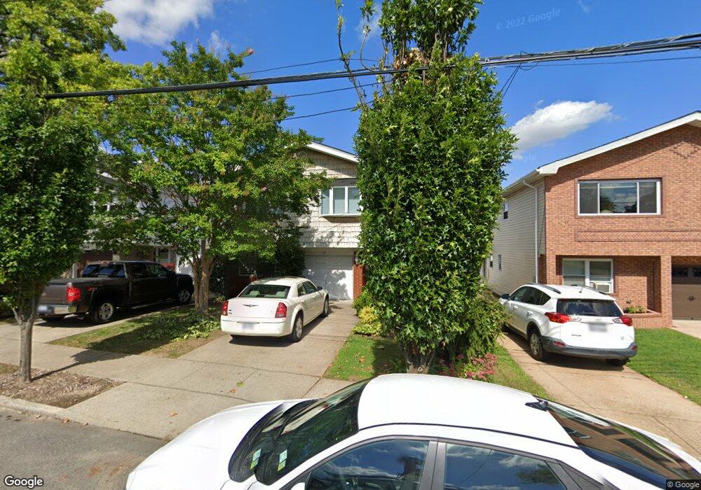
29 E Scranton Ave Staten Island, NY 10308
Great Kills NeighborhoodEstimated Value: $722,855 - $920,000
Studio
--
Bath
1,336
Sq Ft
$633/Sq Ft
Est. Value
About This Home
This home is located at 29 E Scranton Ave, Staten Island, NY 10308 and is currently estimated at $845,214, approximately $632 per square foot. 29 E Scranton Ave is a home located in Richmond County with nearby schools including P.S. 32 The Gifford School, Myra S. Barnes Intermediate School 24, and Susan E Wagner High School.
Ownership History
Date
Name
Owned For
Owner Type
Purchase Details
Closed on
Aug 2, 2000
Sold by
Hogarty Margaret
Bought by
Russo Joseph M and Russo Krista M
Current Estimated Value
Home Financials for this Owner
Home Financials are based on the most recent Mortgage that was taken out on this home.
Original Mortgage
$40,189
Outstanding Balance
$14,407
Interest Rate
8.06%
Mortgage Type
Purchase Money Mortgage
Estimated Equity
$830,807
Purchase Details
Closed on
Feb 17, 1998
Sold by
Hogarty John J
Bought by
Hogarty Margaret
Create a Home Valuation Report for This Property
The Home Valuation Report is an in-depth analysis detailing your home's value as well as a comparison with similar homes in the area
Home Values in the Area
Average Home Value in this Area
Purchase History
| Date | Buyer | Sale Price | Title Company |
|---|---|---|---|
| Russo Joseph M | $100,500 | Stewart Title | |
| Hogarty Margaret | -- | Chicago Title Insurance Co |
Source: Public Records
Mortgage History
| Date | Status | Borrower | Loan Amount |
|---|---|---|---|
| Open | Russo Joseph M | $40,189 |
Source: Public Records
Tax History
| Year | Tax Paid | Tax Assessment Tax Assessment Total Assessment is a certain percentage of the fair market value that is determined by local assessors to be the total taxable value of land and additions on the property. | Land | Improvement |
|---|---|---|---|---|
| 2025 | $7,898 | $45,600 | $12,835 | $32,765 |
| 2024 | $7,910 | $46,080 | $11,983 | $34,097 |
| 2023 | $7,518 | $38,417 | $10,894 | $27,523 |
| 2022 | $7,001 | $44,100 | $13,560 | $30,540 |
| 2021 | $7,380 | $36,780 | $13,560 | $23,220 |
| 2020 | $7,318 | $40,620 | $13,560 | $27,060 |
| 2019 | $6,806 | $39,420 | $13,560 | $25,860 |
| 2018 | $6,228 | $32,014 | $10,410 | $21,604 |
| 2017 | $5,902 | $30,422 | $12,433 | $17,989 |
| 2016 | $5,772 | $30,422 | $12,592 | $17,830 |
| 2015 | $5,122 | $29,974 | $10,190 | $19,784 |
| 2014 | $5,122 | $28,279 | $10,654 | $17,625 |
Source: Public Records
Map
Nearby Homes
- 67 Genesee Ave
- 193 Brookfield Ave
- 287 Abingdon Ave
- 47 E Figurea Ave
- 478 Leverett Ave
- 890 Armstrong Ave Unit 2-3
- 309 Abingdon Ave
- 892 Armstrong Ave Unit 23
- 307 Leverett Ave
- 360 Barlow Ave Unit 1
- 360 Barlow Ave Unit 40A
- 360 Barlow Ave Unit 29
- 360 Barlow Ave Unit 32
- 360 Barlow Ave Unit 24
- 526 Leverett Ave
- 115 Abingdon Ave
- 28 Fenway Cir Unit 2-2
- 538 Leverett Ave
- 147 Cortelyou Ave Unit 2-3
- 270 Leverett Ave
- 25 E Scranton Ave
- 33 E Scranton Ave
- 21 E Scranton Ave
- 37 E Scranton Ave
- 24 E Stroud Ave
- 28 E Stroud Ave
- 20 E Stroud Ave
- 32 E Stroud Ave
- 16 E Stroud Ave
- 16 E Stroud Ave Unit 2
- 19 E Scranton Ave
- 41 E Scranton Ave
- 36 E Stroud Ave
- 12 E Stroud Ave
- 32 E Scranton Ave
- 28 E Scranton Ave
- 36 E Scranton Ave
- 24 E Scranton Ave
- 47 E Scranton Ave
- 40 E Stroud Ave
Your Personal Tour Guide
Ask me questions while you tour the home.