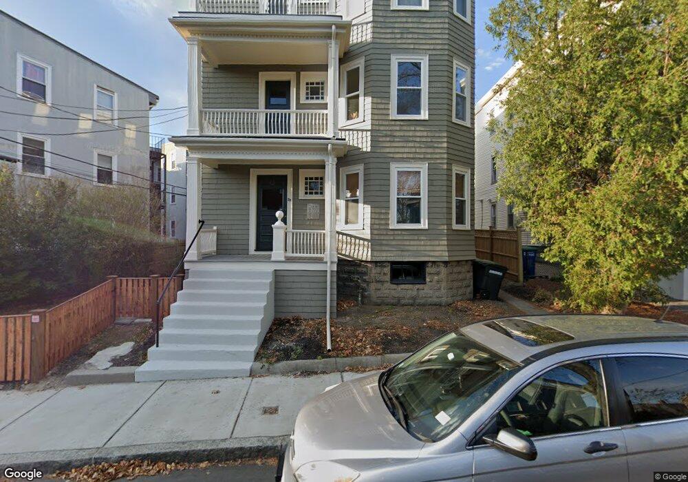
29 Forest St Unit 2 Somerville, MA 02143
Porter Square NeighborhoodEstimated Value: $753,865 - $866,000
2
Beds
1
Bath
1,000
Sq Ft
$792/Sq Ft
Est. Value
About This Home
This home is located at 29 Forest St Unit 2, Somerville, MA 02143 and is currently estimated at $791,966, approximately $791 per square foot. 29 Forest St Unit 2 is a home located in Middlesex County with nearby schools including Somerville High School, Saint Theresa School, and St Peter School.
Ownership History
Date
Name
Owned For
Owner Type
Purchase Details
Closed on
Jan 17, 2013
Sold by
Brinser Grant C and Brinser Susan E
Bought by
Brinser Grant C
Current Estimated Value
Purchase Details
Closed on
Jun 30, 2005
Sold by
Grayzel Frieda T and Brinser Grant C
Bought by
Brisner Grant C and Pitherny Susan E
Home Financials for this Owner
Home Financials are based on the most recent Mortgage that was taken out on this home.
Original Mortgage
$311,200
Interest Rate
5.73%
Mortgage Type
Purchase Money Mortgage
Create a Home Valuation Report for This Property
The Home Valuation Report is an in-depth analysis detailing your home's value as well as a comparison with similar homes in the area
Home Values in the Area
Average Home Value in this Area
Purchase History
We collect this data history from publicly available records. To have your information removed, we recommend requesting removal directly through your county’s website.
| Date | Buyer | Sale Price | Title Company |
|---|---|---|---|
| Brinser Grant C | $72,000 | -- | |
| Brinser Grant C | $72,000 | -- | |
| Brisner Grant C | $389,000 | -- | |
| Brisner Grant C | $389,000 | -- |
Source: Public Records
Mortgage History
We collect this data history from publicly available records. To have your information removed, we recommend requesting removal directly through your county’s website.
| Date | Status | Borrower | Loan Amount |
|---|---|---|---|
| Previous Owner | Brisner Grant C | $311,200 |
Source: Public Records
Tax History
| Year | Tax Paid | Tax Assessment Tax Assessment Total Assessment is a certain percentage of the fair market value that is determined by local assessors to be the total taxable value of land and additions on the property. | Land | Improvement |
|---|---|---|---|---|
| 2025 | $6,705 | $614,600 | $0 | $614,600 |
| 2024 | $6,296 | $598,500 | $0 | $598,500 |
| 2023 | $6,133 | $593,100 | $0 | $593,100 |
| 2022 | $5,928 | $582,300 | $0 | $582,300 |
| 2021 | $5,704 | $559,800 | $0 | $559,800 |
| 2020 | $5,530 | $548,100 | $0 | $548,100 |
| 2019 | $5,916 | $549,800 | $0 | $549,800 |
| 2018 | $5,725 | $506,200 | $0 | $506,200 |
| 2017 | $5,721 | $490,200 | $0 | $490,200 |
| 2016 | $5,093 | $406,500 | $0 | $406,500 |
| 2015 | $4,767 | $378,000 | $0 | $378,000 |
Source: Public Records
Map
Nearby Homes
- 61 Garfield St Unit 14
- 295 Beacon St
- 29 Sacramento St Unit 2
- 815 Somerville Ave
- 24 Linden Ave
- 12 Martin St
- 21 Kent Ct Unit C
- 21 Kent Ct Unit B
- 9 Olive Ave Unit 1
- 20 Wendell St Unit 3
- 20 Wendell St Unit 4
- 49 Porter St
- 39 Hammond St Unit 2
- 41 Bowdoin St Unit 28
- 6 Porter Rd Unit 1L
- 57 Museum St
- 57 Museum St Unit 57
- 8 Wright St Unit 2
- 31 Linnaean St Unit 6
- 6 Shepard St Unit 4
- 133 1/2 Oxford St Unit 12
- 133 1/2 Oxford St Unit 11
- 133 1/2 Oxford St Unit 10
- 133 1/2 Oxford St Unit 59
- 133 1/2 Oxford St Unit 58
- 133 1/2 Oxford St Unit 57
- 133 1/2 Oxford St Unit 56
- 133 1/2 Oxford St Unit 55
- 133 1/2 Oxford St Unit 54
- 133 1/2 Oxford St Unit 53
- 133 1/2 Oxford St Unit 52
- 133 1/2 Oxford St Unit 51
- 132 Oxford St Unit 3A
- 132 Oxford St Unit 2B
- 132 Oxford St Unit 2A
- 132 Oxford St Unit 1A
- 132 Oxford St Unit 1
- 132 Oxford St Unit 3
- 132.5 Oxford St Unit 8
- 132 1/2 Oxford St Unit 1A
Your Personal Tour Guide
Ask me questions while you tour the home.