Estimated Value: $369,000 - $524,000
About This Home
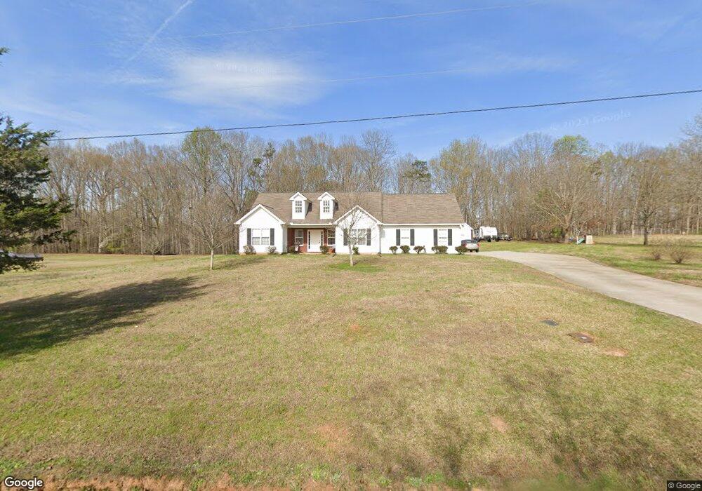
This home is located at 290 Crowe Rd, Homer, GA 30547 and is currently estimated at $411,598, approximately $221 per square foot. 290 Crowe Rd is a home located in Banks County with nearby schools including Banks County Primary School, Banks County Elementary School, and Banks County Middle School.
Ownership History
We collect this data history from publicly available records. To have your information removed, we recommend requesting removal directly through your county’s website.
Purchase Details
Home Financials for this Owner
Home Financials are based on the most recent Mortgage that was taken out on this home.Purchase History
We collect this data history from publicly available records. To have your information removed, we recommend requesting removal directly through your county’s website.
| Date | Buyer | Sale Price | Title Company |
|---|---|---|---|
| $159,900 | -- |
Mortgage History
We collect this data history from publicly available records. To have your information removed, we recommend requesting removal directly through your county’s website.
| Date | Status | Borrower | Loan Amount |
|---|---|---|---|
| Open | $50,000 | ||
| Open | $123,433 | ||
| Closed | $138,905 | ||
| Closed | $40,000 | ||
| Closed | $113,400 |
Tax History
We collect this data history from publicly available records. To have your information removed, we recommend requesting removal directly through your county’s website.
| Year | Tax Paid | Tax Assessment Tax Assessment Total Assessment is a certain percentage of the fair market value that is determined by local assessors to be the total taxable value of land and additions on the property. | Land | Improvement |
|---|---|---|---|---|
| 2025 | $2,148 | $117,325 | $18,153 | $99,172 |
| 2024 | $2,221 | $111,110 | $16,502 | $94,608 |
| 2023 | $2,044 | $99,273 | $17,324 | $81,949 |
| 2022 | $1,776 | $86,515 | $14,821 | $71,694 |
| 2021 | $1,653 | $75,964 | $11,112 | $64,852 |
| 2020 | $1,572 | $70,540 | $8,564 | $61,976 |
| 2019 | $1,397 | $62,629 | $8,564 | $54,065 |
| 2018 | $1,365 | $60,250 | $7,346 | $52,904 |
| 2017 | $1,427 | $60,392 | $6,388 | $54,004 |
| 2016 | $1,468 | $60,392 | $6,388 | $54,004 |
| 2015 | $1,478 | $60,392 | $6,388 | $54,004 |
| 2014 | $1,478 | $64,664 | $10,660 | $54,004 |
| 2013 | -- | $64,664 | $10,660 | $54,004 |
Map
- 135 Canters Run
- TRACT A-1A AND Bennett Rd
- TRACT A-1B AND Bennett Rd
- 108 Indigo Cir
- 0 Kesler Rd Unit 10664561
- TRACT 5 Christmas Tree Rd
- 0 Murray Rd Unit 10811914
- 0 Murray Rd Unit 28208371
- 144 Muscadine Pass
- 118 Muscadine Pass
- 4638 Highway 63
- 176 Murray Rd
- 2331 Kesler Rd
- 360 Boling Rd
- 102 Grayhill Dr
- 2411 Kesler Rd
- 0 Christmas Tree Rd Unit LotWP005
- 0 Christmas Tree Rd Unit 28208372
- 0 Christmas Tree Rd Unit 10811911
- 108 Sawtooth Place
- 292 Crowe Rd
- 282 Crowe Rd
- 276 Crowe Rd
- 296 Crowe Rd
- 274 Crowe Rd
- 274 Crowe Rd Unit 2&2A
- 302 Crowe Rd
- 2447 Highway 51 N
- 2473 Highway 51 N
- 2473 Highway 51 N
- 2377 Highway 51 N
- 2657 Highway 51 N
- 2657 Georgia 51
- 2446 Highway 51 N
- 2371 Georgia 51
- 2371 Highway 51 N
- 2672 Highway 51 N
- 2743 Highway 51 N
- 2368 Georgia 51
- 461 Crowe Rd
Ask me questions while you tour the home.